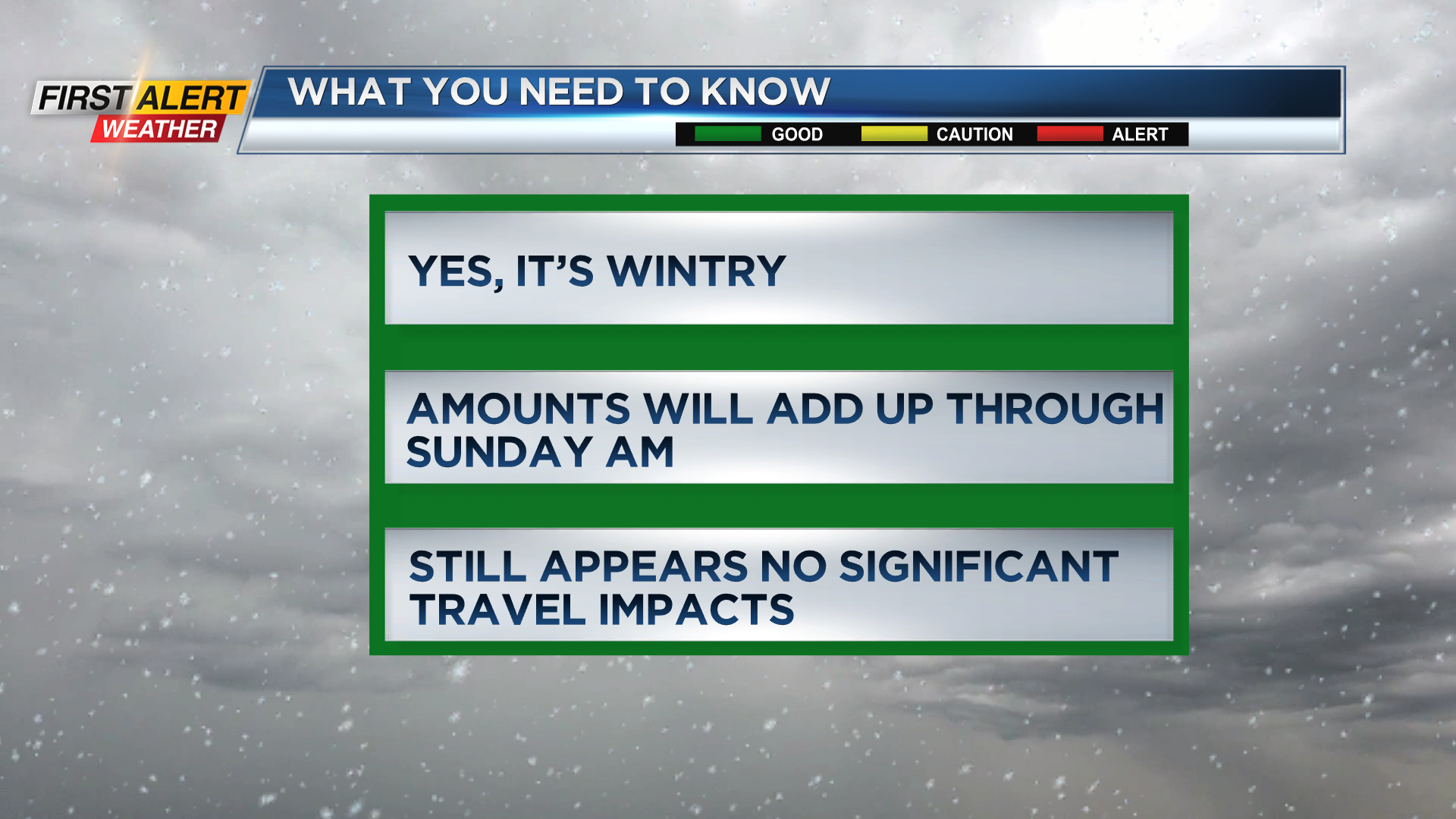
First Alert Weather: Wintry into the weekend with additional lake effect snow on the way
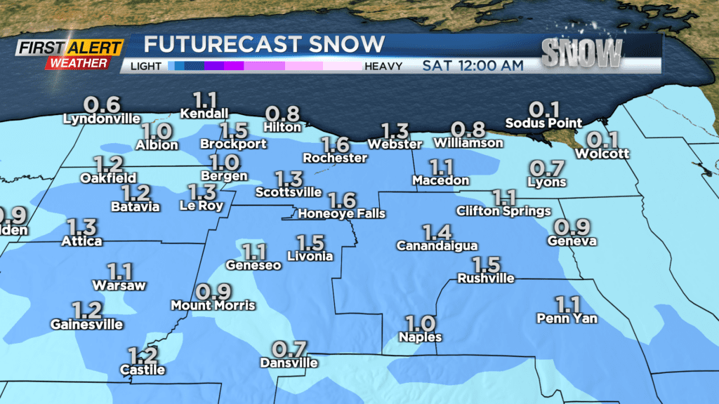
ROCHESTER, N.Y. — Snow will taper to local lake effect flakes on Friday afternoon. Then, expect light additional accumulations into Friday night of 1-2 inches with any higher amounts closer to Lake Ontario and into Wayne County.
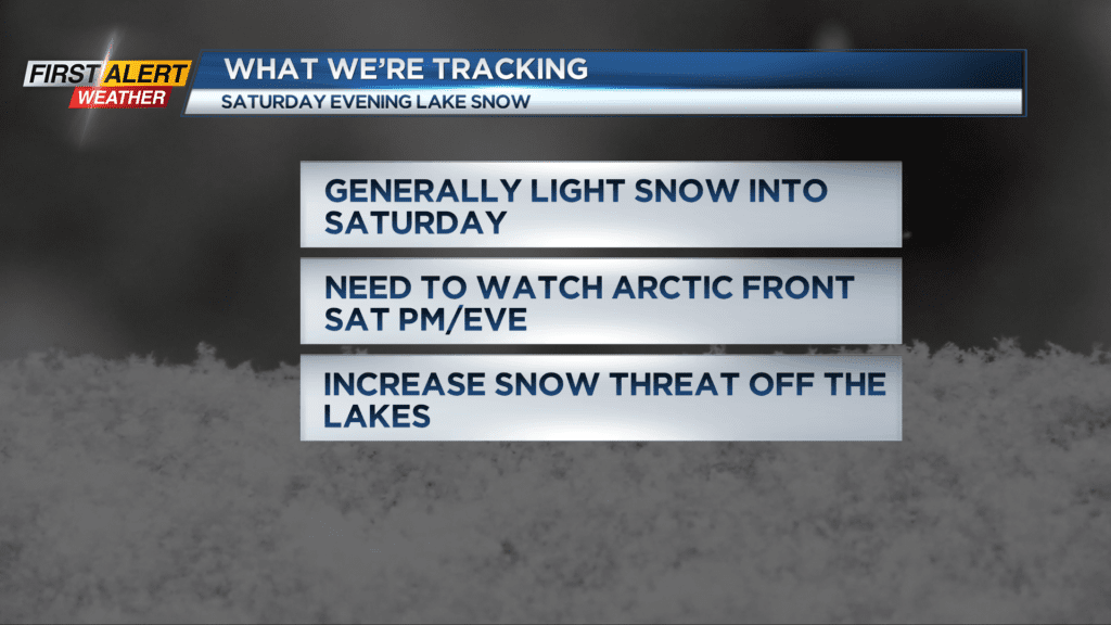
There’s frigid weather on the way into Saturday with temperatures in the teens and wind chill readings below zero. Areas of local lake snows will continue through the day with a burst of snow later in the afternoon and evening possible, especially along Route 104.
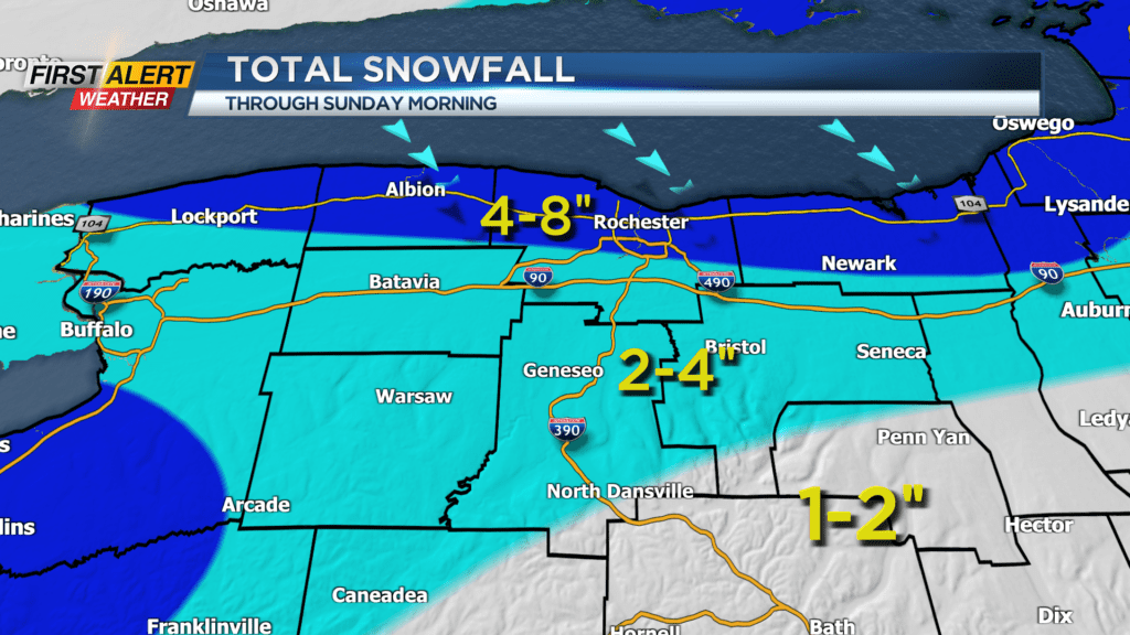
Additional accumulations on Saturday will be light for most but several inches are possible near Lake Ontario. When you add it all up from Friday and Saturday, storm totals will be in the 2-4 inch range for most with 4-8 inches north of the Thruway through Sunday Morning.
Stay tuned to News10NBC for the latest updates on the lake effect snow threat this weekend.