First Alert Weather: Cooler and wetter conditions this weekend
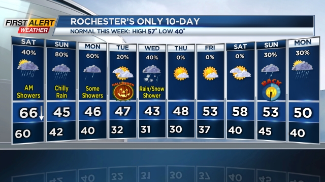
ROCHESTER, N.Y. — We spent much of this week in the 70s but that air will be replaced by much more seasonable temperatures at first, then cooler than average air.
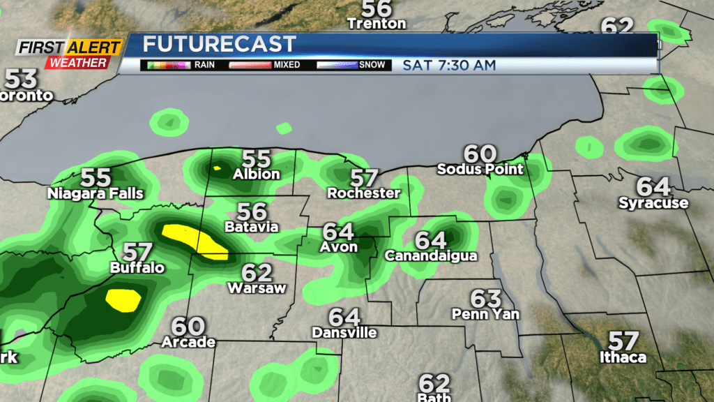
Temperatures on Friday night will hold in the mid 60s until our cold front arrives around sunrise Saturday. We’ll see a few hours of scattered showers in the morning with temperatures dropping from the 60s back into the 50s.
Our high temperature on Saturday will occur first thing in the morning with most of the day spent in the 50s. Once showers end, high pressure builds in and we’ll see some nice sunshine returning into the afternoon, though you’ll notice the cool breeze. Clouds thicken again overnight, with another round of rain arriving by early Sunday morning.
Sunday may not end up being a total washout, but expect a chilly rain through at least the morning, becoming more scattered into the afternoon. Temperatures will fall into the 40s on Sunday.
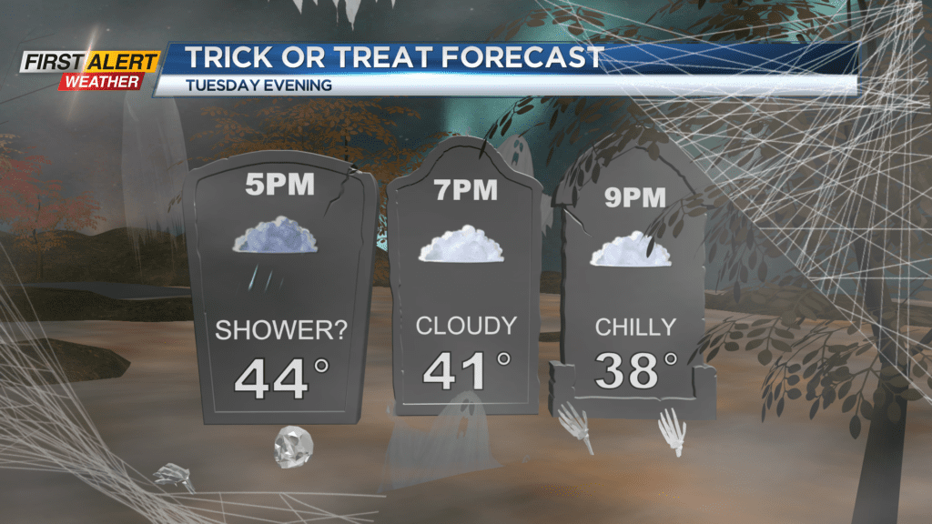
We’ll keep that brisk and chilly air around on Monday, with highs in the 40s and some lake effect rain showers. High pressure will briefly build in for Tuesday, which should keep us mostly dry but still cool for Halloween.
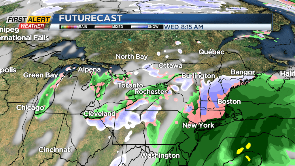
Trick or Treaters may want to layer up, with temperatures in the lower 40s by the time they hit the streets. We may then see our first wet flakes of the season on Wednesday, though no accumulation is expected.