First Alert Weather: Damp & dreary for Wednesday before some snow this weekend
[anvplayer video=”5151626″ station=”998131″]
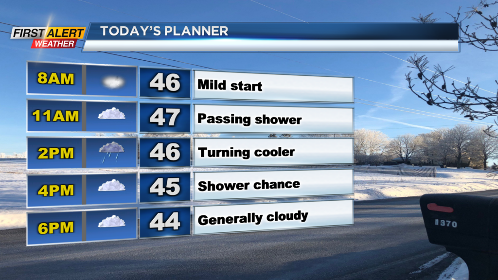
ROCHESTER, N.Y. — We’re waking up to a mild but damp start to our Wednesday. Temperatures are starting off in the mid 40s but it has come with extra cloud cover and a few isolated showers.
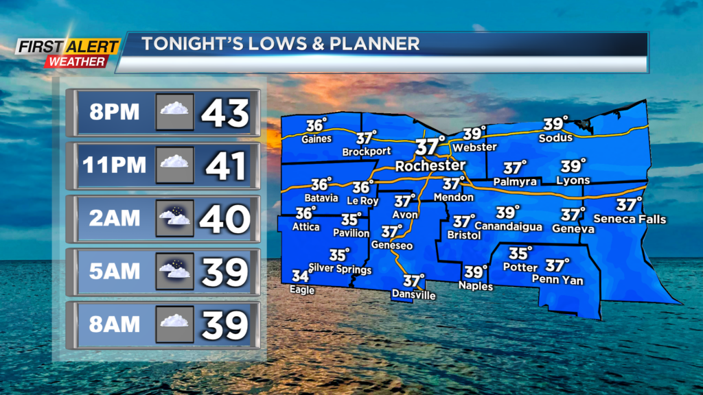
As we move forward through Wednesday, unsettled weather will continue along with some cooler weather. Temperatures will slowly drop in the afternoon and fall into the low 40s this evening with a cold front swinging through.
Also, cloudy skies are expected with a chance for a few showers with the front passing through. A washout is not expected, but a few stray showers will be possible throughout the day.
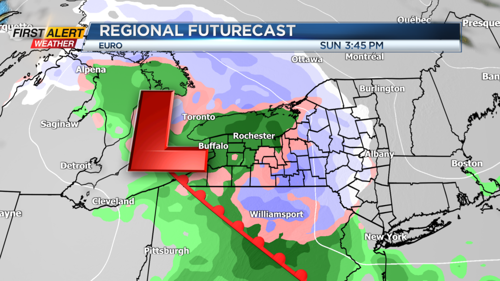
Things will slowly begin to clear out for Wednesday night and Thursday but we really aren’t expecting too much in terms of sun until Friday. Partly cloudy skies Friday and early Saturday will let our afternoon high reach near 40 before turning unsettled on Sunday.
A weak wave of low pressure will swing through the upper Great Lakes and into our region with rain and snow showers for Sunday. This will bring us a chance for some rain and snow. Uncertainty remains on how much cold air will be available for this system, but some minor accumulations will be possible through the afternoon hours, mainly in the higher elevations.
We're waking up to a mild but damp start to our Wednesday.
Also as of now, no major effects are expected on roadways on Sunday with the rain and snow forecasted. We will monitor and trends.
______________
Download the WHEC First Alert Weather app to stay up to date while on the go.
Watch the latest full forecast online.