First Alert Weather: Dry start to the week, but it does not last
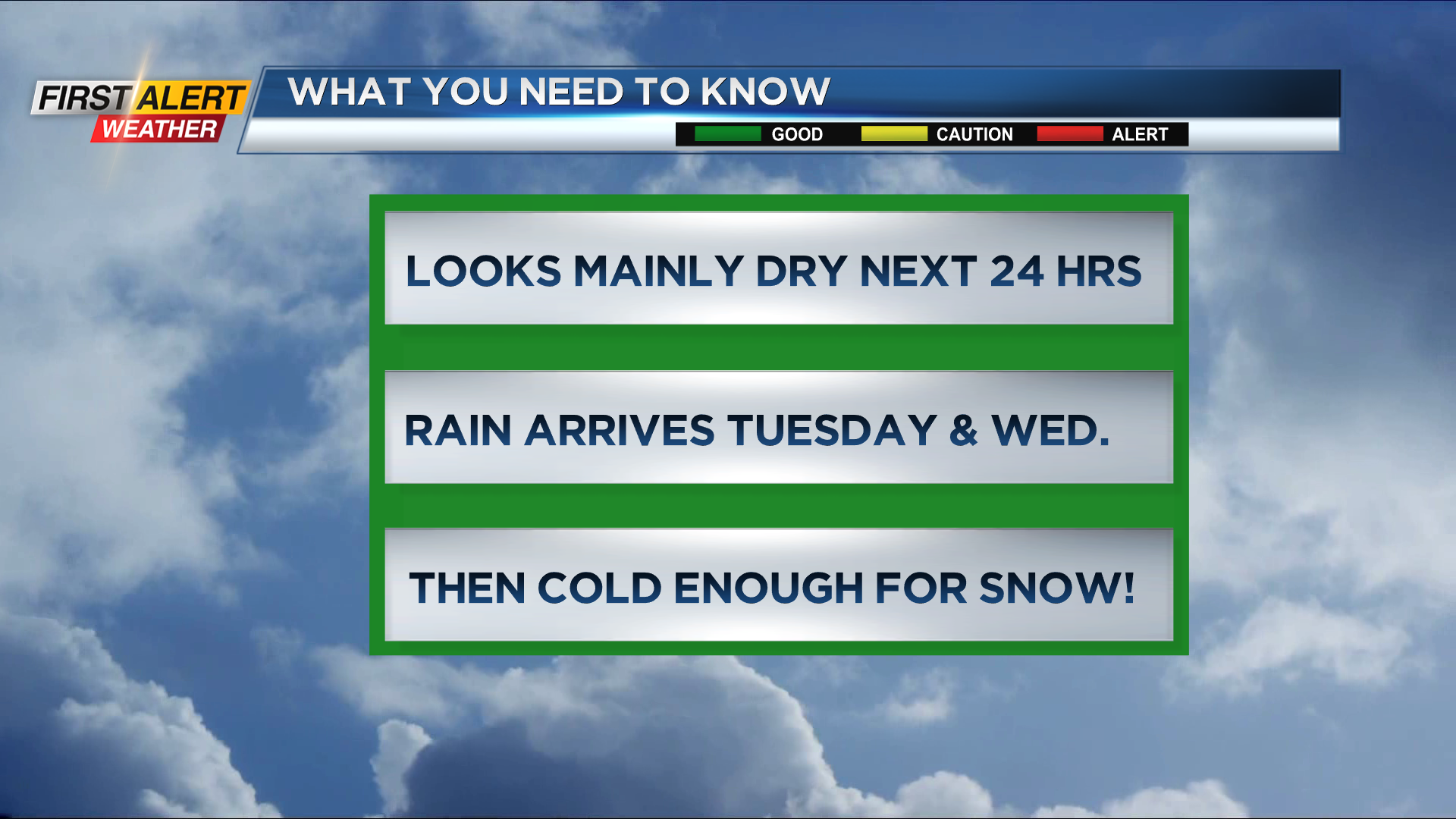
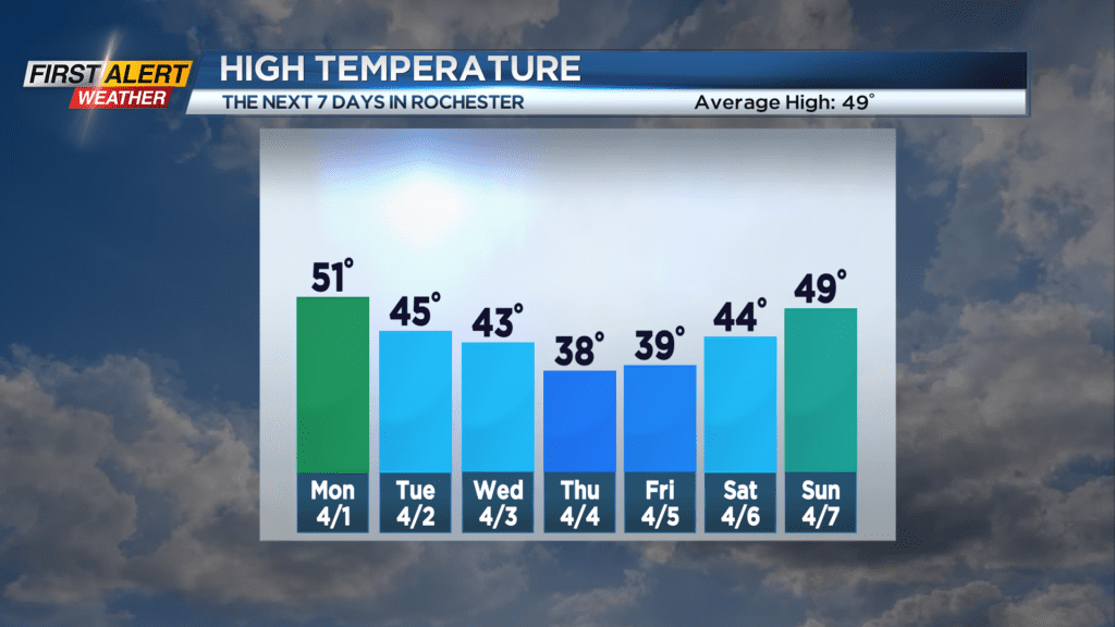
ROCHESTER, N.Y. – A high-pressure system has temporarily moved across the great lakes bringing some clearing and pleasant weather to start the week. However, a storm will slowly move towards Western New York by Tuesday and Wednesday with the probability of precipitation going way up for the region. Initially, this will be mild enough for rain, but marginally colder air will arrive Wednesday night, Thursday, and Friday. This will produce occasional wet snow with small accumulations likely for the Rochester area.
Sunday night, look for skies to become mostly cloudy. It should be mainly dry for the overnight with the low temperature in the upper 30s. Monday, the first day of April, will feature partial sunshine. You will find a range of temperatures as the mercury will stay in the 40s lakeside but will rise into the middle 50s south of Rochester. Then occasional light rain is likely for Tuesday through Wednesday with both days only in the low to middle 40s. Then winter returns by Thursday and Friday with occasional snow showers. Right now, it appears to be small accumulations through the end of the week. Both days the temperature will be mainly in the 30s.
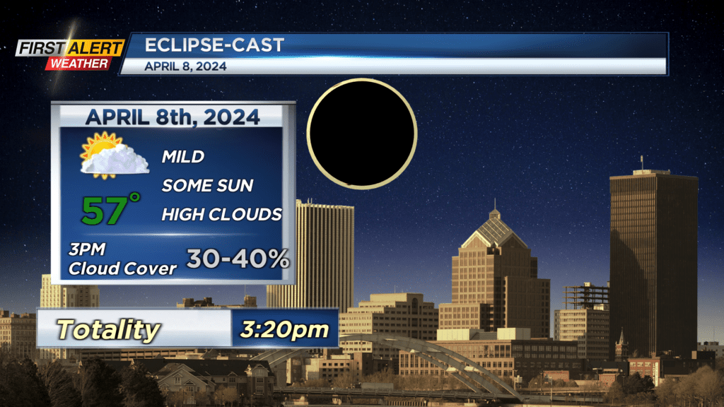
Looking ahead to the eclipse on Monday, the News First Alert meteorologists are “cautiously optimistic” that the weather will cooperate for good viewing.
Stay tuned to News 10NBC First Alert Weather for updates on the forecast.