First Alert Weather: Dry weather for now, as cleanup continues in Ontario County
[anvplayer video=”5184610″ station=”998131″]
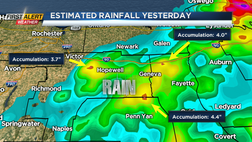
Yesterday the rain came fast and furious for communities in the Finger Lakes. Particularly hard hit was the city of Canandaigua, where nearly four inches of rain fell in less than two hours. As a result, flash flooding was evident in poor-drainage areas. Fortunately, our weather has dried out significantly and will likely stay mainly dry for at least the next 24 hours. However, beyond Tuesday, the likelihood of showers and thunderstorms will be on the rise once again and the threat of rain will be with us right into the weekend.
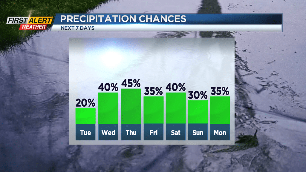
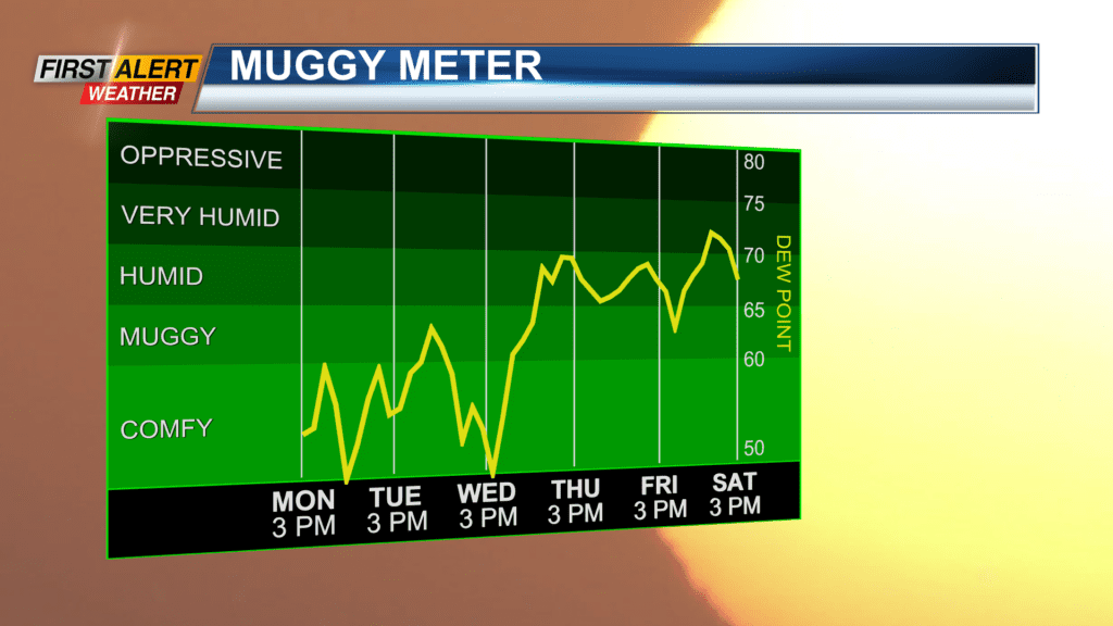
Tonight, look for patchy clouds to give way to clearing skies later tonight. The low temperature will be near 63 degrees. Tuesday will bring partly to mostly sunny skies. It will turn breezy and warmer during the afternoon. The high temperature will be in the middle 80s. Then the humidity will increase quickly for the middle of the week and likely last through the upcoming weekend. Wednesday will feature breaks of sunshine with a passing shower or thunderstorm. The high temperature near in the lower 80s. And the chance of showers and thunderstorms will remain, mainly during the afternoon hours, for Thursday, Friday, and Saturday. All three days, Western New York will reach the lower 80s.
Stay tuned to News 10 NBC First Alert weather for updates on the forecast.