First Alert Weather: Drying out Tuesday, then turning stormy for the last day of summer
[anvplayer video=”5136019″ station=”998131″]
ROCHESTER, N.Y. (WHEC) — Our last Monday of summer started off quite wet, with a round of rain and plenty of thunder, delivering about a quarter to half an inch of rain over most of our region.
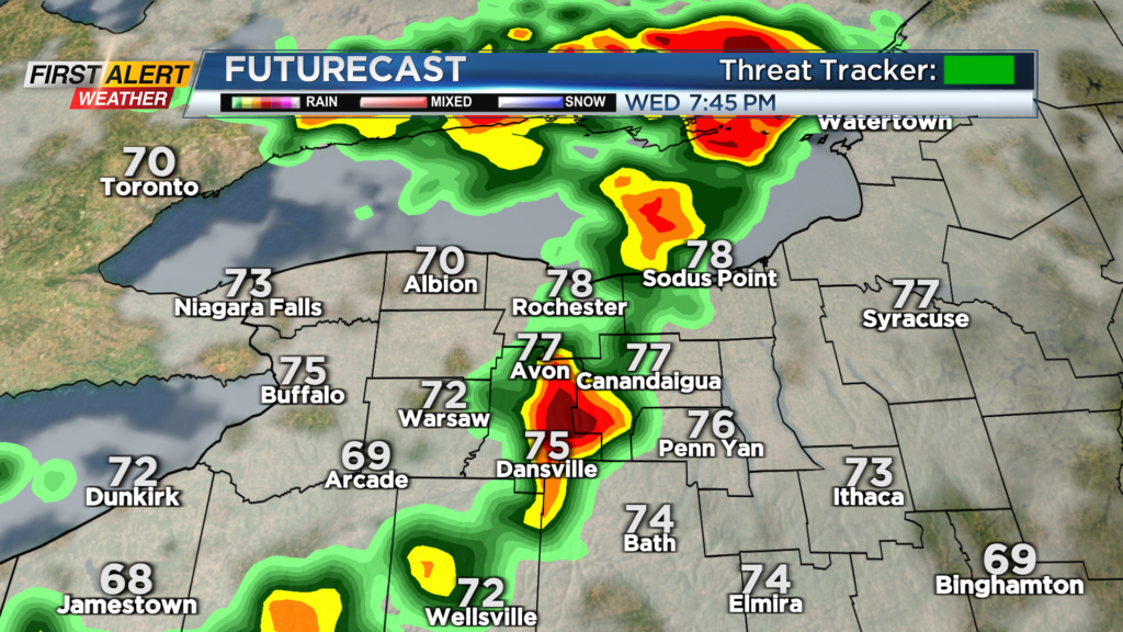
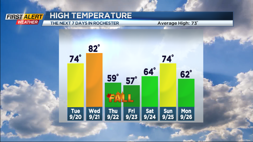
Any showers or thunder with a cold front sweeping through tonight will end before midnight, then leave us with a partly cloudy sky. Tuesday looks pretty good with a mix of clouds and sun, a slight breeze and just the slight chance of a passing shower. Summer ends on Wednesday with a bang. Highs will make it back into the 80s with dry weather through about dinner-time. After that, expect another round of thunderstorms with yet another, stronger cold front. There’s a chance a few of those storms could be strong with gusty winds, but the timing of the front isn’t ideal for severe weather, as the sun will be setting. Still, we’ll keep an eye on the trend, and if the arrival of the front speeds up a few hours, a Yellow Alert may be needed for Wednesday evening.
Fall arrives on Thursday, and so does the fall air! Highs on Thursday will struggle to make it out of the 50s with a brisk breeze and scattered showers likely. Most of the wet weather will be gone by Friday, but we’ll keep the fall air around, with highs once again in the 50s. The first weekend of fall looks decent, with dry weather and some sun on Saturday. Rain chances may start to go up again by the end of next weekend. We’ll keep you posted.