First Alert Weather: Enjoy today before rain and snow tomorrow
[anvplayer video=”5152096″ station=”998131″]
ROCHESTER, N.Y. A cold start to our Saturday as temperatures have started near the 20-degree mark!
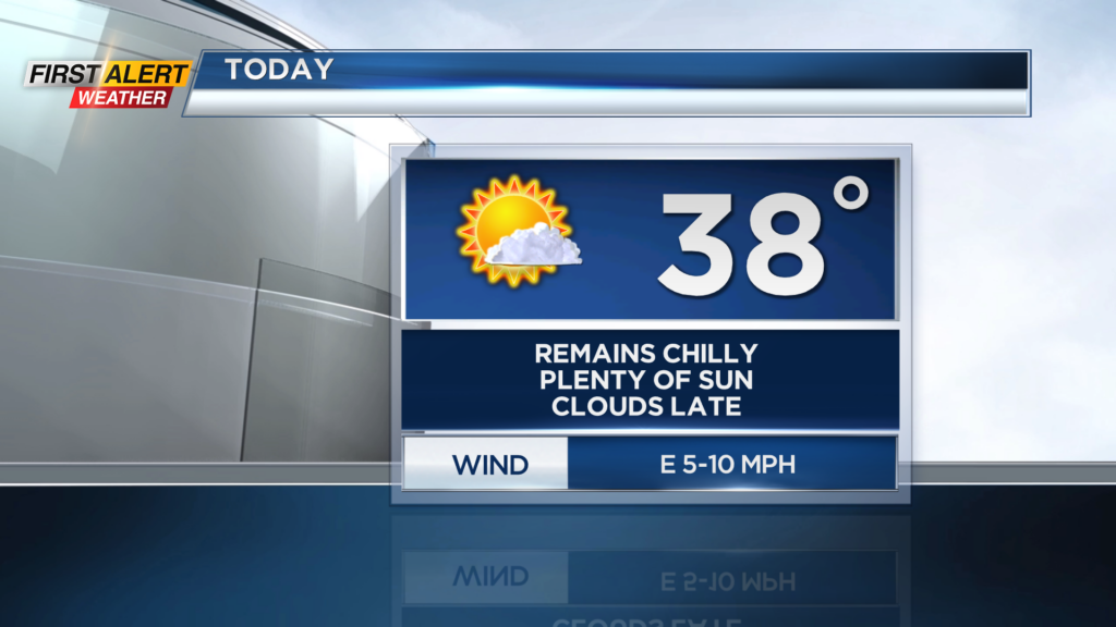
We will remain on the cold side once again today as afternoon highs only reach the mid and upper 30s. The good news is that the sun will be shining. Plenty of sun is expected for us today, but clouds will increase late this evening.
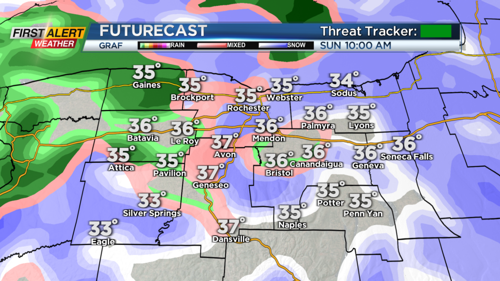
This is ahead of our next chance for unsettled weather, in the form of rain and snow, on Sunday. A weak clipper system will swing through our region tomorrow with rain and snow showers for us. Rain and snow shower chances will be from the morning hours Sunday through the evening.
In terms of accumulations, not much is expected. High elevations east of Rochester could see nearly 2 or 3 inches, but the remainder of the region will see less than an inch of slush. Roads should be good to go as well, especially as afternoon highs reach the mid and upper 30s.
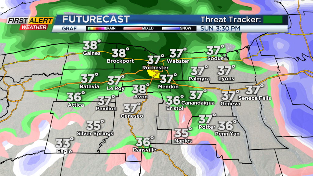
A few flakes linger into Monday morning, which could create a slick spot or two away from the city, but very minor issues are expected. We will then dry out into the middle of this weekend before we track our next possible winter storm.
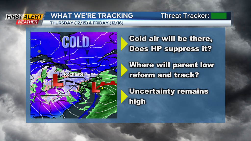
Questions remain for the end of this week as low pressure will track into the Central US, and then reform along the East Coast. A big question will be where does low pressure form and where does it track afterward. Will it move up the East Coast and bring us heavy snow or does it track south and leave us with little or nothing?
First Alert Meteorologist Alex Bielfeld has your Saturday forecast.
One thing that is for sure though, is that the cold air will be there. Make sure you tune in for updates as we get closer. We will continue to track this possible storm and bring you updates as they become available.