First Alert Weather: Fair weather for the work week, but some rain, snow and wind for the weekend
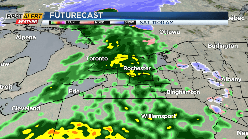
Timing is everything, and the timing of our next storm unfortunately will impact the weekend.
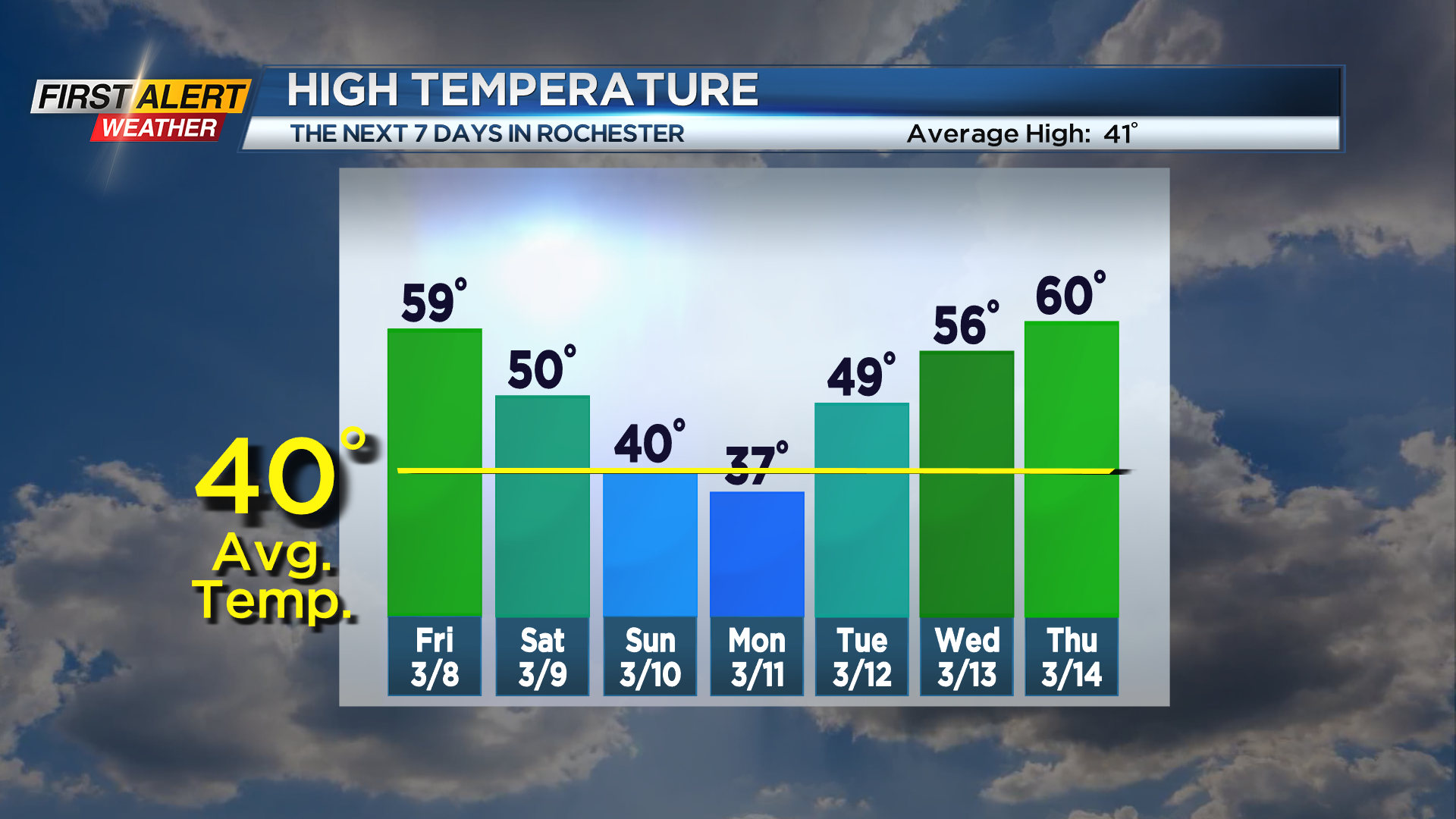
First, fair weather for Friday with sunshine mixed with high clouds and temperatures up near 60 degrees. Clouds will thicken late, and some showers will arrive by Saturday morning. Showers will become steadier during the afternoon, with a busy breeze out of the south. Saturday will likely be close to a washout as the area of low pressure moves through. Sunday will be turning chillier as the lows pull away. While the steadiest precipitation will fall on Saturday, Sunday will see showers mixed with snow showers as temperatures fall through the 40s and into the 30s. Winds will turn a little gusty. No accumulating snow is expected during the day on Sunday, but we will likely see a minor accumulation (a few inches) into Monday morning in the form of lake effect. At this point, we don’t see any major issues on roads or with the wind, so we’ll remain “green” on the First Alert Threat Tracker.
Monday will certainly look and feel like winter for a day, but we’ll climb back into the 40s on Tuesday, and 50s and 60s for the remainder of the work week with mainly dry weather. We’ll be tracking our next system for the end of next week and into the weekend, which could potentially have at least some impact on the St. Patrick’s Day parade downtown. It is still more than a week out, so expect at least some changes in that forecast.