First Alert Weather: Fall air sticks around for a few days
[anvplayer video=”5192049″ station=”998131″]
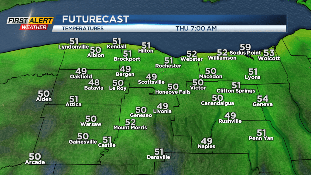
Temperatures struggled to make it out of the 60s on Wednesday, but the humidity dropped off considerably, and we dried things out. So overall, very little to complain about. We’ll see (and feel) much of the same on Thursday, with a few lake clouds to start, followed by a mostly sunny sky, low humidity and temperatures holding in the upper half of the 60s. High pressure builds in overhead Thursday night into Friday. With that, we’ll see a mainly clear sky and light winds, which will lead to a cool night. Many spots away from Lake Ontario will be dipping into the 40s. Perhaps a few spots well south into the Southern Tier could see some patchy frost, but no widespread frost is expected. Friday will be a beautiful day, with wall to wall sunshine, and temperatures flirting with 70.
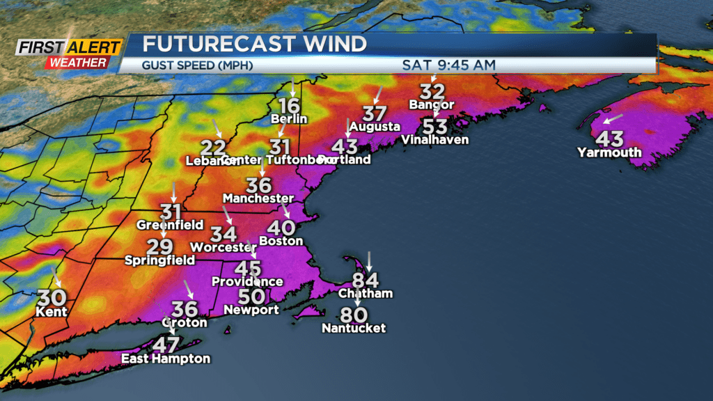
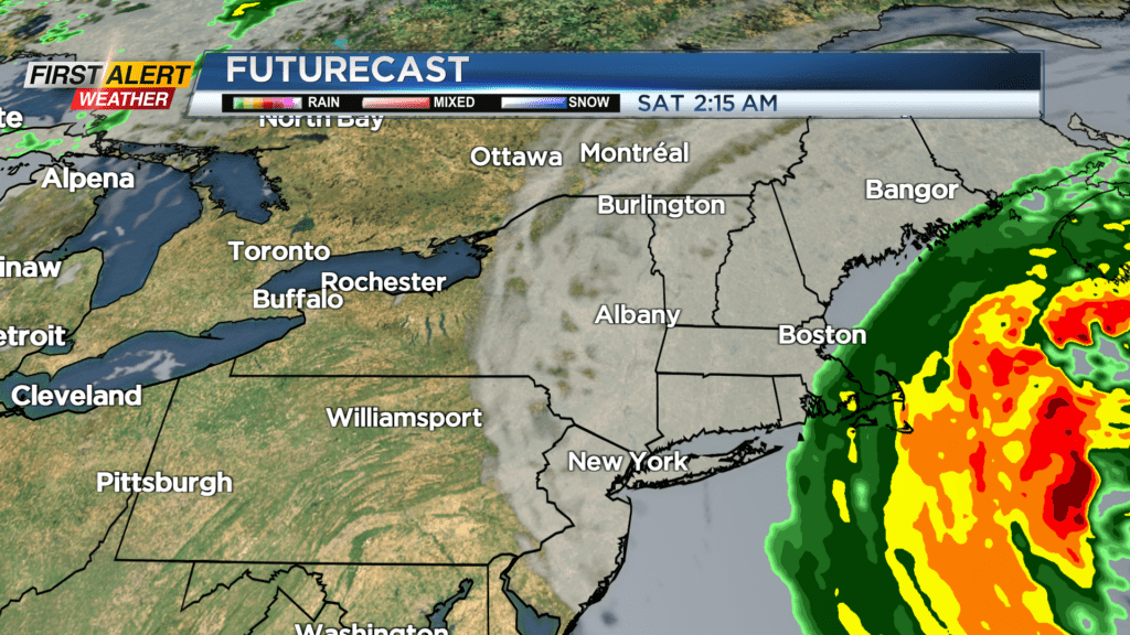
The weekend still looks quite nice, with mainly dry weather. Hurricane Lee will be tracking up the east coast (off the coast), bringing high waves, high wind and rain to coastal New England and into Atlantic Canada over the weekend. The biggest weather impact locally will be some high clouds from Lee east of Rochester. Otherwise we will see dry weather and temperatures in the lower 70s. Sunday also looks nice for the most part. But, our next wave of low pressure will be moving in by the end of the weekend and early next week, bringing in a slight chance of a shower by late Sunday, and a much better chance of scattered showers on Monday. Temperatures will begin to warm a bit late next week, which are also our last few days of summer. Fall arrives next weekend.