First Alert Weather: Falling temperatures and damp weather Sunday
ROCHESTER, N.Y. – Reality will begin to set in after Saturday’s record typing warmth.
The mild air to start Sunday will be replaced by more seasonable temperatures as the day goes on. Temperatures will drop through the 40s into the 30s by later in the evening following the passage of a cold front. Showers will also tend to shift east, then stall out, keeping parts of the region damp for much of the day.
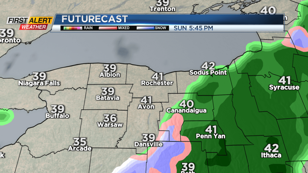
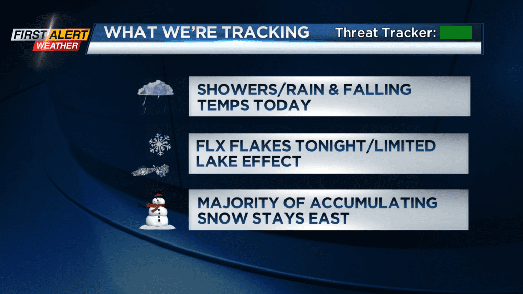
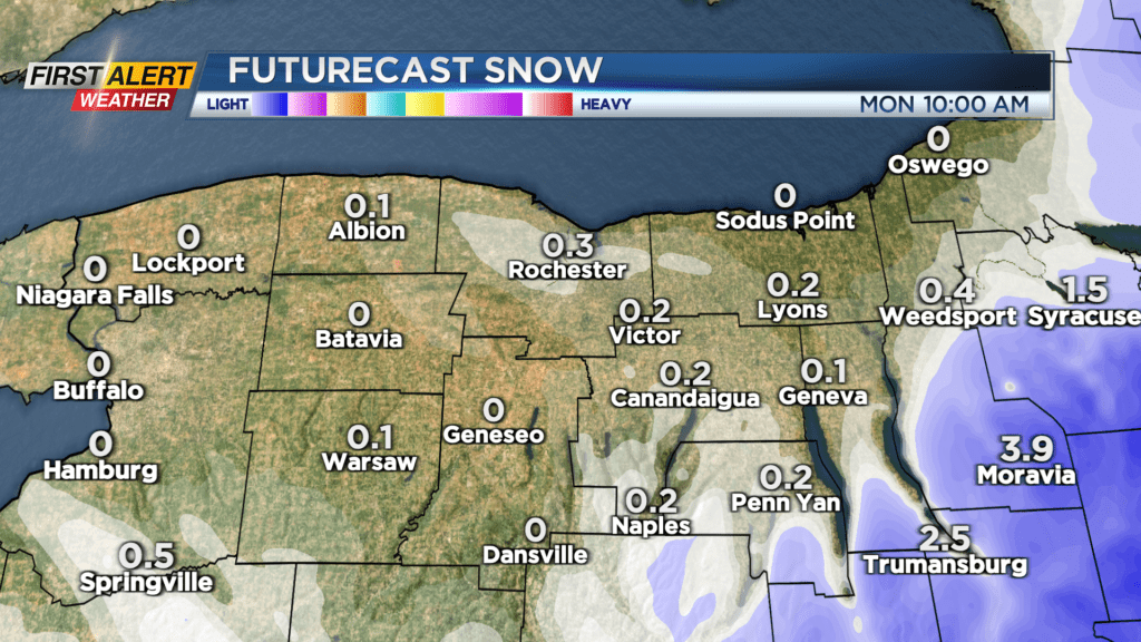
The driest weather will be found west of Rochester, with the wettest weather in the Finger Lakes as another area of low pressure develops along the coast. As the colder air deepens later Sunday evening, we’ll see a slow transition over to some wet snow. Some minor accumulation is possible in the Finger Lakes, especially the higher terrain.
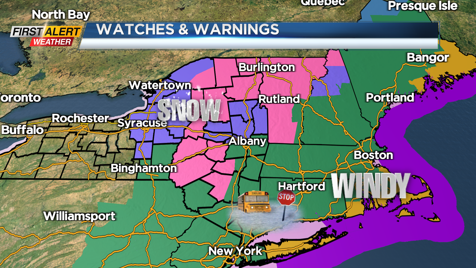
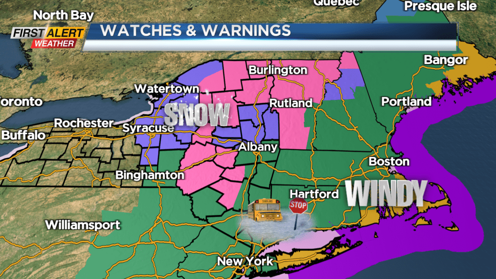
In fact, the further east into central and eastern New York you go Sunday night, the more accumulating snow you’ll see. Winter Storm Warnings and Winter Weather Advisories are posted for eastern and upstate NY, while flooding and wind will be an issue into New England. So while we’ll see an unsettled and changeable Sunday, we’ll miss the most significant impacts from this storm.
Some minor lake effect will develop into Monday as the air gets colder, but any accumulation should be minimal. Otherwise, it’ll be blustery and much chillier with highs in the mid 30s. Other than a brief and moisture-starved cold front early Wednesday, the rest of the upcoming work week should be fairly uneventful with mainly dry weather and a bit more sunshine than what we’ve seen recently.