First Alert Weather: Fantastic today before unsettled tomorrow
[anvplayer video=”5149828″ station=”998131″]
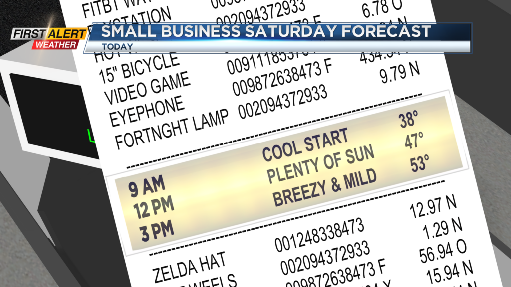
ROCHESTER, N.Y. It’s a cool start to our Saturday this morning with temperatures around the freezing mark, but we are expecting a warm-up later today!
Highs this afternoon will reach the mid and low 50s, and the clear skies right now will linger through today before clouds build late. Enjoy the weather today because unsettled weather is expected for folks heading home from the holiday weekend tomorrow.
An area of low pressure over Texas will race northeast and bring us rain by Sunday afternoon. Rain tomorrow afternoon could be heavy at times and limit visibility on the roads as well as create some pooling and ponding, especially west where a deep snowpack continues to melt.
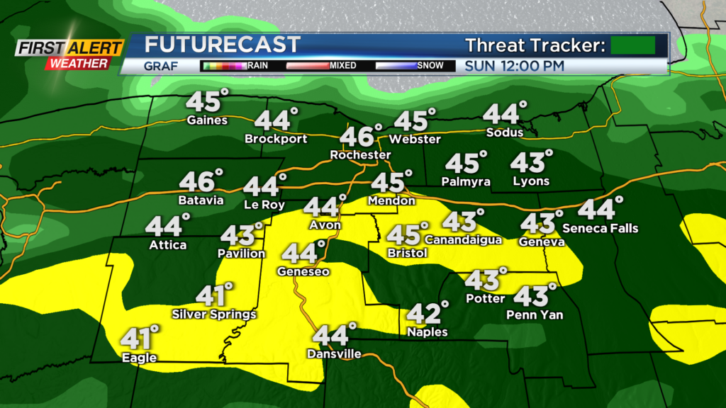
No major flooding is expected with the melting snowpack. Rain and scattered showers will last into early Monday morning before drying out Monday afternoon. We will generally be quiet Monday and Tuesday before a stronger cold front swings through Wednesday and Thursday.
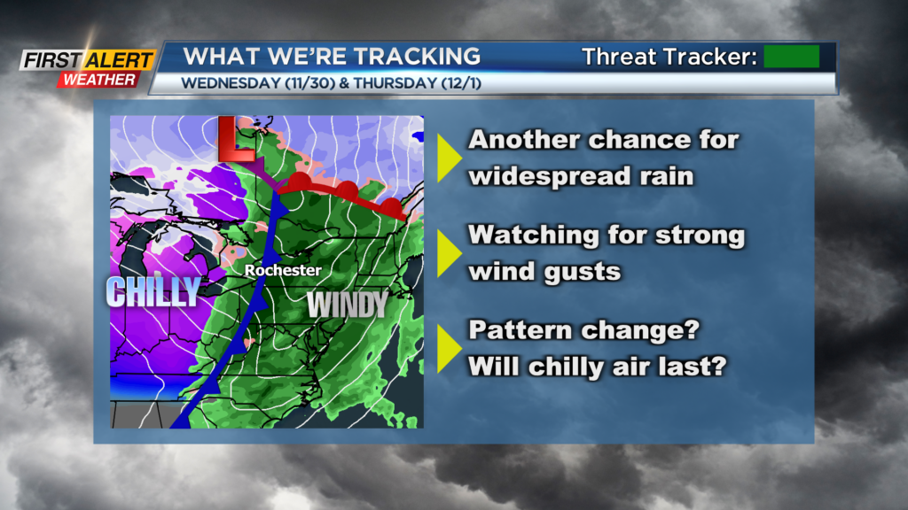
A strong cold front with widespread showers, but more importantly strong winds, will swing through as we end November and begin December. There is no alert for this system as of yet, but we are keeping our eyes on the opportunity for strong wind gusts Wednesday and Thursday.
Gusts on Wednesday as of now could gust upwards of 40 m.p.h. before increasing to around 50 m.p.h. by Thursday. We would like to see a little more consistency with numerical modeling on wind gusts for those days before an alert is issued so make sure to stay up to date with the forecast over the next few days.