First Alert Weather: Feeling like winter through the week
[anvplayer video=”5147538″ station=”998131″]
ROCHESTER, N.Y. Waking up to a much cooler start here in Western New York and the Finger Lakes with temperatures in the 30s.
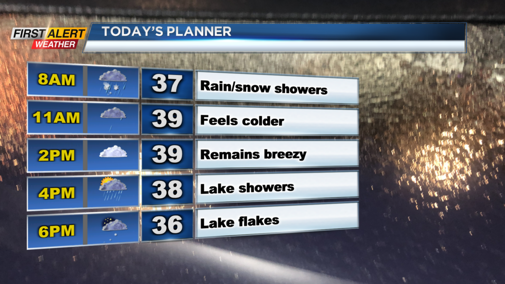
Not much movement is expected in the temperature department this afternoon as highs only reach 40 degrees. Not only will it be cold, but it will also be breezy through today, which means the temperatures will feel even colder with wind chills in the 30s through today.
Also, we will have occasional rain and snow showers to deal with. No issues on the roads are expected, but we could see some minor accumulations on the colder surfaces in the higher elevations today. Rain and snow shower chances continue through this evening and switch over to snow showers tonight.
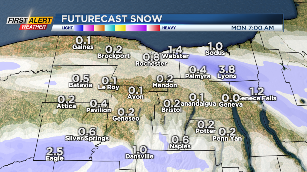
Areas east of Rochester will have an opportunity to get in on their first light accumulations tonight on colder surfaces with potentially an inch of snow by tomorrow morning. A few lake effect flurries may linger into tomorrow morning, but things dry out by the afternoon with partly cloudy skies.
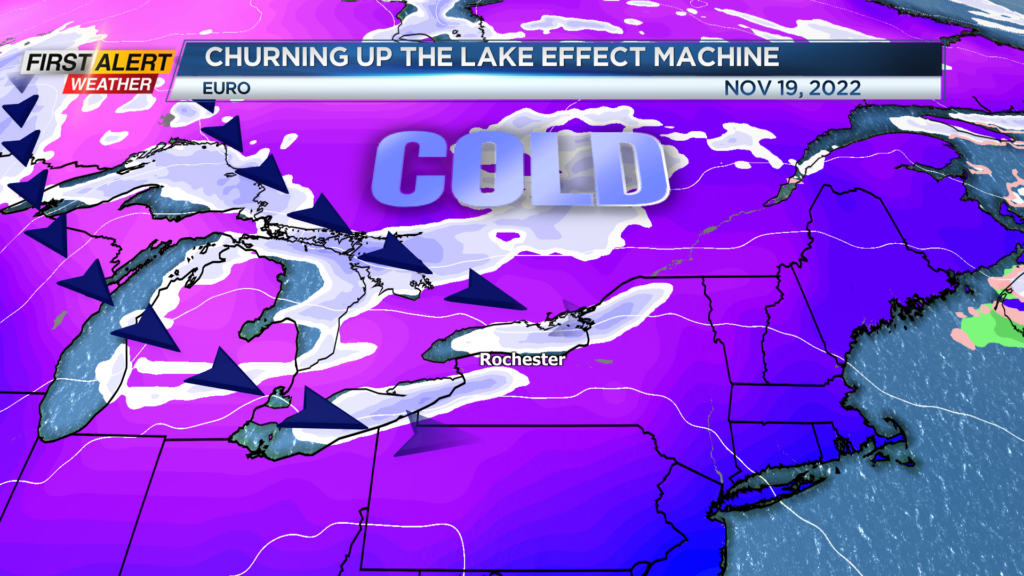
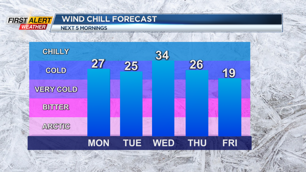
It will remain cold tomorrow and through the work week with highs struggling to reach over 40 degrees. On Wednesday, we will keep our eyes on an area of low pressure off the East Coast. As of now, things are well east for any impacts locally but we will keep our eyes on it.
The bigger story for us locally will be what is behind this area of low pressure. Once that swings by, we will look at our first real chance for any light accumulations locally with the lake effect snow machine potentially revving into high gear.
First Alert Meteorologist Alex Bielfeld has your Sunday forecast.
A surge of cold air will swing in locally on the backside of that area of low pressure and start up the lake effect snow machine for folks east of Lake Ontario and Lake Erie, and with occasional snow showers, and possibly squalls, we could be looking at our first accumulations across our region! Details as the week progresses.