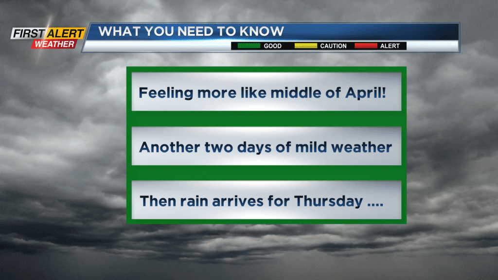
First Alert Weather: Feeling more like the month of April for this Christmas Day
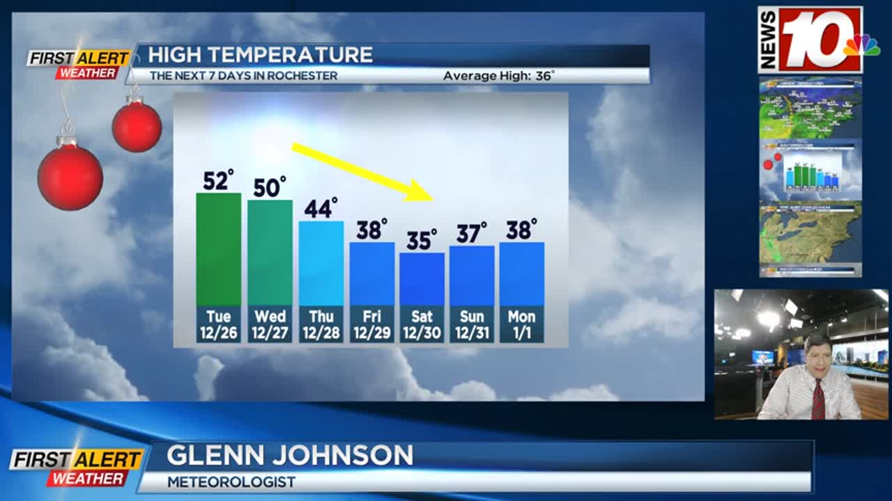
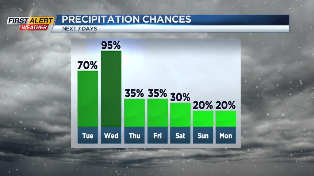
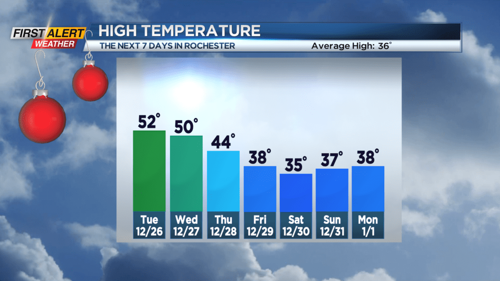
It was the warmest Christmas day in four decades for Western New York as the temperature pushed into the middle 50s. And it appears this unseasonably warm weather will last for the next two days before rain arrives — and then a slow, steady downturn is expected in the temperature by Thursday and Friday. More typical winter weather will arrive Friday and Saturday, but right now, little or no snow accumulation is expected heading into the weekend.
Tonight will be another very mild night with partly cloudy skies. The low temperature will be in the lower 40s. Typically, this time of the year Rochester is in the lower 20s. Tuesday will be dry for the morning with a few rain showers arriving for the afternoon. Again, it will be mild with a high temperature near 52 degrees. Wednesday will bring more of a steady rain throughout the day and the mercury near 50 degrees. Thursday, the temperature will finally begin to fall through the 40s with a spotty rain shower. It gets progressively colder for Friday with the temperature staying in the 30s. The end of the week will feature flurries and snow showers.
Stay tuned to News 10NBC First Alert weather for updates on the forecast.