First Alert Weather: Finally looking like winter this weekend

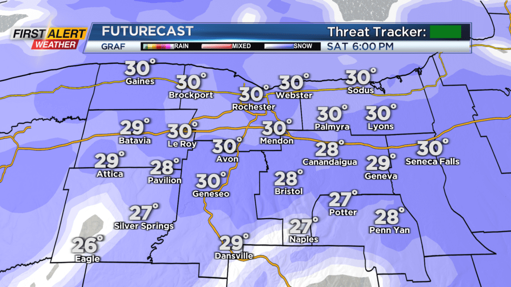
ROCHESTER, N.Y. — Waking up Saturday to a cold start with temperatures in the 20s and low 30s. Not only that, but it is also cloudy once again as we are expecting snow to roll in late Saturday afternoon.
An area of low pressure over the southeast U.S. will run along the East Coast and bring us wintry scenes later Saturday and Sunday. Saturday morning will stay dry, and most of the afternoon too. Snow will begin to move in from south to north after 3 p.m. Saturday, and snow will be heavy at times Saturday evening and night. Snow will eventually persist into snow showers by midnight Saturday, but limited visibility and slick roads will be likely.
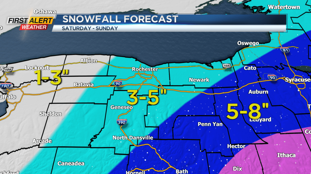
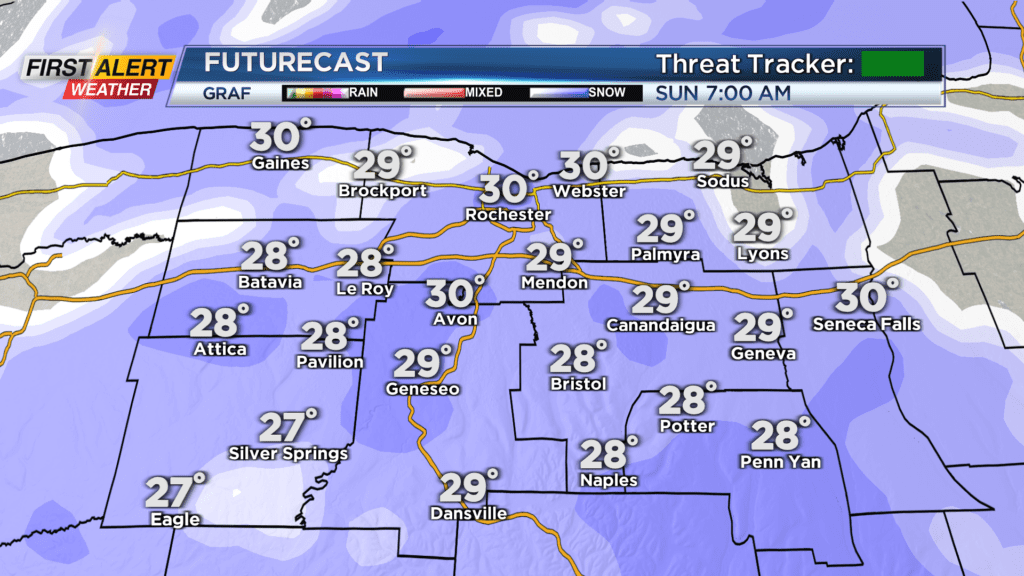
Snowfall rates at times Saturday evening could reach near an inch per hour before tapering to snow showers. Snow showers will continue into Sunday morning before tapering by the afternoon. Slick roads and limited visibility will remain possible through Sunday morning before conditions improve late. When it’s all said and done Sunday afternoon, most of the region will see anywhere between three and five inches of snow with areas well west of Rochester only receiving about one to three inches of snow.
Areas well east in the Finger Lakes will see a bit more with five to eight inches of snow possible.