First Alert Weather: First shot of lake effect snow
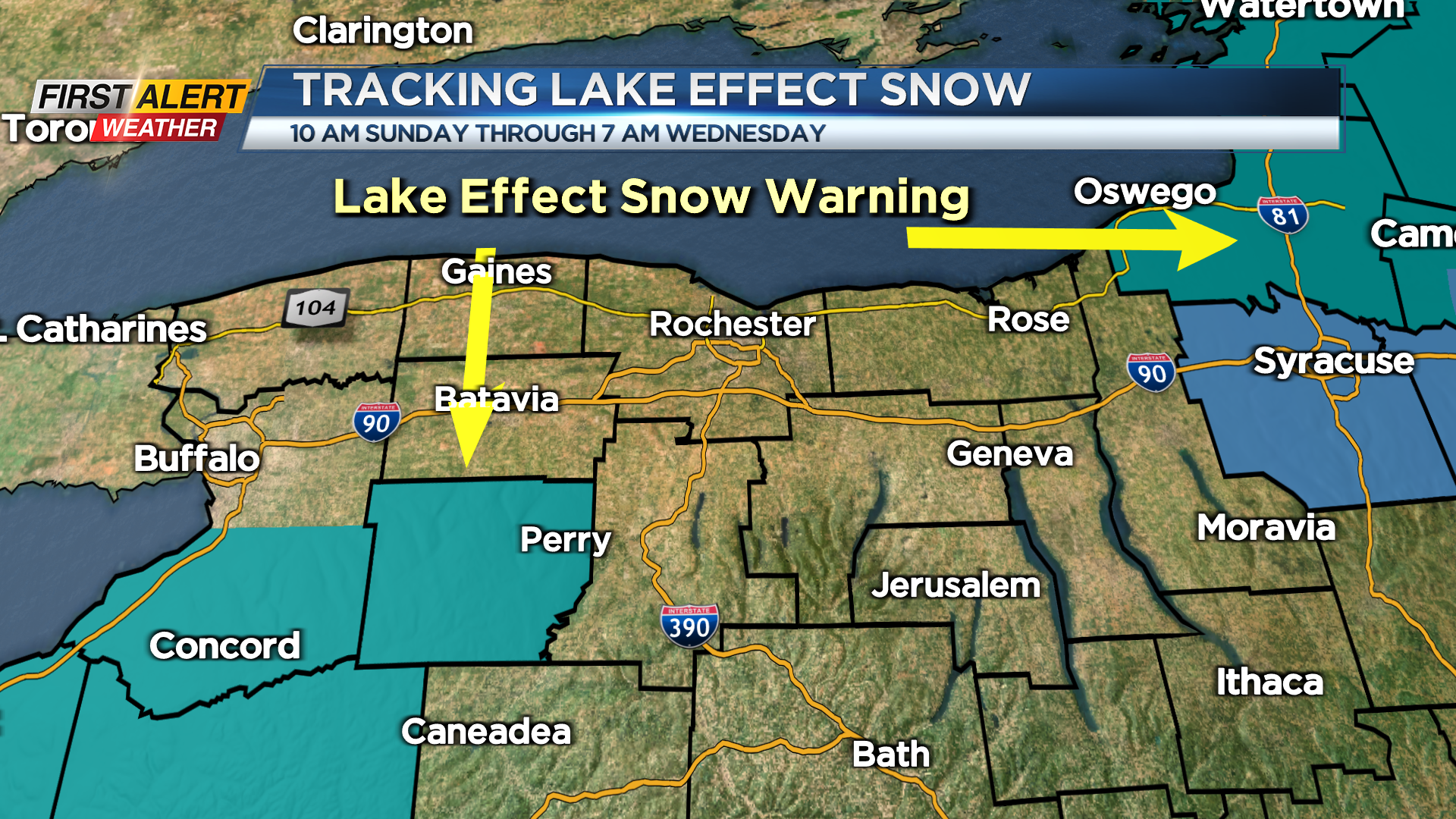
ROCHESTER. N.Y. – Several cold fronts will swing across Western New York in the next 24 hours, and this will usher in the coldest weather of the season. This air will be cold enough to produce lake effect snow downstream from Lakes Erie and Ontario. This will likely be some heavier snow squalls for some, but just flurries to others. Right now, it appears that initially this will be a westerly wind, which means the snow will be most persistent south and southwest of Rochester. Currently there is a lake effect snow warning for Wyoming County which is 50 miles southwest of Rochester. As a result, most of the accumulation will be across Wyoming County with this snow band weakening as it reaches southern portions Livingston County later Monday into Tuesday.
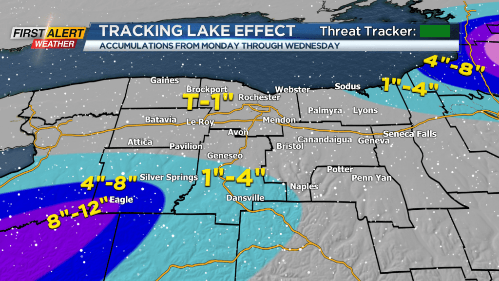
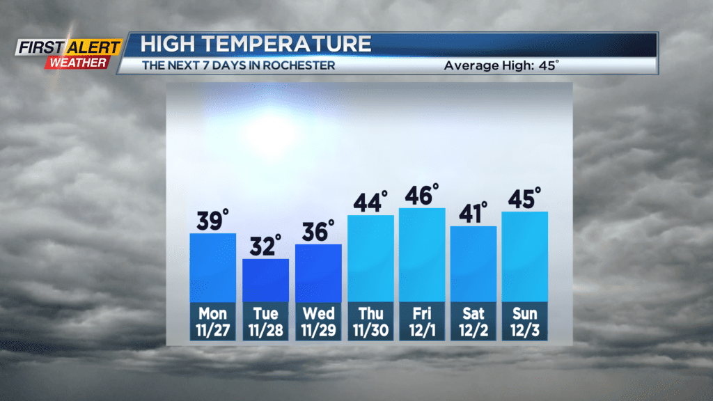
Sunday night, it is rain showers with the temperature slowly falling through the 40s into the middle 30s. This rain may mix with wet snow late tonight in the higher elevations. Monday Rochester will find breaks of sunshine and it will be windy with the temperature falling through the 30s. However, Lake Erie snow will develop southwest of Rochester with snow accumulation in Wyoming County in the range of a coating to two inches. More lake snow is expected south of Routes 5 and 20 for Monday night into Tuesday with Rochester see just snow flurries. However, portions of Wyoming County will likely measure another 4 to 8 inches (maybe another 1-3 inches in southern Livingston County).
Stay tuned to News 10NBC First Alert Weather for more updates on the forecast.