First Alert Weather: First snowflakes of season on Thursday but tracking a big warm-up
[anvplayer video=”5142874″ station=”998131″]
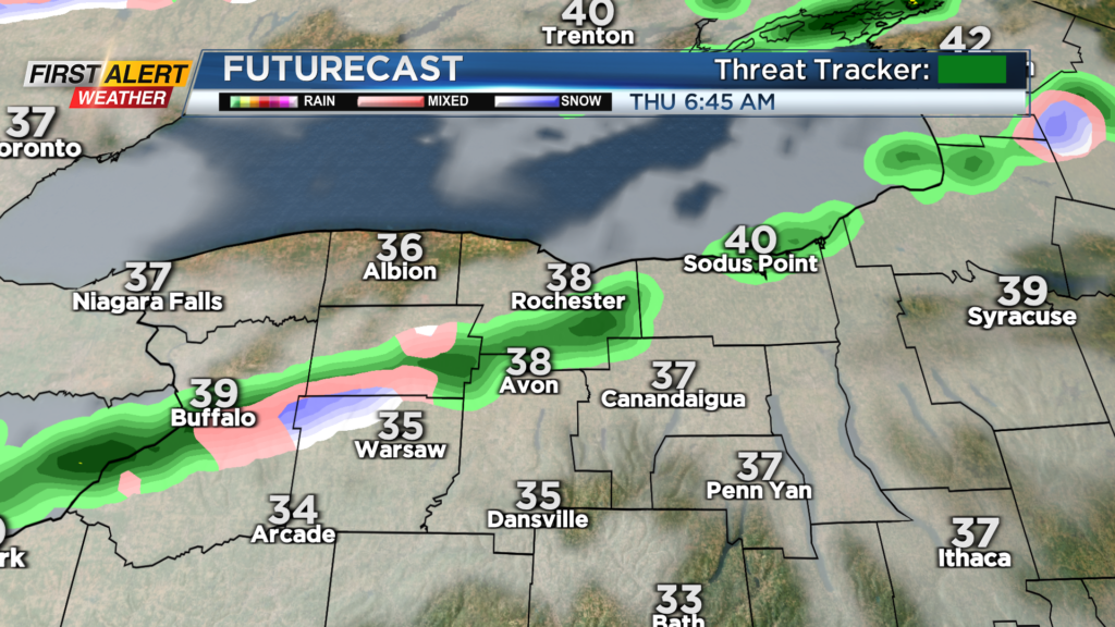
ROCHESTER, N.Y. — Some lake-effect showers and wet snow are in the air on Thursday morning.
Those showers will weaken and move north and west of us in the afternoon. Even though it will be mainly dry, clouds and a chilly breeze will persist throughout the day.
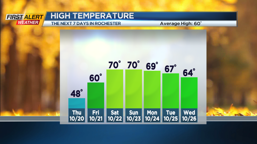
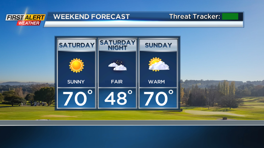
The pattern finally breaks down on Friday as the clouds break for some sunshine and temperatures start to head up. More pronounced warm-up this weekend as temps make a run toward 70 degrees.
There will be lots of sunshine Saturday. A few clouds may drift in on Sunday but it will be dry for outdoor plans all weekend long. Stay tuned to News10NBC for updates on how long the warm weather sticks around into next week.
You can see our foliage report here:
[anvplayer video=”5142890″ station=”998131″]
______________
Download the WHEC First Alert Weather app to stay up to date while on the go.
Watch the latest full forecast online.