First Alert Weather: Friday evening weather update
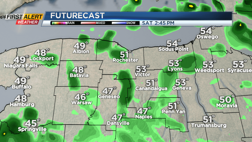
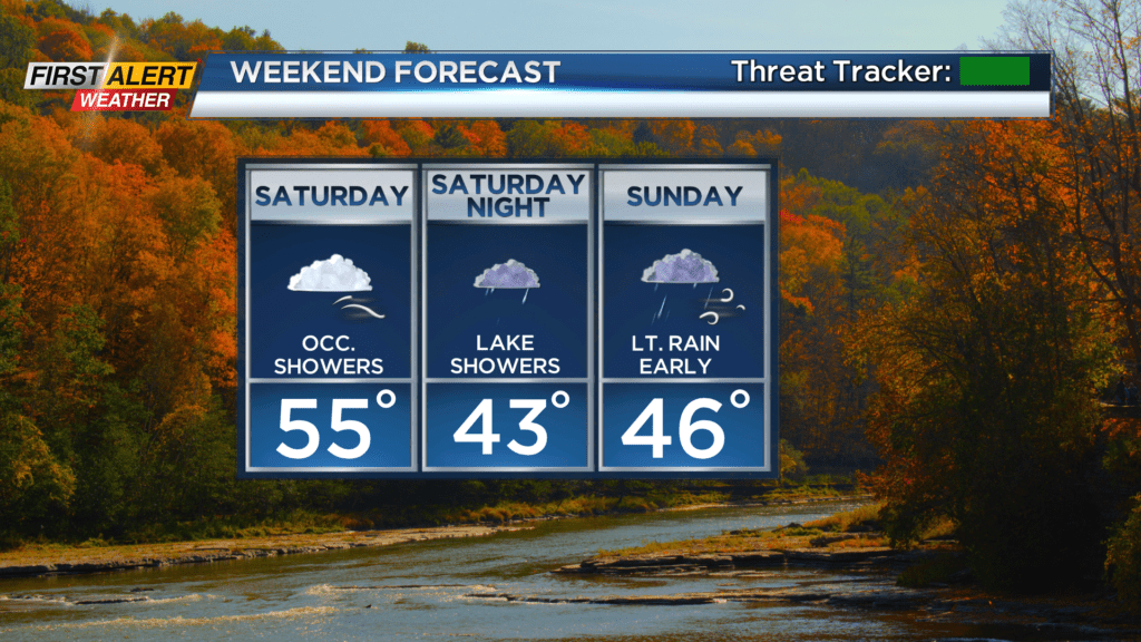
A storm system moving through the eastern Great Lakes and redeveloping along the East Coast will bring us a cooler, windy and unsettled weekend. But we’re not looking at a washout. We’ll see occasional showers overnight as the low moves overhead. After it does, we’ll begin to turn cooler on Saturday, with temperatures dropping through the 50s, especially into the afternoon. With the cool air deepening aloft, we’ll see a lake response start to develop. This means some passing showers, especially late morning into the afternoon hours.
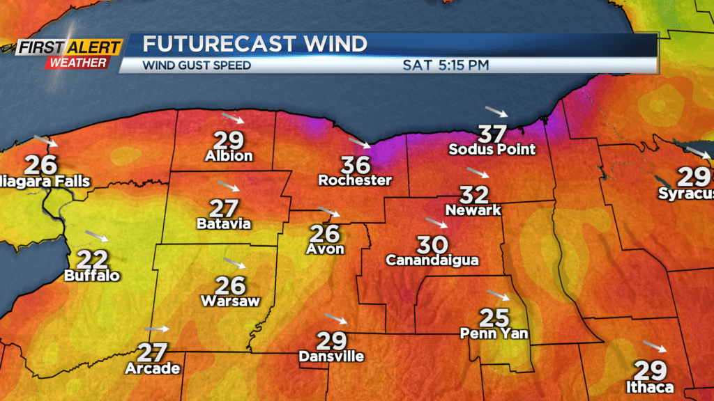
We’ll also see the wind kicking up out of the northwest with some gusts 30-35 mph. This won’t cause any issues with downed trees or outages, but it will make temperatures feel quite a bit cooler.
Still, Saturday will be the drier of the weekend days, with more dry time than wet time. Showers on Sunday will tend to focus more on the morning hours, before tapering during the afternoon as the low pulls away. We’ll have to continue to deal with that gusty northwest wind, and cooler air with highs in the 40s on Sunday.
Monday will see a nice clearing trend with more sunshine returning, but it’ll be another cooler day with highs in the lower 50s. In fact, if we get enough clearing Sunday night, we may see some frost early Monday morning away from Lake Ontario. Much of the rest of next week will feature temperatures back into the 60s, possibly pushing 70 by late week. But, we’ll be watching the exact placement of a front that will meander overhead. It does appear that a stronger storm system will push through sometime next weekend, putting an end to our milder air, and bring in yet another round of wet weather for the weekend. And while not an official forecast yet, there are some signs pointing to a cooler Halloween this year. Stay tuned!