First Alert Weather: From 50s to flurries, but the winter chill doesn’t last

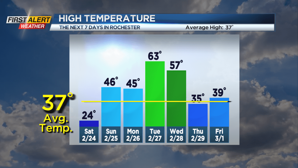
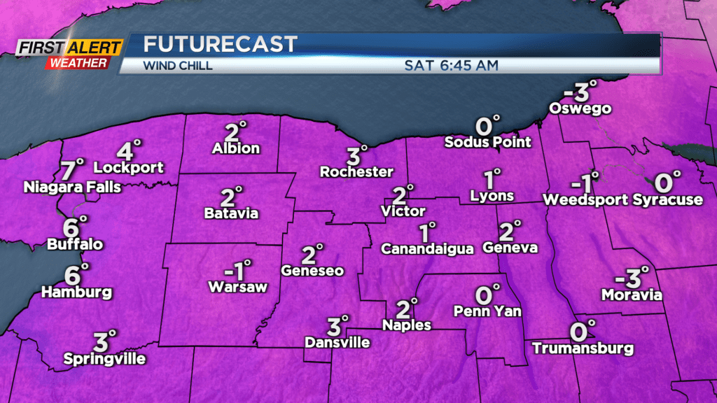
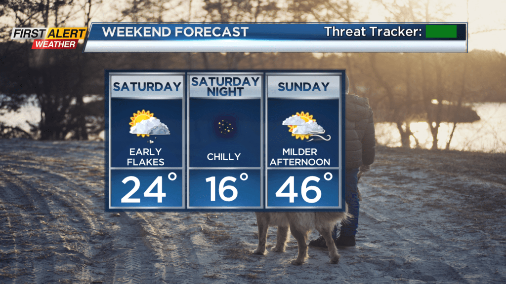
Temperatures topped out in the mid 50s on Friday thanks to some bonus sunshine, but a potent cold front plowing through the area will put a quick end to that warmth. We’ll wake up Saturday morning to temperatures in the mid teens. That is about 40 degrees colder than just about 12 hours prior! Some lake flurries and clouds will likely be around, but won’t last. Drier air and high pressure will bring a return to sunshine into the afternoon, but the temperatures will remain quite cold in the lower 20s. We’ll drop into the teens again Sunday morning, but climb into the mid 40s by afternoon with a mix of clouds and sunshine and southerly breeze.
We’ll begin another very impressive warm-up next week, with temperatures on Monday in the mid 40s, then surging into the 60s on Tuesday. Depending on the timing of our next storm system and cold front, we could hang onto the warm air into Wednesday, but we’ll drop quickly once again with rain over to snow showers and a little wind with that next cold front on Wednesday. While we don’t have any big or severe weather in forecast, hang onto your hats, as our temperatures will take us on a wild ride!