First Alert Weather: Good forecast for Sunday holiday travelers
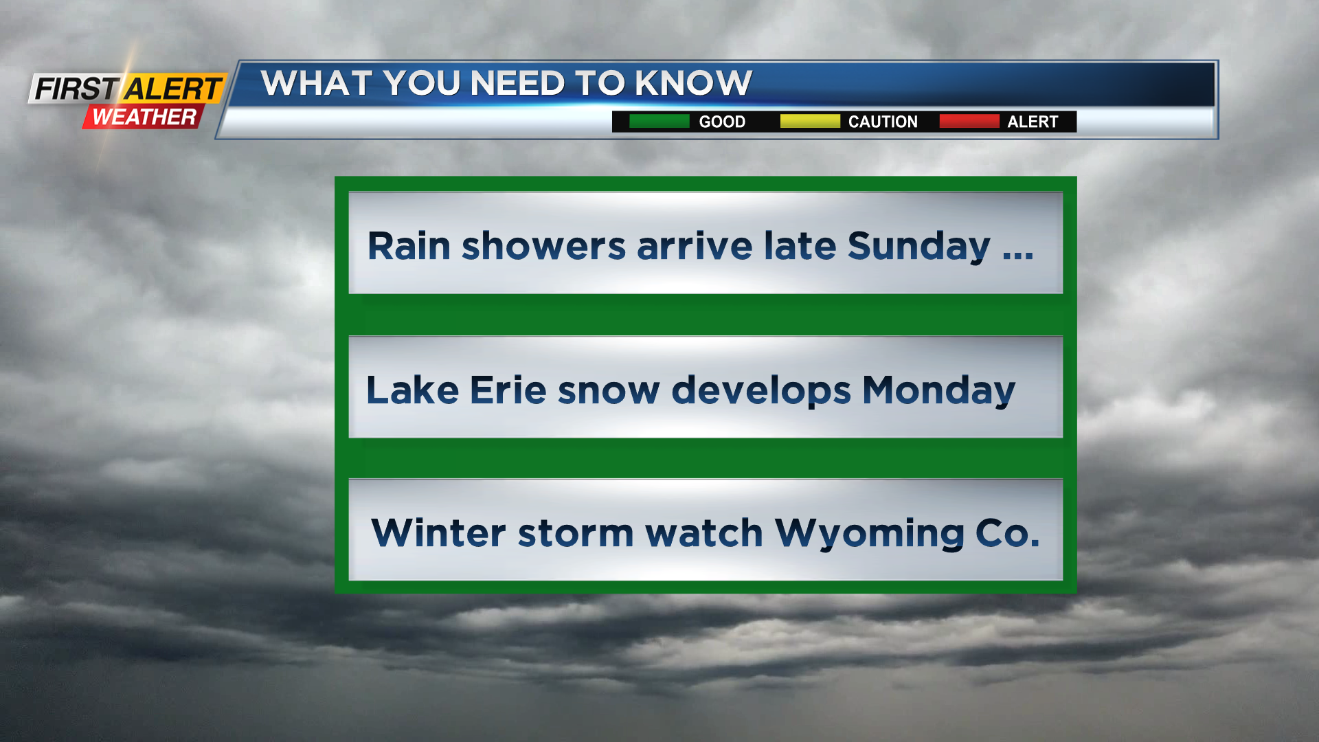
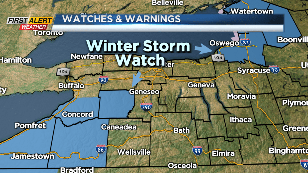
ROCHESTER, N.Y. – Our relatively calm November weather continues for most of Sunday as dry weather will last for most of the daylight hours. Then a series of cold fronts will cross Western New York for Sunday night and Monday. This will bring in much colder air into the region and eventually produce lake effect snow. However, most of time, we will see a westerly wind direction. That has significance as to who will see most of the accumulating lake snow. Initially this will be a Lake Erie snowfall, which means most of the time the immediate Rochester area should see little or no accumulation. As a result, the News 10NBC First Alert Threat Tracker will be “green” for the foreseeable future. However, because of the Lake Erie snow, there is a winter storm watch for Wyoming County which is approximately 50 miles southwest of Rochester.
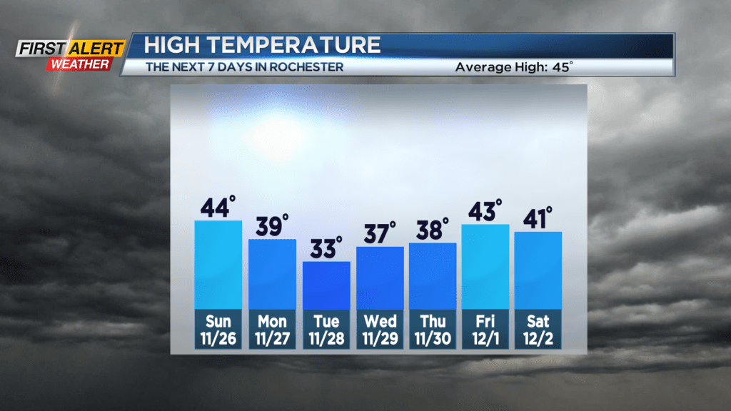
Saturday night, look for partly cloudy skies and a low temperature in the upper 20s. Sunday we may sneak in a little hazy sunshine for the morning, then clouds arrive with a late day rain shower possible. It will not be a cold with the temperature rising into the low to middle 40s. Monday, we expect a few breaks of sunshine with Lake Erie snow developing south of the New York State Thruway. Most folks in the southern tier could see an inch or less, but southern portions of Wyoming County will see 2-4 inches. The temperature will be falling through the 30s with a gusty wind. Monday night and Tuesday there will be more Lake Erie snow with additional accumulation south of Rochester. It will stay windy and cold with temperature readings mainly in the lower 30s.
Stay tuned to News 10NBC First Alert weather for updates on the forecast.