First Alert Weather: Heat, humidity, and some storms returning Saturday
[anvplayer video=”5185230″ station=”998131″]
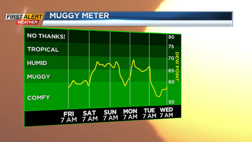
ROCHESTER, N.Y. — After a nice, dry and comfortable end to the work week, our focus turns to more humidity and another round of potentially heavy rain this weekend.
Breaking down the specifics: Saturday morning will be dry with a mix of clouds and sun, but you’ll begin to notice the warmer and more humid air building back in. We’ll top out in the mid to upper 80s during the afternoon with dew points surging into the upper 60s. There’s the slight chance we could see a few thunderstorms firing in the moist air during the afternoon, but the heaviest rain will hold off until after sunset.
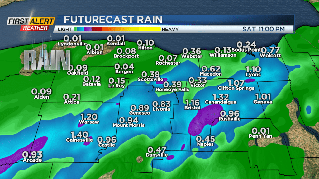
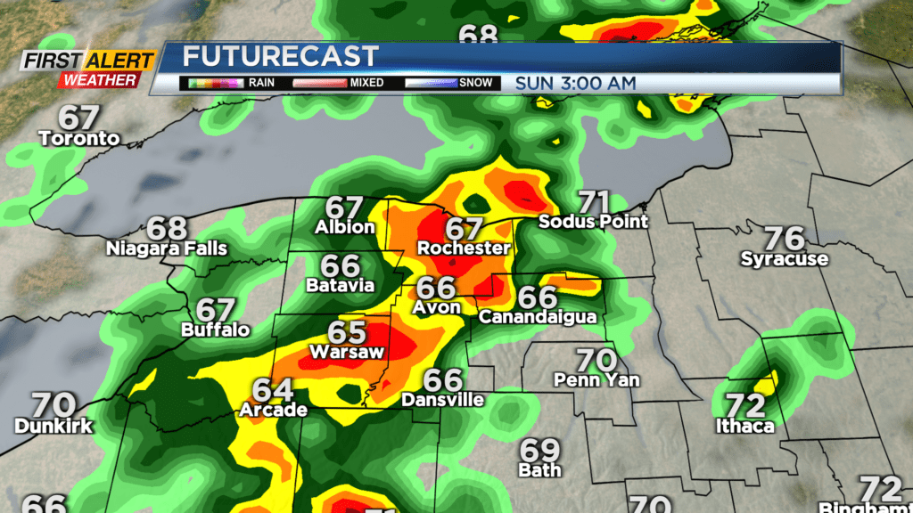
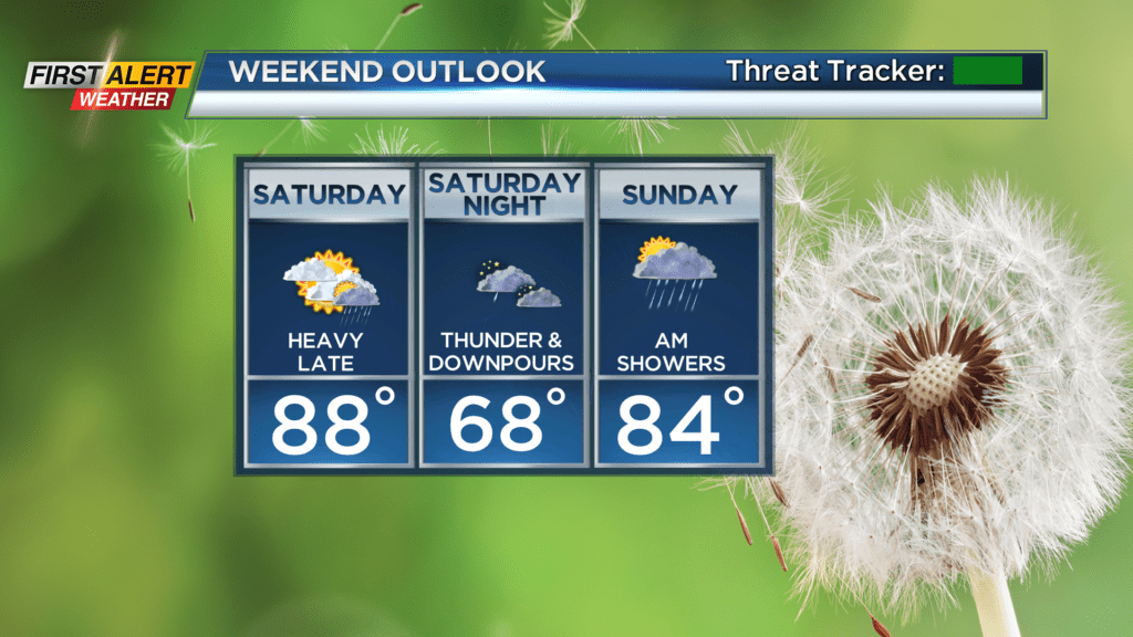
An area of low pressure will bring some storms to the area after sunset, and could bring some thunderstorms that tap into the more humid air, dropping some pockets of heavier rain. Most areas won’t see issues with this, but if this falls over areas that have seen recent flooding, we could see some more flooding issues arise. This is something News10NBC will be monitoring as we get into Saturday. If it is looking more likely that the heaviest rain falls over the Finger Lakes, or rain comes down too fast for any one spot, then the First Alert Weather team may issue a Yellow Alert for Saturday night. In addition to the heavy rain, a storm or two could produce gusty wind Saturday night.
The heaviest rain tapers Sunday morning with some sunshine returning. But we’ll still be dealing with lots of humidity, so a few more thundershowers may pop up Sunday afternoon.