First Alert Weather: Heat on Labor Day and early this week
[anvplayer video=”5190997″ station=”998131″]
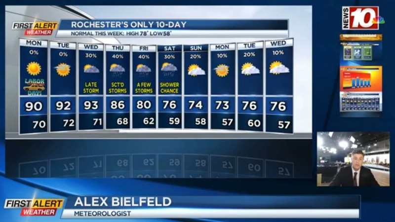
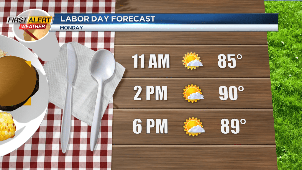
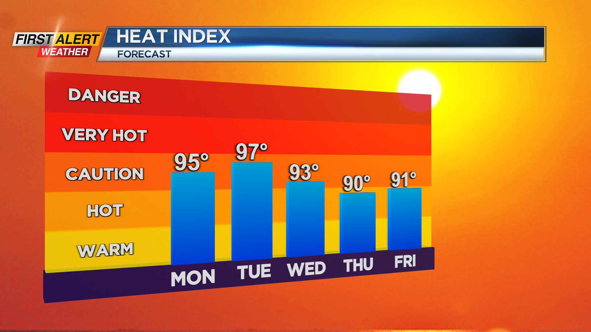
ROCHESTER, N.Y. — A hot and humid conditions are expected for Labor Day as temperatures reach the 90-degree mark and feel even hotter.
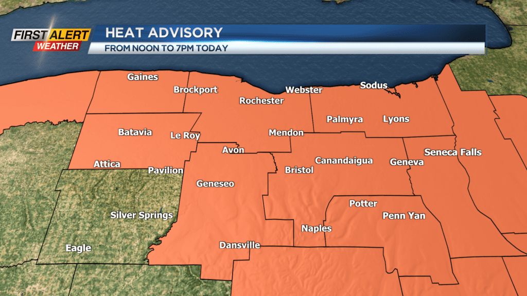
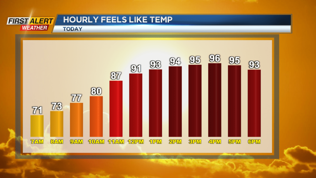
Dew points in the afternoon will hover around 70 degrees which means that, along with our high near 90, there will be feel-like temperatures in the mid-90s at times. The National Weather Service will have a Heat advisory in place for our region on Monday afternoon due to the heat indices.
Other than making sure you stay cool today it will be a beautiful Labor Day. Plenty of sunshine is expected which means it will be a great day to hang out poolside our lakeside just before the kids head back to school. Speaking of back to school, it will feel even hotter Tuesday and Wednesday.
Tuesday will feature another clear day with plenty of sunshine, but it will also remain humid and hot. Highs Tuesday afternoon will reach the low 90s and with the humidity in place it will feel near the triple digit mark at times.
Wednesday will be just as hot, but a few clouds will roll in during the afternoon with the chance of a thunderstorm late in the day. This is thanks to an approaching cold front that will slowly bring us relief by the weekend. The remainder of the week will feature scattered showers and storms, but due to the slow progression of this front it will remain muggy through Friday.
Temperatures will be cooler thanks to the extra cloud cover as we cool into the mid and low 80s by Friday afternoon. Relief will arrive on Saturday as the cold front will eventually swing through. This will drop our dew points and our afternoon temperatures as we settle back down into the 70s.
As far as the thunderstorms Thursday and Friday, there is the chance for a gusty shower or storm, but our severe threat is low for now.