First Alert Weather: Heating up for the rest of the week
[anvplayer video=”5179210″ station=”998131″]
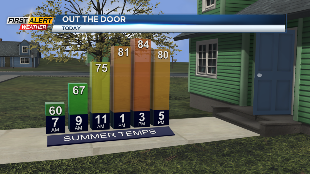
ROCHESTER, N.Y. — It’s another day and another beautiful start to the morning. Temperatures on Tuesday are starting off in the 50s across our region with another warm day ahead.
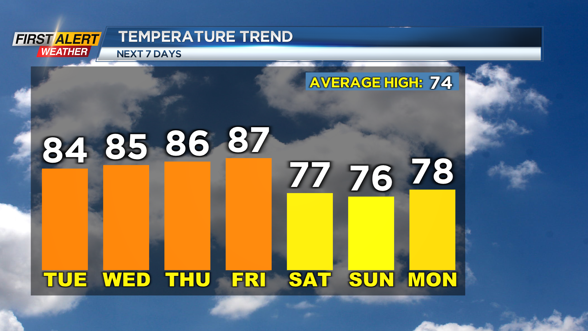
Temperatures on Tuesday afternoon will reach the mid and low 80s and once again come with plenty of sunshine. Sunshine continues through the remainder of the week with highs pressure in complete control of our weather.
With this, we will see our afternoon highs reach the upper 80s by Friday. The afternoon highs will reach into the upper 80s. Dew points through the rest of this week will remain in the 50s.
However, they may turn a touch humid Friday evening as an advancing cold front bring us a chance for a shower or storm Saturday. Not a whole lot of moisture is expected with this front on Saturday, but we could see a pop-up afternoon shower or storm across our region.
The best chance for that will be in the Finger Lakes. The main story with this front is the cooler air behind it. This front will bring our afternoon highs back into the 70 for the weekend and even as cool as the low 70s by early next week.
______________
Download the WHEC First Alert Weather app to stay up to date while on the go.
Watch the latest full forecast online.