First Alert Weather: Heavy lake effect west of Rochester this week
[anvplayer video=”5148099″ station=”998131″]
ROCHESTER, N.Y. The main weather story into the weekend will be the potentially crippling lake effect snow event across western New York.
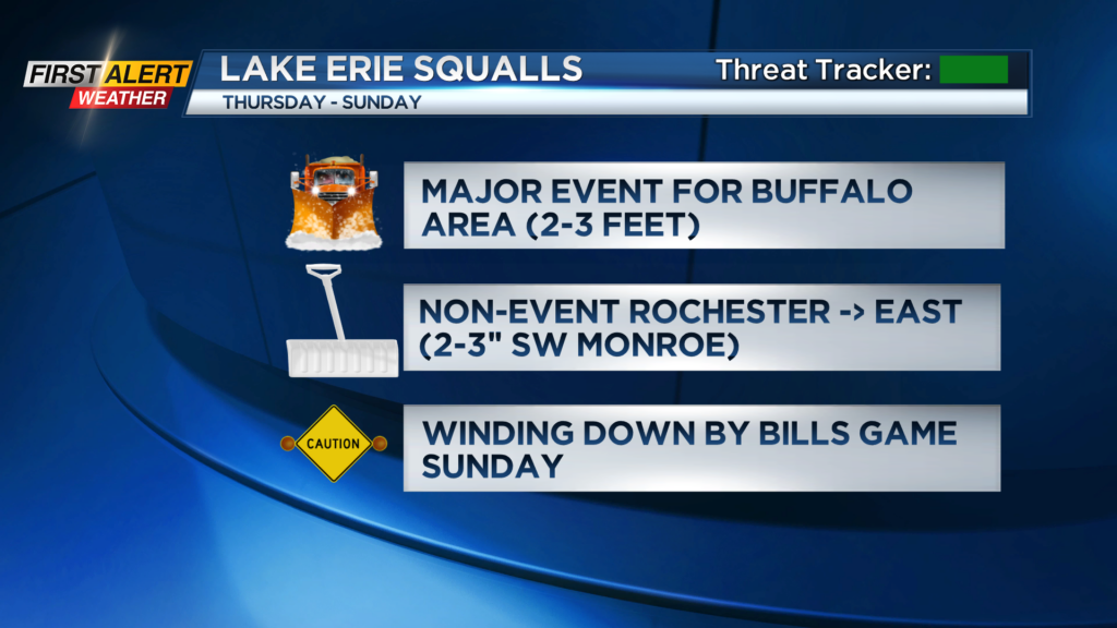
This will be a major event for the Buffalo area, with very few impacts across the Rochester area and Finger Lakes. Our western counties, including Orleans, Genesee and Wyoming counties will be impacted by this snow at times, but not to the extent of the Buffalo region.
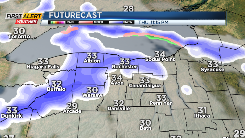
Scattered lake snow showers on Thursday will organize into a solid band of heavy lake effect snow near and south of Buffalo Thursday night, impacting Erie, Wyoming and Genesee counties. The western parts of Genesee and Wyoming Counties will likely need shovels and snowblowers Friday morning, while the eastern half of those counties will see very little.
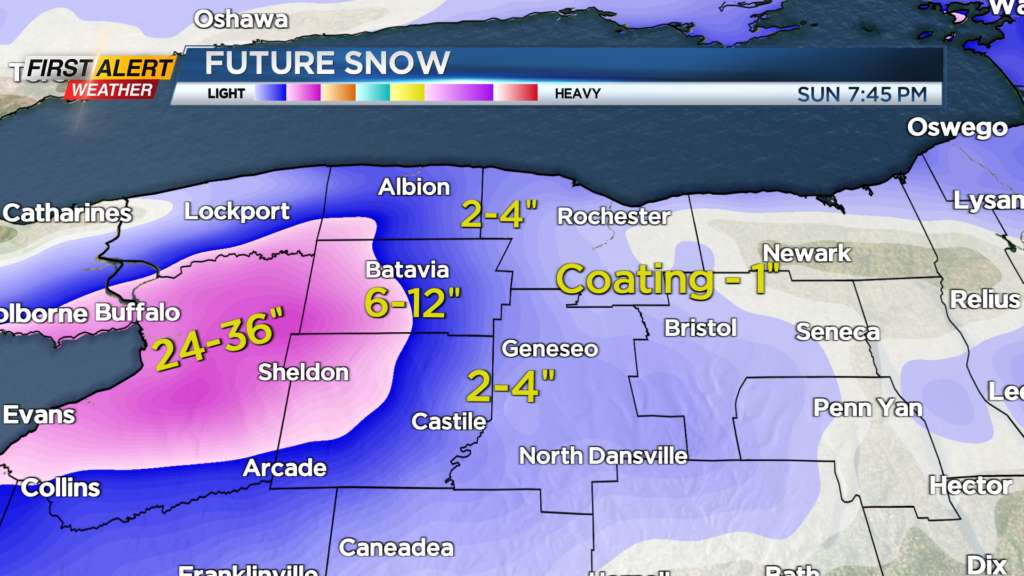
The band will continue nearly steady-state, dumping more snow near and south of Buffalo on Friday, then a jog northward on Saturday. This is when parts of Orleans County may see some accumulating snow. The main band will drop south again on Sunday, and begin to weaken significantly.
Thruway travel west of Batavia will be extremely difficult, if not impossible, at times Friday and Saturday. Meanwhile, the Rochester region, including western parts of Monroe County and Livingston County will occasionally get sprayed by this band of lake effect, but impacts and snowfall will be minimal.
If you have plans to go to the Bills game on Sunday, conditions will be improving as far as the snow falling, but it’ll be blustery and chilly. Roads will still be snow-covered, and the stadium will take some work to clean up from the snow! Stay tuned as this forecast develops.