First Alert Weather: Impressive October warmth continues
High temperatures pushed into the mid-80s in Rochester on Tuesday with more to come. High temperatures on Wednesday should spike into the mid- and upper 80s.
The record high for Wednesday is 89 degrees from 1926, and we’re forecasting 88 degrees. So, it’ll be close whether or not we officially reach a record.
Thursday will be our last unusually warm day, with highs once again into the lower to mid-80s with dry weather, though we will see more clouds building in late. We may not break any records, but this stretch of 80s is highly unusual. The last time we had four consecutive days warmer than 80 degrees was back in 1947.
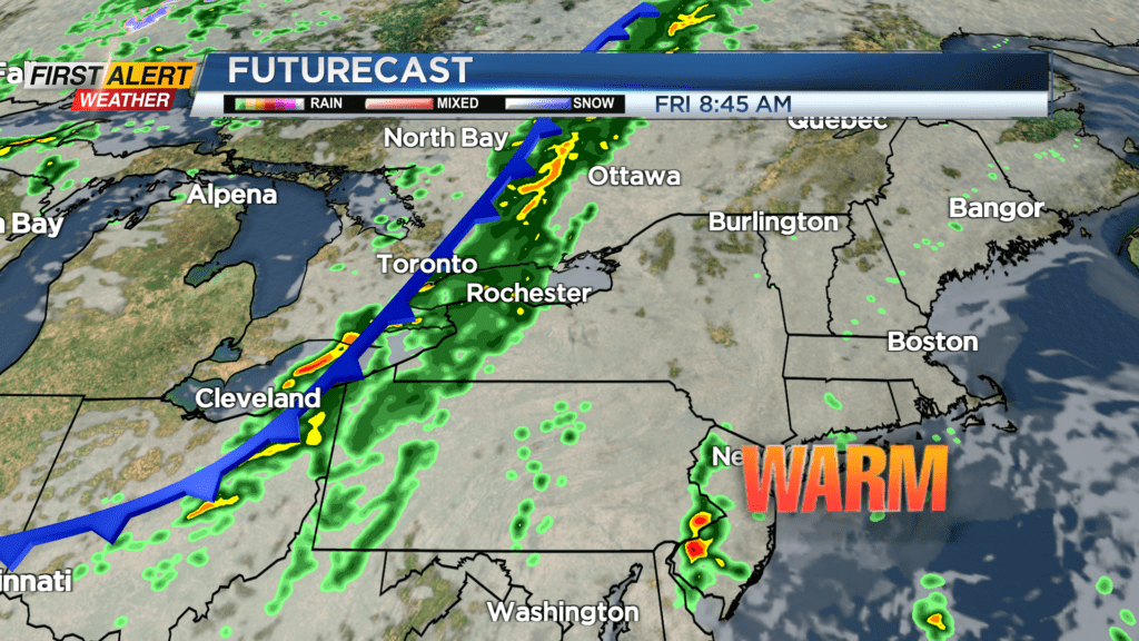
Our big warmth comes to an end on Friday, and comes crashing down by the weekend. A cold front slowly sliding through on Friday will finally drop some rain on the area, and drop our temperatures back into the 70s, which is still warmer than average.
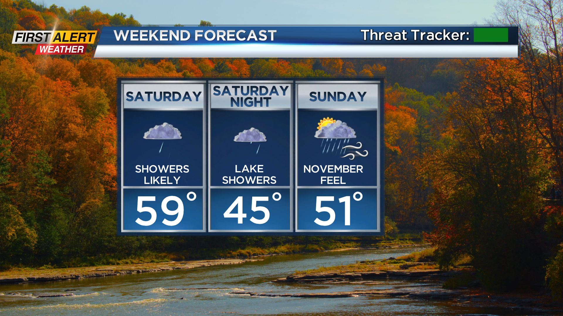
You’ll really feel the difference over the weekend, with highs struggling to reach 60 on Saturday and holding in the lower 50s on Sunday.
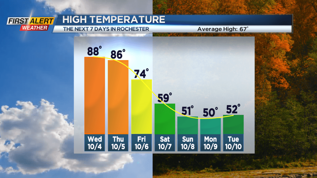
Both weekend days will see some rain showers, including lake rain, with a much cooler breeze developing on Sunday. Highs will remain well below averaged in the 50s through the middle of next week with off and on lake rain showers before some improvement toward the end of next week.