First Alert Weather: It will finally look like winter this weekend
[anvplayer video=”5158703″ station=”998131″]
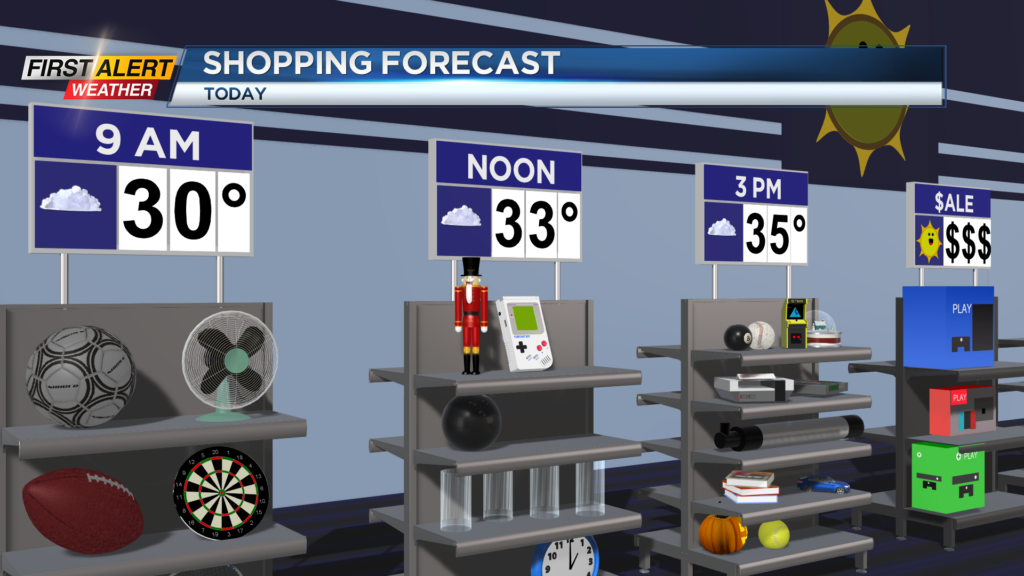
A chilly start to the day on this Saturday as temperatures are starting off below the freezing mark. We did see some snow last night that melted on windshields, and with the refreeze give yourself a few minutes to warm up your car this morning.
There is the chance for a snow shower or two this morning, but we will mainly remain cloudy through today with no additional accumulation. Temperatures will also remain chilly with highs only reaching the mid 30s this afternoon.
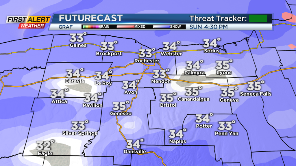
Cloud cover will stick around tonight and tomorrow before giving way to light and moderate snow Sunday afternoon. Snow likely develops from west to east across our region starting around three in the afternoon tomorrow.
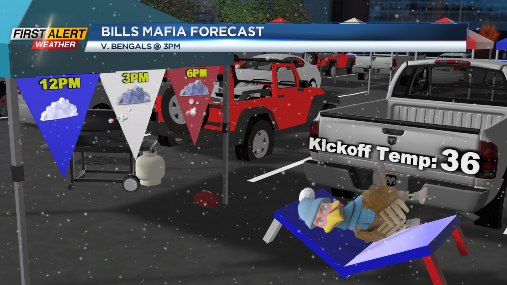
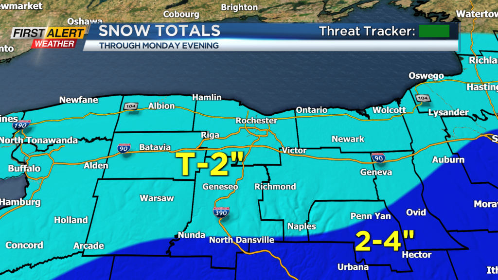
Snow will continue into early Sunday evening before transitioning over to snow showers for Sunday night and Monday. Snow shower chance continue into early Monday before drying out late, and when all is said an done only about a trace to two inches of snow is expected. As for Bills fans tomorrow, the ride to Highmark will be fine, but the ride home could be a bit slick.
Also during the game, we will see on and off light to moderate snow as well so make sure you dress for the wintry weather!