First Alert Weather: Labor Day weekend starts dry, but trending wetter
[anvplayer video=”5132810″ station=”998131″]
ROCHESTER, N.Y. The “unofficial end of summer” is upon us with the Labor Day weekend, and we’d love for the summer season to go out with a bang!
But it is looking like that won’t be the case. We start the weekend off great, with warm air and a mix of clouds and sun on Saturday. We’re dry, outside of a slight chance of an isolated afternoon thundershower, mainly in the Finger Lakes.
A few more showers are possible Saturday night as moisture being fed in from the south combines with an approaching cold front from the north. This front will sag southward on Sunday, creating scattered showers and a few thunderstorms, especially south of Rochester, and mainly during the afternoon.
Then, a wave of deeper moisture moves in late Sunday, bringing the potential for a more widespread rain Sunday night into at least the first part of Monday.
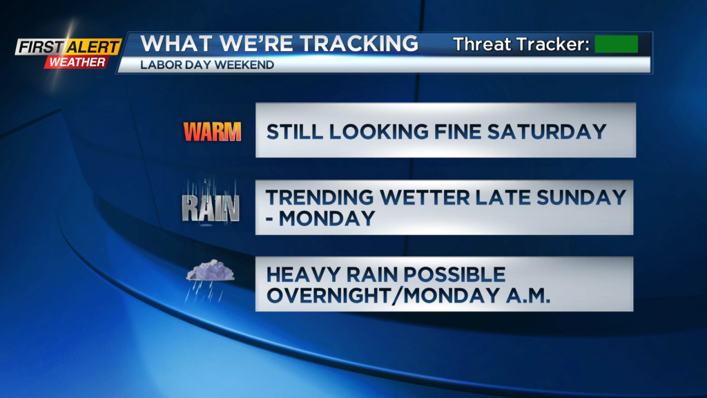
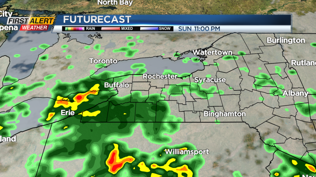
If this scenario were to play out, we’ll get a soaking rain, with the potential for 1″ of rainfall, where the rain falls the heaviest. This would create more of a “washout” for Labor Day itself.
That being said, this forecast isn’t set in stone. If the axis of heavy rain shifts slightly farther south, parts of our area may end up with more dry time Sunday into Monday.
First Alert Meteorologist Stacey Pensgen has your Friday forecast.
While there remains quite a bit of uncertainty regarding the specifics of this forecast, it has been trending wetter for the second half of the holiday weekend.
Flooding and severe weather are not anticipated at this point. So, while the forecast isn’t ideal, we remain green on the First Alert Threat Tracker. First Alert meteorologists Alex Bielfeld and Glenn Johnson will have updates throughout the holiday weekend on News10NBC starting at 6 a.m. and 6 p.m.