First Alert Weather: Lake Ontario snow possible Tuesday night
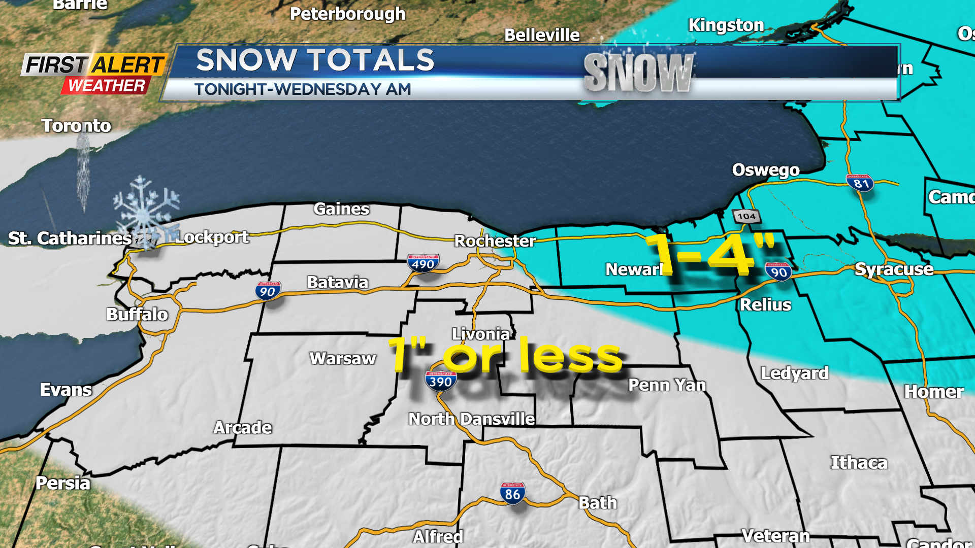

ROCHESTER, N.Y. – Noticeably colder air will spread over Western New York Monday night. It appears this will be cold enough, with a favorable wind direction, to generate some lake effect snow off Lake Ontario. Several bands of snow will develop later Tuesday night with the focus east of Rochester across Wayne County. This will be of a short duration event with most of the snow ending by early Wednesday morning. A high-pressure system then builds across the great lakes for mid-week before another fast-moving low-pressure system arrives on Thursday. As a result, day to day changes in weather will bring frequent bouts of snow from time to time. However, generally this will amount to small accumulations at any one time, but a gradual accumulation will slowly increase into the weekend.
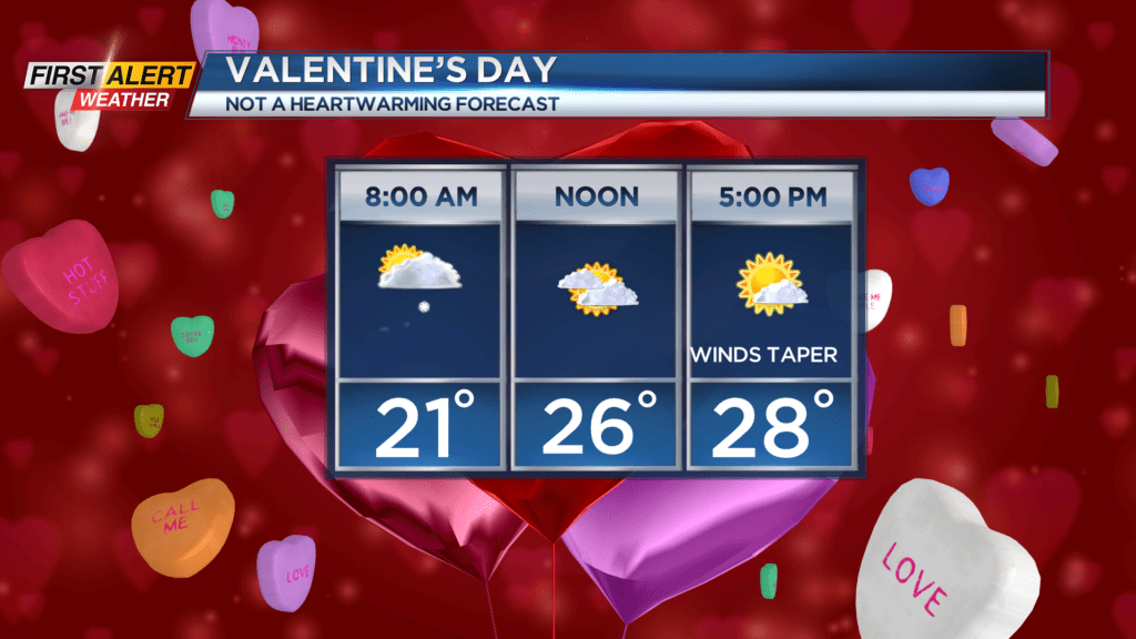
Tuesday night, look for occasional lake effect snow showers to develop. Most spots will see an inch or less, but one to four inches of accumulation is possible over portions of Wayne County. The low temperature will be near 21 degrees. Valentine’s Day will find any lingering lake flurries coming to an end, then skies will become partly sunny. It will be blustery and cold with the temperature remaining in the 20s. Thursday will be mainly cloudy with wet snow by the afternoon. This snow may mix with rain at times with a slushy inch or two by the evening. The high temperature will be in the middle 30s.
Stay tuned to News10NBC First Alert weather for updates on the forecast.