First Alert Weather: Lake snow and cold wind overnight & Thursday
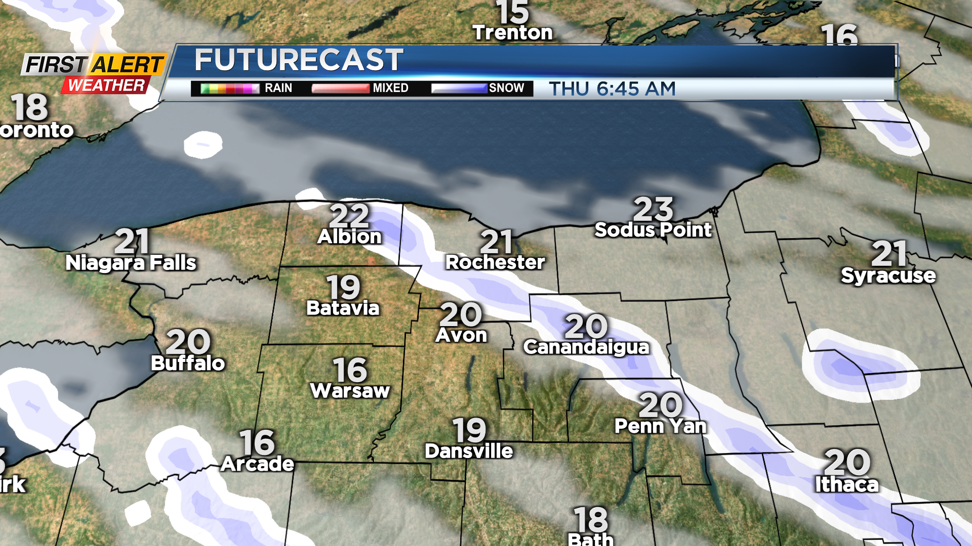
ROCHESTER, N.Y. – A series of cold fronts will finish dropping through the area Wednesday night, bringing with it some squalls that’ll briefly reduce visibility within the squall, gusty winds and a quick coating to an inch of accumulation. Winds will shift post-front, allowing a band of lake effect snow to develop overnight. Within this band, you could see another inch or two of snow in very localized spots. Outside of this lake effect, it’ll just be cold and windy. That chilly wind will continue into Thursday, with any early lake snow coming to an end. Temperatures will be in the lower 20s to start the day, but that busy wind will make it feel more like the single digits in the morning. We should see at least some sun returning on Thursday, and any snow will once again melt away fairly quickly, despite that chilly air.
Friday starts off dry with some sun, but we’ll cloud up ahead of our next system. This storm will move fairly quickly over Western New York, but not before it brings a few inches of accumulating snow. The snow has had a hard time accumulating during the day due to the strong March sunshine, but the steadiest snow is expected to fall overnight Friday, when the sun won’t be out to melt it. So, you’ll likely wake up Saturday morning to a few inches of snow. That being said, it won’t last long, as temperatures should climb above freezing and that March sun will aid in melting. If you’re looking for more spring-like air, we should see temperatures rising back into the 50s next week.