First Alert Weather: Last few days of April will bring up and down temperatures
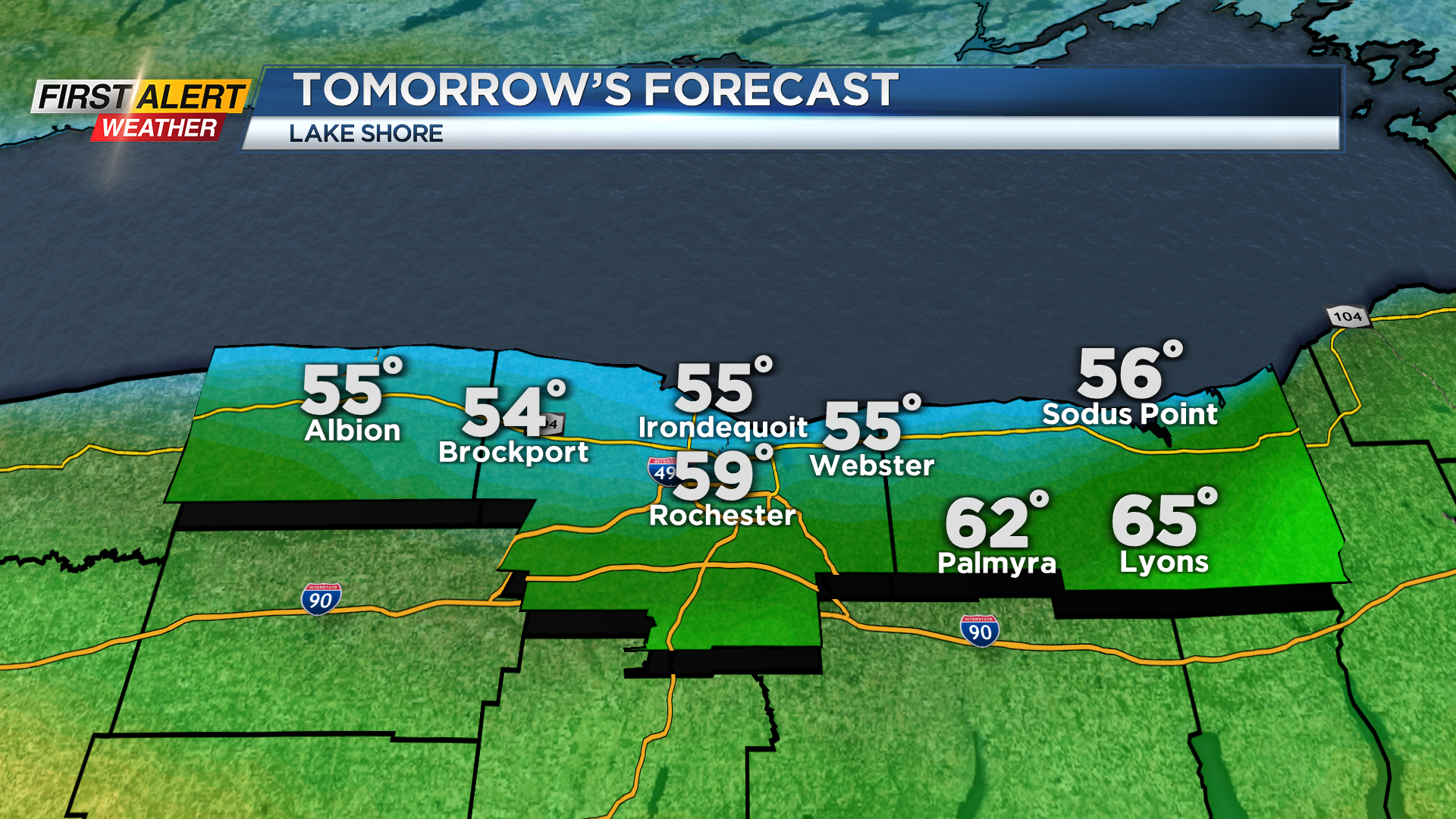


ROCHESTER, N.Y. – A front will pass across Western New York Sunday night. Ultimately, where this front ends up will determine the temperatures for us over the next 24 hours. Complicating the forecast will be some spring season lake effect weather. This happens because the water temperature on Lake Ontario is only in the mid-40s. As a result, a rather weak wind flow will likely bring some much cooler temperatures for communities within a few miles of the Lake Ontario shoreline. Monday, expect the northern towns such as Hamlin, North Irondequoit, or Sodus to remain in the upper 40s and low 50s, but folks living south of Rochester could be well into the 70s.
Sunday evening will be cloudy, so look for an increasing chance of a passing shower or thundershower later tonight. The low temperature will be within a few degrees of 50. Monday will likely start with some low clouds or patchy fog, then skies will become mostly sunny for the afternoon. Again, there will be a big difference in the temperature from north to south with a range of 50 degrees (north) to as much as 70 degrees to the south. Tuesday, the last day of April, could bring a few showers and possibly a thundershower. The high temperature approaching 70, but cooler near Lake Ontario.
Stay tuned to News 10NBC First Alert weather for updates on the forecast.