First Alert Weather: Light snow for Tuesday but local heavy lake snow for Wednesday
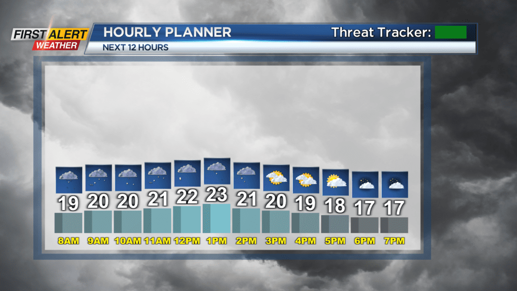
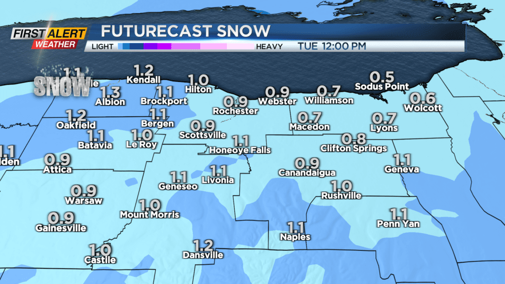
ROCHESTER, N.Y. — It will be cloudy and cold with some light snow developing on Tuesday morning across the region. Amounts will be light in Rochester with a coating to an inch expected before ending early in the afternoon.
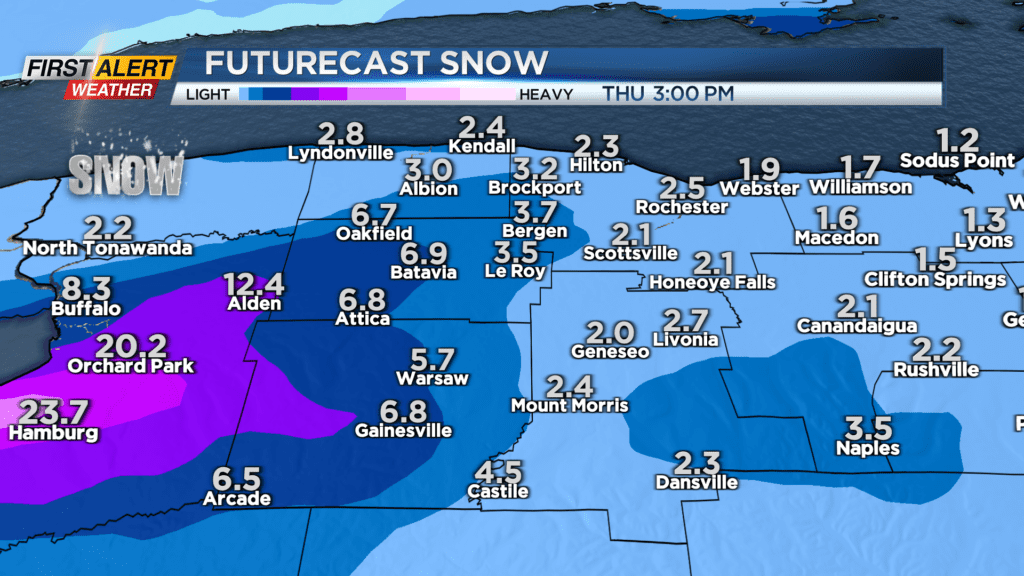
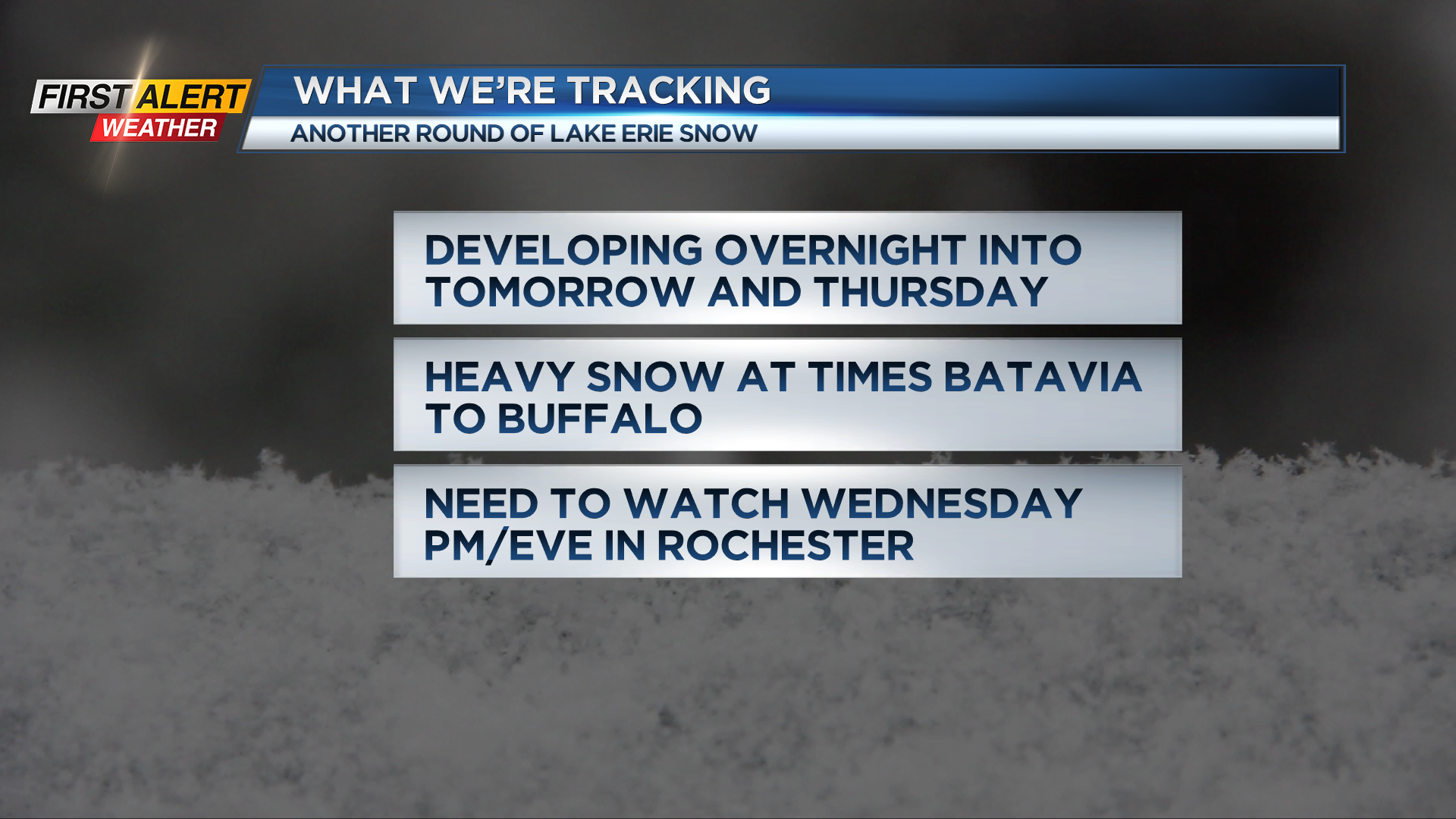
Snow a little steadier in parts of the Finger Lakes where an inch or two is likely in Yates County. Attention on Tuesday night will turn back to Lake Erie as another heavy snow band will develop off the lake. This band will impact almost the same areas as the one over the weekend.
The primary threat for heavy snow at times will be in Genesee County. This band will occasionally drift north and bring busts of snow into Orleans and also south at times into Wyoming County.
As the band shifts, some of the snow will reach Monroe County. Amounts will be considerably less in the metro but a couple inches are possible Wednesday evening and then again on Thursday with a bit more over the western part of the county.
Some of this snow will bring light accumulations through the Finger Lakes the next couple days as well. The exact placement and amounts will need to be monitored and updated as we get into the event so stay tuned to News10NBC for updates on that snow threat, especially if you have travel plans toward Buffalo.