First Alert Weather: Local lake flakes Thursday morning

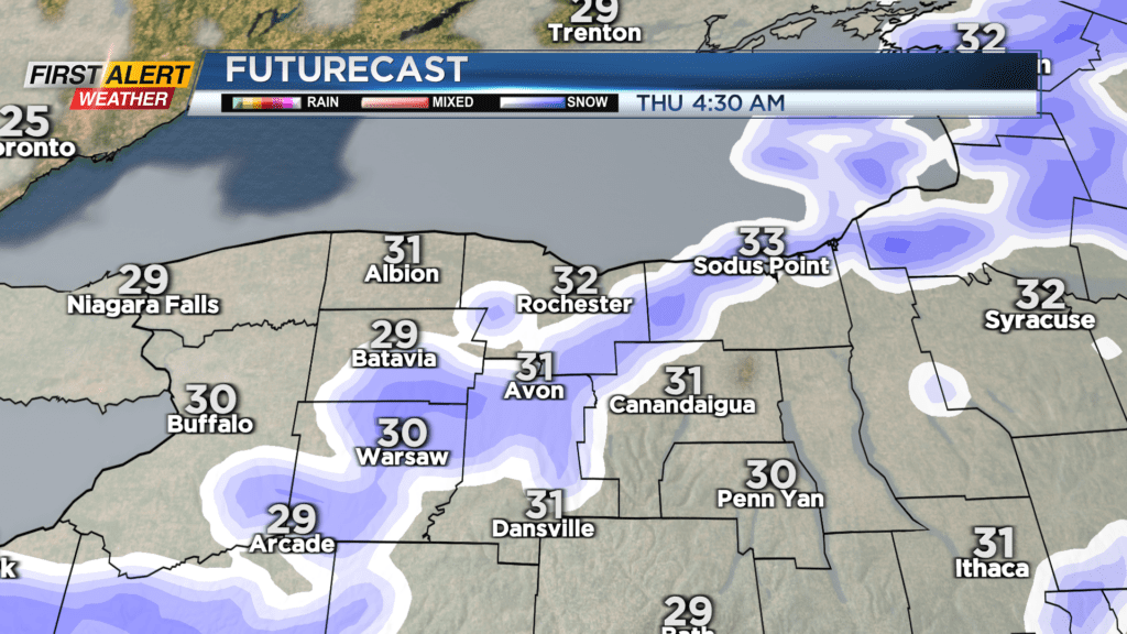
ROCHESTER, N.Y. — A cold front dropping through overnight will kick of some snow and lake effect into early Thursday.
The snow overnight will amount to less than one inch of accumulation, and any lingering lake snow showers early Thursday will also see less than one inch, but temperatures will be dropping into the 20s. So there will likely be slick spots on the roads through the morning commute. Some sun should return through the afternoon. Friday also will feature a mix of clouds and sun, and nothing more than a some lake flurries.
Our attention then turns to a weekend Nor’easter that will impact much of the Northeast, but to varying degrees. The heaviest snow will likely fall in interior eastern Pennsylvania, and New England. We expect some snow to make it into our area, but at this point we expect a general light area-wide snowfall.
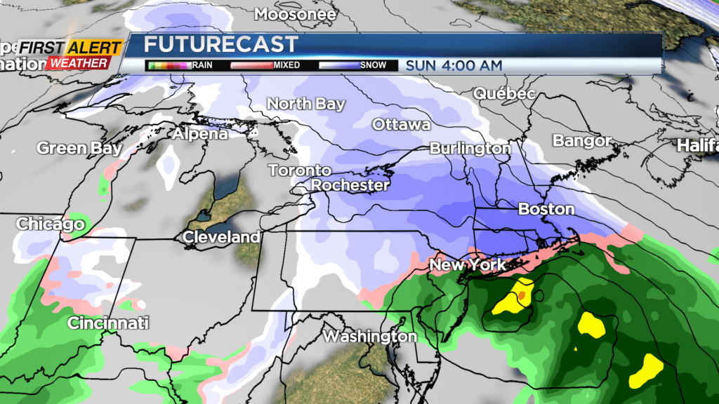
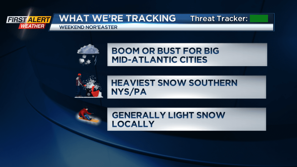
Some light snow will begin to develop later Saturday afternoon and evening, and taper Sunday morning. The steadiest snow will fall across the Rochester region overnight Saturday. The heaviest snow for us will fall in the Finger Lakes, with lesser amounts the further west you go. So, Buffalo may see little more than one inch of snow Saturday night into Sunday, while parts of the Finger Lakes could perhaps do a little bit of shoveling Sunday morning.
Rochester is in the middle, and will likely see a minor accumulating snow. There are plenty of adjustments expected in this forecast, and a snowfall map will be coming out in the next day or two, when the forecast becomes a little more clear.