First Alert Weather: Looking good this week, eyes on showers for PGA
[anvplayer video=”5176941″ station=”998131″]
ROCHESTER, N.Y. — Monday is another chilly start across the region as temperatures have started off in the upper 30s and low 40s.
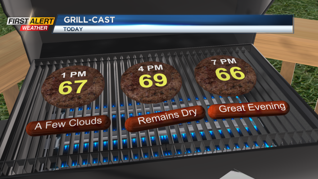
We will rebound as temperatures on Monday afternoon make their way into the upper 60s and low 70s. Another beautiful day Is expected as sunshine will be in full force once again.
Heads up though as the absence of the high clouds will lead to a high UV index, which means a sunburn can happen in about 20 minutes. Most of this week will be nice and that continues for Tuesday.
On Tuesday, we will also be tracking a cold front that will swing through late, but most of the day will be filled with sunshine, dry weather, and mild temperatures. This cold front will bring us a chance for a shower or two after the evening commute but most of us look dry.
The bigger story with this cold front will be the shot of chilly air for Wednesday. We will see our afternoon highs well below average as they struggle to reach 50 degrees. The silver lining in Wednesday’s forecast is that we will be greeted with plenty of sun once again.
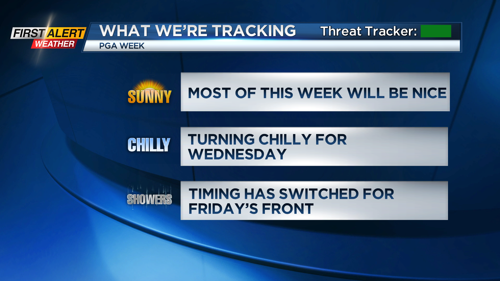
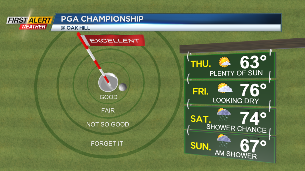
Sunshine continues through the remainder of the work week and the start of PGA at Oak Hill. We have taken the showers out of the forecast for Friday as the cold front has trended slower over the past 24 hours.
This means that we will now keep our eyes on any effects of the tournament on Saturday and Sunday. It looks like we will be seeing some showers in the afternoon on Saturday which linger into Sunday morning before clearing. The biggest concern will be the chance for lightning as the showers roll through on Saturday.
Right now, it does not look like much of an issue, but something that we will be tracking through the next several days.
______________
Download the WHEC First Alert Weather app to stay up to date while on the go.
Watch the latest full forecast online.