First Alert Weather: Mainly dry today before showers tomorrow
[anvplayer video=”5140490″ station=”998131″]
ROCHESTER, N.Y. We are waking up to another chilly start across Western New York and the Finger Lakes, but today we will turn a little warmer than yesterday.
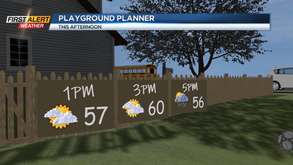
After starting in the 40s, temperatures this afternoon will make the upper 50s and low 60s for some! However, this will come with mostly cloudy skies. Clouds will thicken as we move through our Sunday and give way to an opportunity for an isolated shower late today.
Most, if not all, will be dry, but a shower or two cannot be ruled out after 5 p.m. A better chance for showers will move in as we head into Monday morning. Scattered showers will be possible early tomorrow morning before transitioning into isolated showers by lunchtime tomorrow.
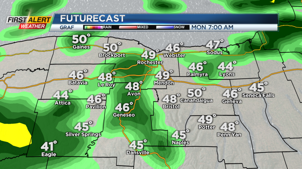
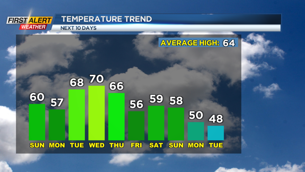
A washout tomorrow is not expected as sunshine returns with drier weather in the afternoon. Tomorrow will be another cool one with highs in the upper 50s before milder weather makes an appearance.
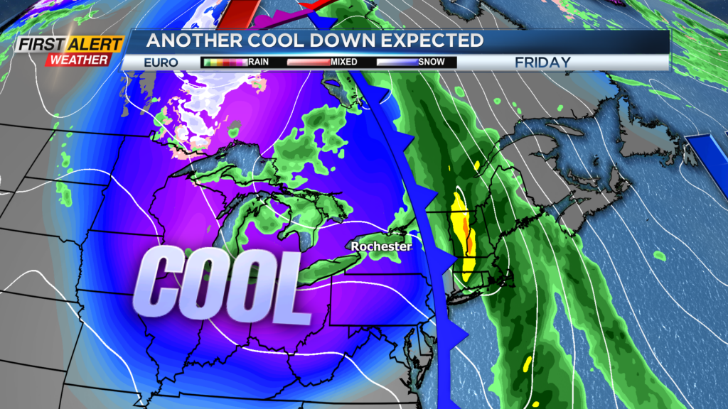
Highs toward the middle of the week will reach the low 70s, but it is short-lived as another cool-down pushes through Thursday. A strong cold front will swing through Thursday with showers and breezy conditions and with another injection of cooler air.
This front is one of two cold shots expected over the next 10 days. Our second shot of cooler air will move in on Sunday of next weekend with showers and drop our afternoon highs early next week into the upper 40s.
First Alert Meteorologist Alex Bielfeld has your Sunday forecast.
There is also a chance that the high elevations could see a few flakes or ice pellets mixing in with some lake effect action on the backside.