First Alert Weather: Mild air Saturday, then big changes Sunday
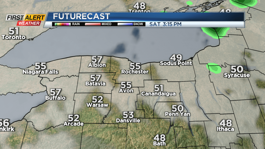
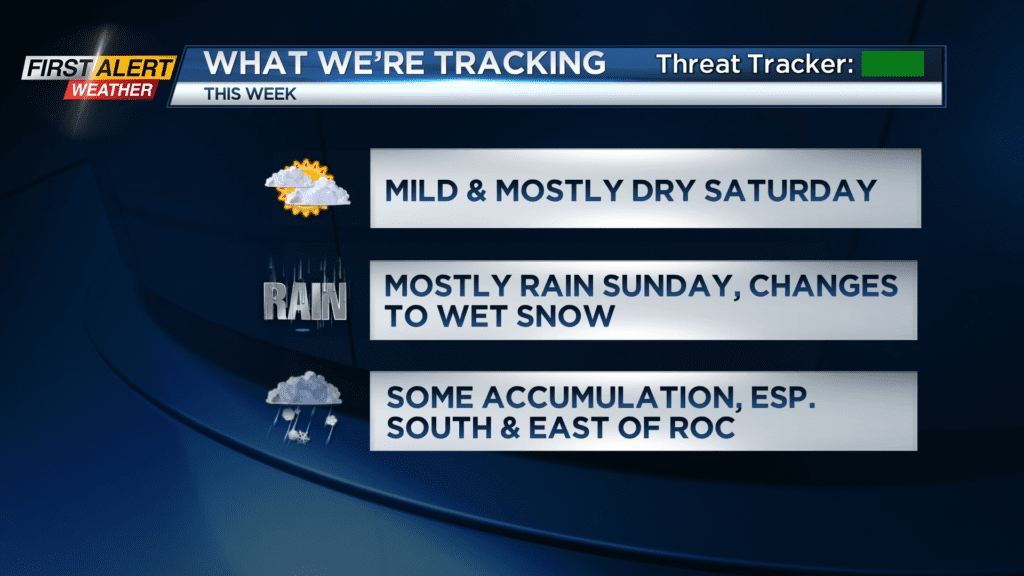
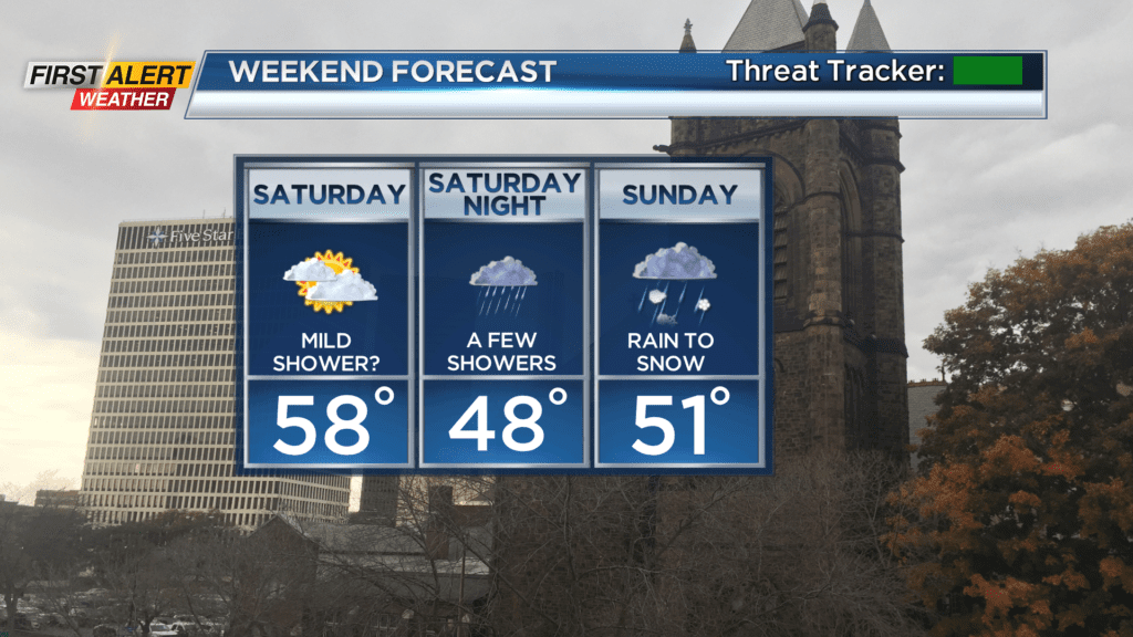
Temperatures in the lower 50s on Friday will climb into the mid and upper 50s on Saturday. Other than a brief passing afternoon or evening rain shower, we should see mainly dry weather to go along with that mild air. Saturday will be your day to get any outdoor chores done, as our weather turns much more unsettled on Sunday.
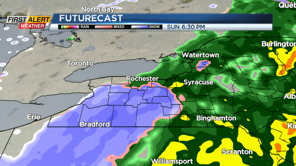
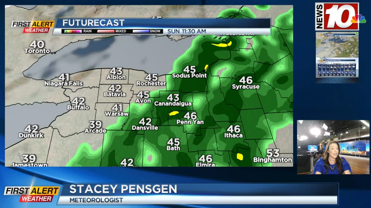
Showers Sunday morning will become more steady into the afternoon, especially east of the Genesee Valley. Temperatures will drop into the 30s by later in the evening, which will allow rain to begin to change over to wet snow. At this point the best chance of seeing some accumulating snow will be south and east of Rochester, in the Finger Lakes, and in the highest terrain. So, some snow is likely Sunday evening into Monday morning, but this will most likely be an elevation-driven snowfall event. Temperatures are very marginal, so just a degree or two colder could make a big difference in our forecast. We’ll continue to update this forecast as we continue through the weekend.
The Monday morning commute may be a little slick, with temperatures hovering right around the freezing mark, and especially if we do get any sloppy wet snow in and around Rochester. It’ll turn blustery and chillier on Monday with some limited lake effect. Then much of next week is fairly uneventful with seasonable temperatures and nothing more than a passing rain or wet snow shower with a mid-week cold front.