First Alert Weather: Mild with rain and snow showers today before possible arctic air late week
[anvplayer video=”5159912″ station=”998131″]
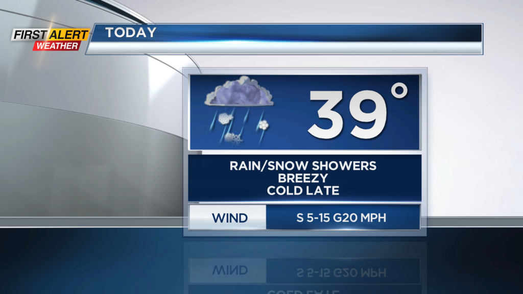
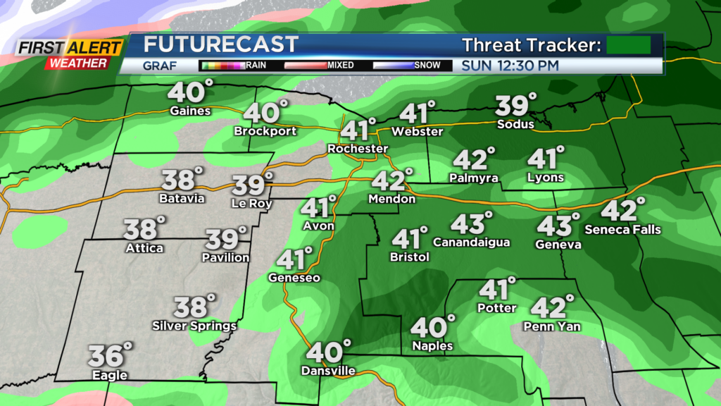
ROCHESTER, N.Y. – Waking up this morning to cloudy conditions and chilly temperatures with them just above the freezing mark. Through today, we will remain cloudy with a few rain and snow showers possible. It will mainly be rain through today as temperatures will be above the freezing mark and make their way near 40 this afternoon.
However, late today we will see our temperatures drop into the low 30s with a quick transition over to a few snow showers. No accumulation is expected, but it will turn a bit chilly after a mild afternoon. Cooler weather will continue to swing in across our region through this week as we remain in the upper 20s on Monday with a few snow showers, and then into the low 20s for Tuesday. Overall though, not much unsettled weather is expected this week, but we will be keeping our eyes on late this week for potential Arctic air.
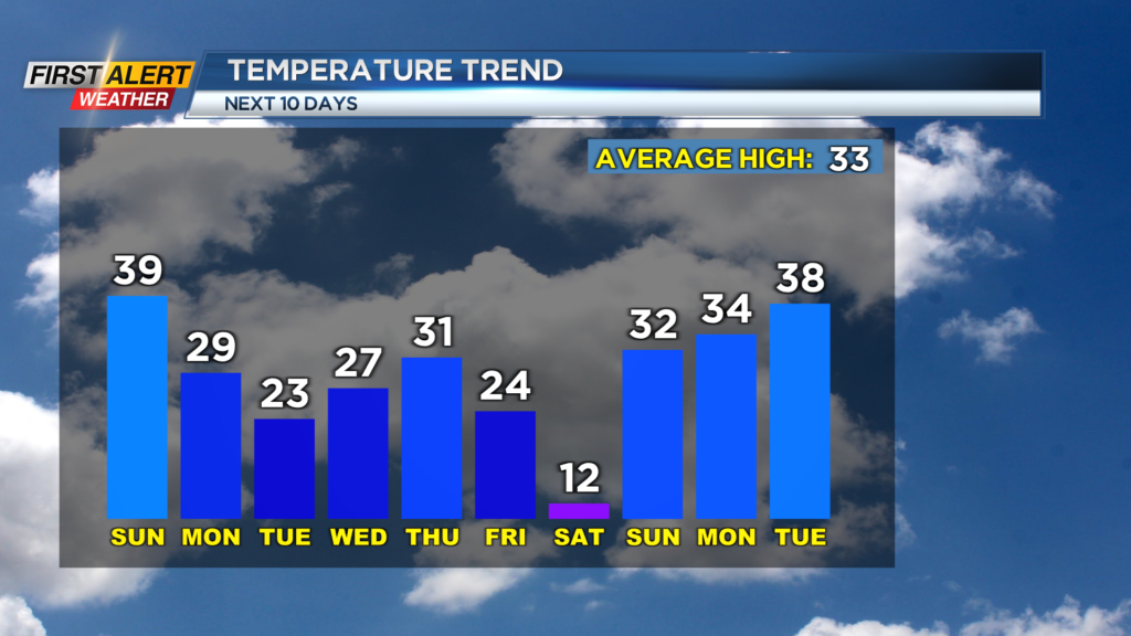
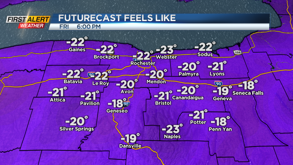
This will also come with an arctic front, which is capable of bringing snow squalls, Friday. The bigger story with this front will be the possibility of bitter air invading our region. Temperatures on Friday look to crash into the single digits by the afternoon after an early high in the mid 20s, and then remain near 10 degrees for Saturday.
Not only will it be bitter cold, but it will also be windy. This means the wind chill will become a factor and that on Friday it could feel like -20 by the evening and by Saturday morning we could feel even colder than that. Even with the arctic air on the way, it will not last too long as temperatures quickly rebound Sunday afternoon.