First Alert Weather: Milder air Tuesday, but showers make a return
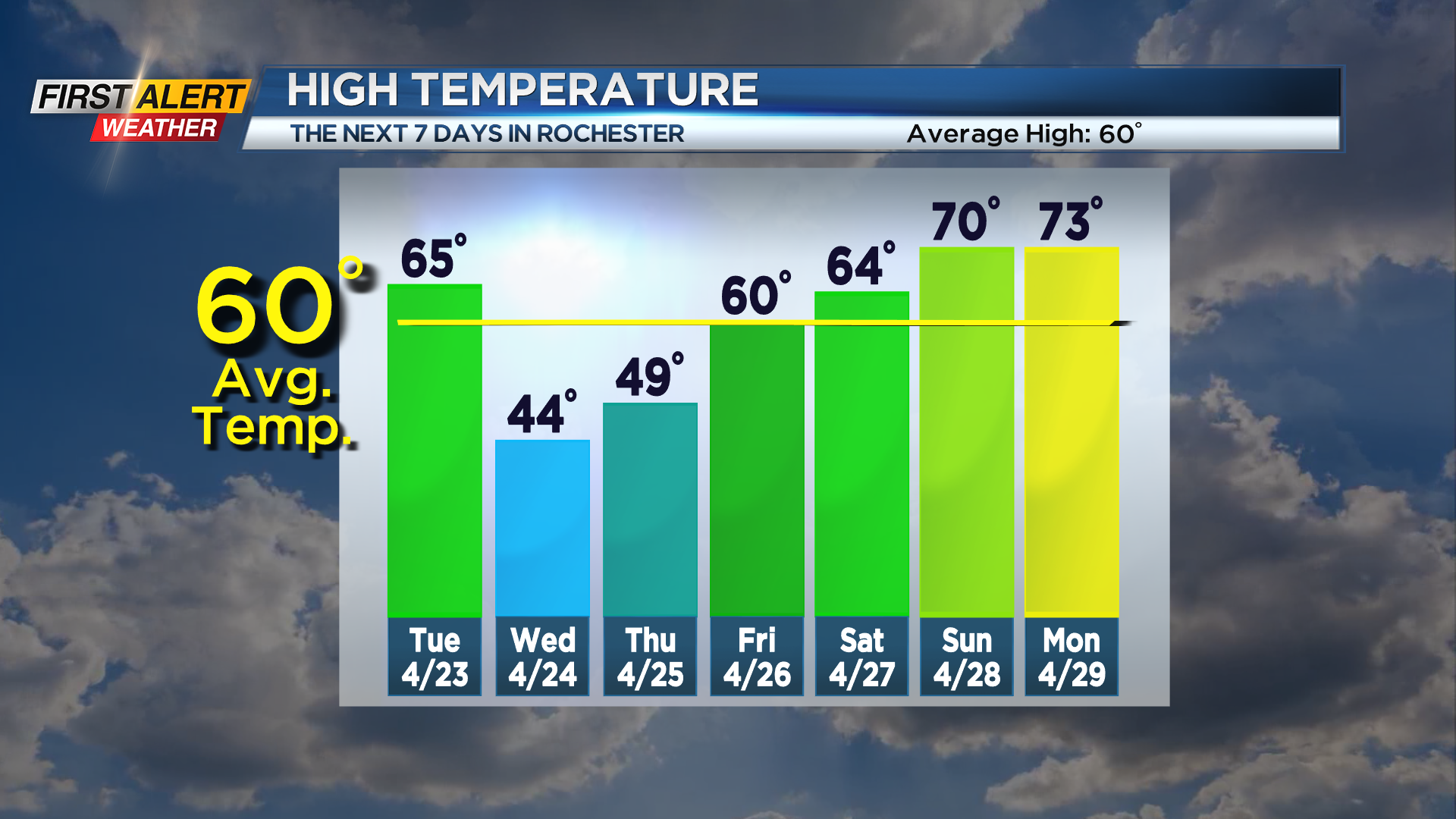
ROCHESTER, N.Y. – Monday was a marvelous (although cool) way to start the work week with high-pressure planted overhead. This high will be moving away, allowing our next system to move in from the west. Tuesday will be turning a bit breezy, with a warming wind out of the south pushing us into the 60s during the afternoon. We’ll see some sun to start, but clouds tend to thicken up as the day goes on. We’ll stay dry until late afternoon, then some rain showers will move in, and stick around overnight. A pretty strong cold front moving through early Wednesday will drop us through the 40s with rain showers. It’ll be chilly enough in the late morning for perhaps a few wet snowflakes to mix in, but nothing accumulating. Another big area of high pressure moves in quickly behind this, giving us a little bit of clearing late on Wednesday before the sun sets.
This will set us up for another nice, but cool day on Thursday with highs in the 40s to near 50 and an abundance of sunshine. Friday will remain dry with a good deal of sun, but warm back into the upper 50s to near 60. At this point, next weekend will be warming through the 60s and maybe into the 70s, but it’ll come with a few rain showers at times. We’ll work on timing out any wet weather this weekend as the week goes on.