First Alert Weather: More clouds, more humidity, more showers on the way
[anvplayer video=”5189559″ station=”998131″]
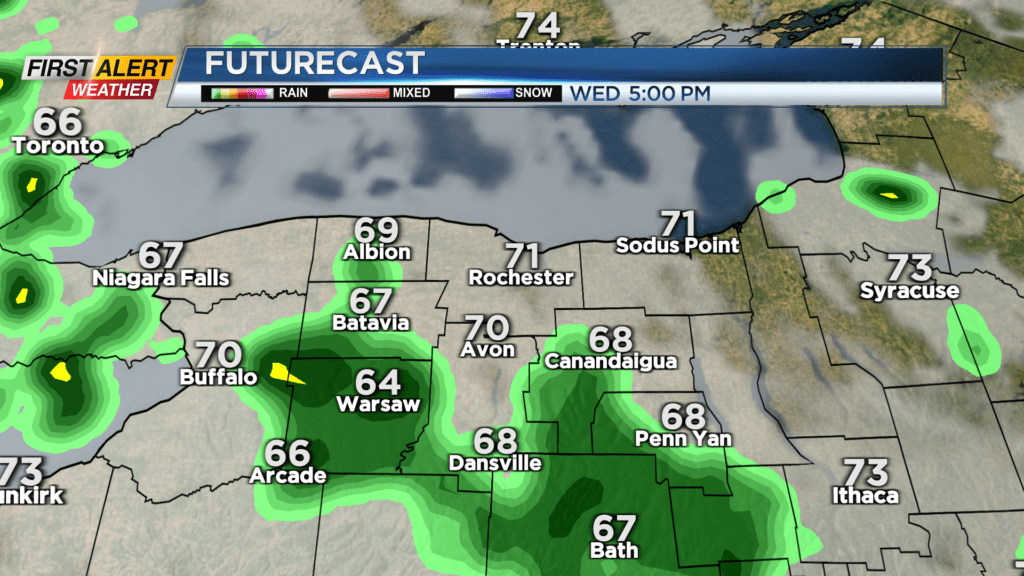
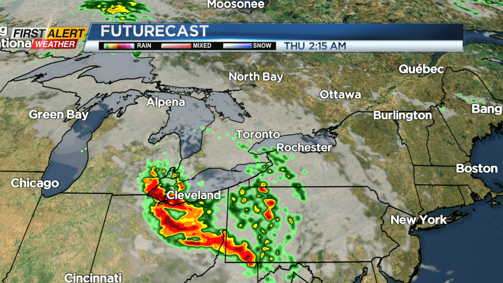
The big time heat will stay to our west, but we’ll see the clouds thicken and humidity increase as a boundary separating our comfortable air and the major heat to our west. Wednesday will see a few showers later in the day, but lots of dry time. Moisture ramps up Wednesday night and Thursday, as the heat dome slides slightly further east. The big heat will stay away from us, but humidity will ramp up more, with dew points surging into the upper 60s. In addition to this, some moisture from what was Hilary (the tropical system that impact the southwest) will work in. This means that any convection that does get going will likely produce locally heavy rain.
If we see some sunshine developing on Thursday, a few storms may develop. Again, heavy rain would be the main impact, and at this point, the most active weather is expected to stay to our west. But, it is worth watching. Friday remains muggy with a few showers around. That boundary finally slides south on Saturday, but it’ll likely bring another round of rain with it. This means the weekend may start off on a wet note.
Sunday looks to clear out, with more sunshine and still cool, but comfortable air in the lower 70s. There are some signs of a warming trend heading into next week, along with a good deal of dry weather.