First Alert Weather: More lake effect snow Sunday
Waking up this Sunday to another wintry start.
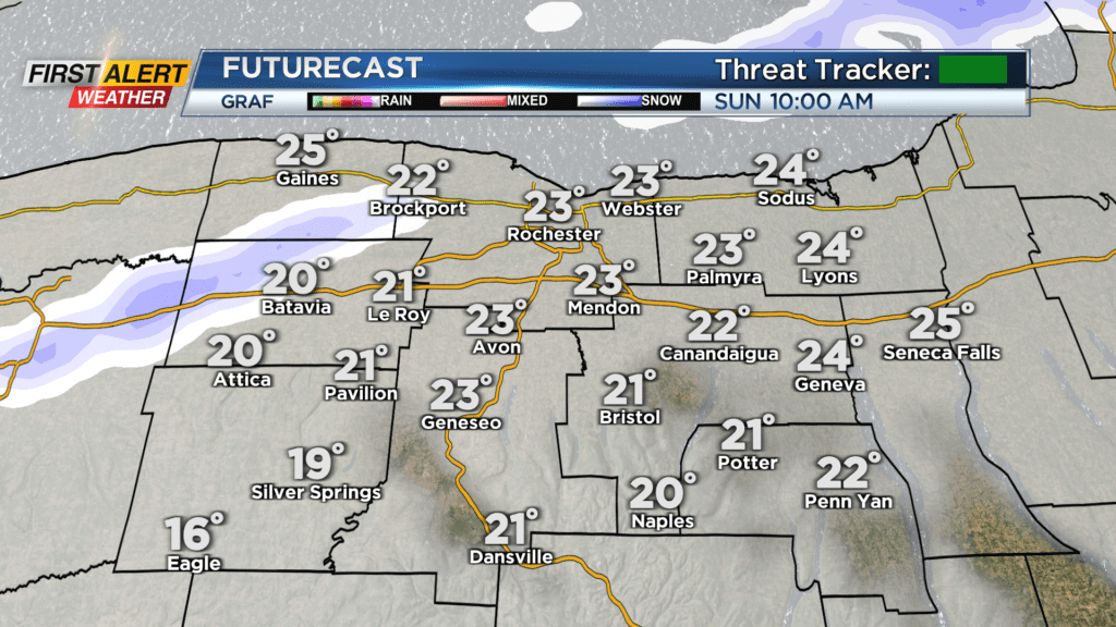
We are generally mostly cloudy with lake effect snow from Lake Erie to our west. We are cold Sunday morning with temperatures near 20 but feeling much colder with the gusty conditions.
Temperatures on Sunday will make their way to near 30 degrees, but it will remain windy and wind chills will sit in the teens. As far as lake effect snow, the Lake Erie band will likely persist through the late morning hours before dissipating. A Winter Weather Advisory for Genesee and Wyoming Counties expires at 1 p.m. Sunday afternoon.
This will be due to a wind direction shift as they will shift from the southwest to northwest Sunday afternoon. That will then open the door for a few snow showers for the rest of us Sunday evening. No big issues are expected with the snow showers Sunday evening, but heads up: driving west Sunday morning with lake effect snow off Lake Erie.
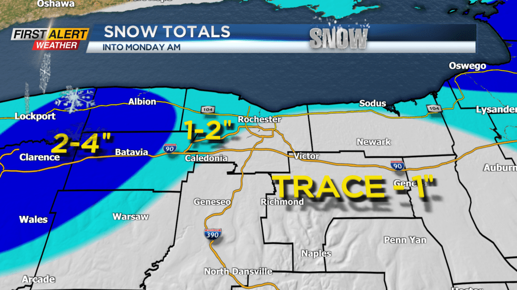
We are also watching out for lake effect snow showers persisting into Monday morning, especially east of Rochester before dissipating. When things are said and done Monday morning, most will see 2 inches or less while areas right along Lake Ontario could see an additional 1-2 inches of snow.
Areas west of Rochester will see an additional 2-4 inches with localized higher amounts as most of that falls Sunday morning due to the Laker Erie band. Then, after clouds and lingering snow showers early Monday, the sun returns in the afternoon. We remain cold Monday with a high in the 30s, but we turn milder this week with highs near 50 by Wednesday.