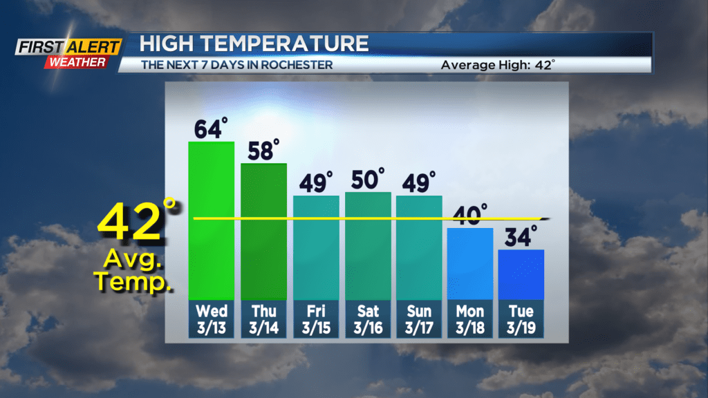
First Alert Weather: More like May on Wednesday
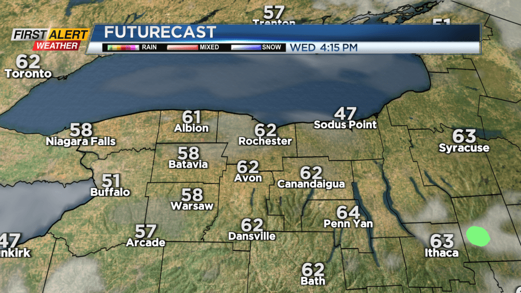
Our fair weather and spring-like air continues into the middle part of the week. We’ll see a mix of clouds and sunshine, and temperatures pushing into the lower to mid 60s. Not record territory, but certainly more reminiscent of late April or early May. Most of Thursday will be dry and quiet, but clouds will thicken and we’ll begin to see some rain moving in by late in the evening and overnight.
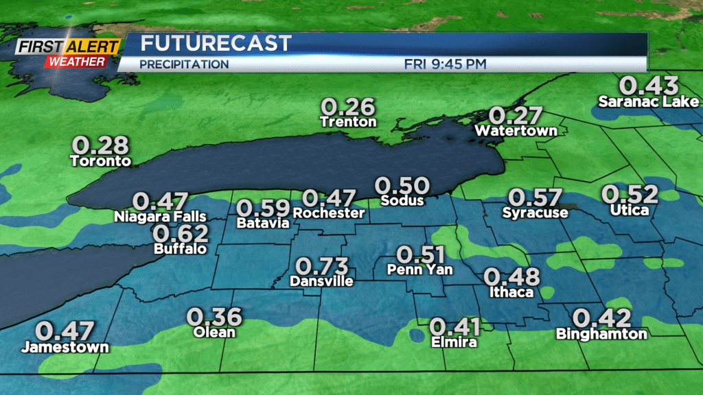
Temperatures on Thursday will still be mild, depending on your location. If you live within a few miles of Lake Ontario, you’ll likely feel the lower 40s. 50s will be likely closer to Rochester, and upper 50s south of the Thruway. Rain will be around on Friday, especially for the first half of the day, then begin to taper off somewhat during the afternoon. This trend is great for the St. Patrick’s Day parade on Saturday! We should see dry weather, temperatures near 50 and perhaps a little bit of sunshine.
Sunday will see another cold front with a few showers, followed by a punch of chillier air Monday – Wednesday of next week. Spring arrives late Tuesday, and we’ll likely feel the chilliest air of the week on Tuesday, with temperatures in the 30s and some lake flurries or snow showers.