First Alert Weather: More wet conditions for Thursday
[anvplayer video=”5188247″ station=”998131″]
ROCHESTER, N.Y. — After a great afternoon on Wednesday, we are back to wet weather for Thursday.
We are starting off Thursday with cloudy skies and rain showers expected to roll in. Thursday will not be a washout, but at times this morning occasional showers will be possible.
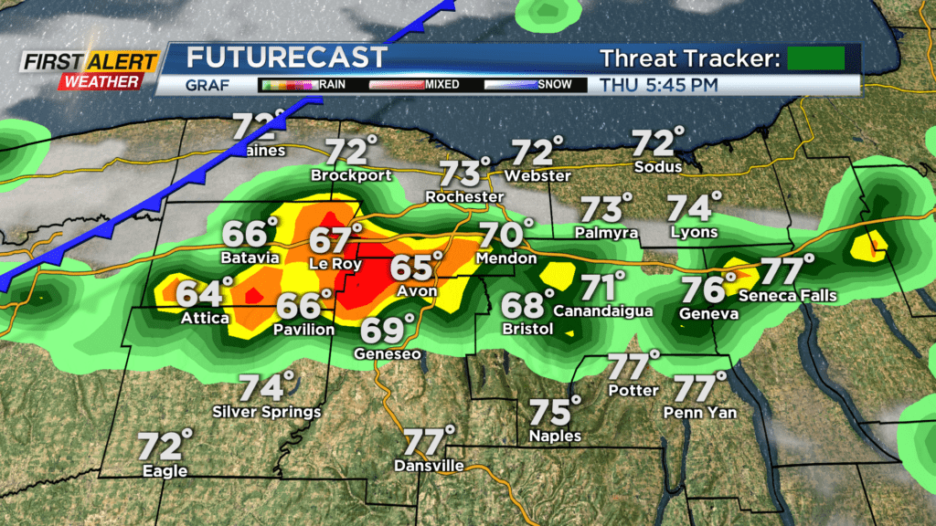
We will then dry out a bit toward lunchtime on Thursday, but we will remain mostly cloudy and humid. Round 2 of showers and storms will move in late in the afternoon and evening hours as a cold front moves in from the west.
This cold front will help pop up a few showers and storms through the evening commute. Rain may be heavy at times this evening before lingering showers on the backside of the cold front. A few showers will be possible into early Thursday night, but drier weather will take over.
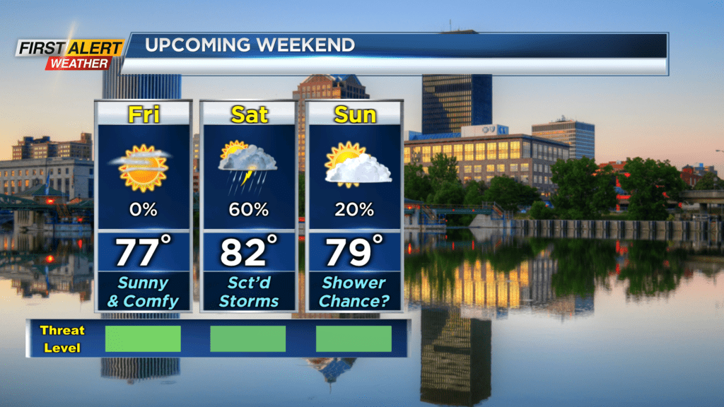
A nice day is expected on Friday as the sun returns and afternoon highs sit in the upper 70s. We will be more comfortable and breezier with gusts near 20mph through the day. Clouds will then increase as showers and storms are expected to return for Saturday.
As of now, scattered showers are likely early Saturday before a few thunderstorms in the afternoon. A storm or two that does pop Saturday afternoon will have a chance to produce gusty winds. We are back to mainly dry weather for Sunday, but an isolated afternoon shower does look possible.