First Alert Weather: Near record warmth to end the work week
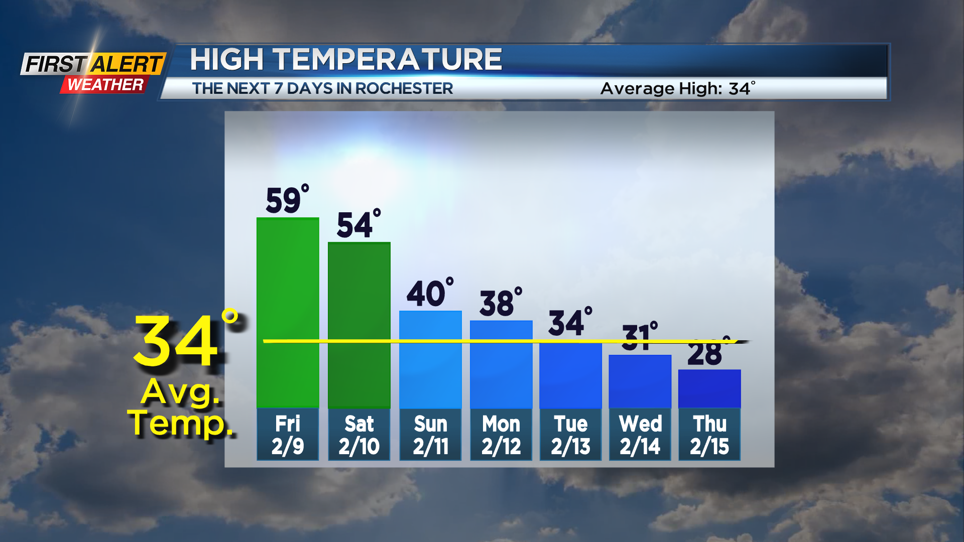
ROCHESTER, N.Y. – Temperatures soared into the 50s on Thursday with dry weather, and we’ll keep that going into Friday. Friday’s highs should reach the upper 50s to near 60. The record high for Friday’s date is 62, so we aren’t forecasting a record as of now, but it’ll be close. This will especially the case if we get enough breaks of sun. We may see a stray shower, but most of the day will be dry. That will change on Saturday, though. A wave of low pressure riding along a slow moving cold front will bring a period of showers and rain from late morning into the afternoon, before tapering. Once the rain ends, temperatures will drop back into the 40s the rest of Sunday, then falling into the 30s for Monday.
We’re tracking a potential storm that could bring some snow to the northeast late Monday into Tuesday. Whether or not we get snow will depend on the track of the low. At this point, the best chance of seeing a few inches of snow would be in the Finger Lakes, with the low to our south. If that low moves a little further north and west, Rochester may see a few inches of snow by Tuesday morning. If it moves a little further south and east, Rochester gets nothing. It is worth watching, but we’re not expecting anything major at this point. We do expect a big change in the overall pattern next week, with much chillier air and some occasional light lake snow showers.