First Alert Weather: Nice break from the harsh winter weather
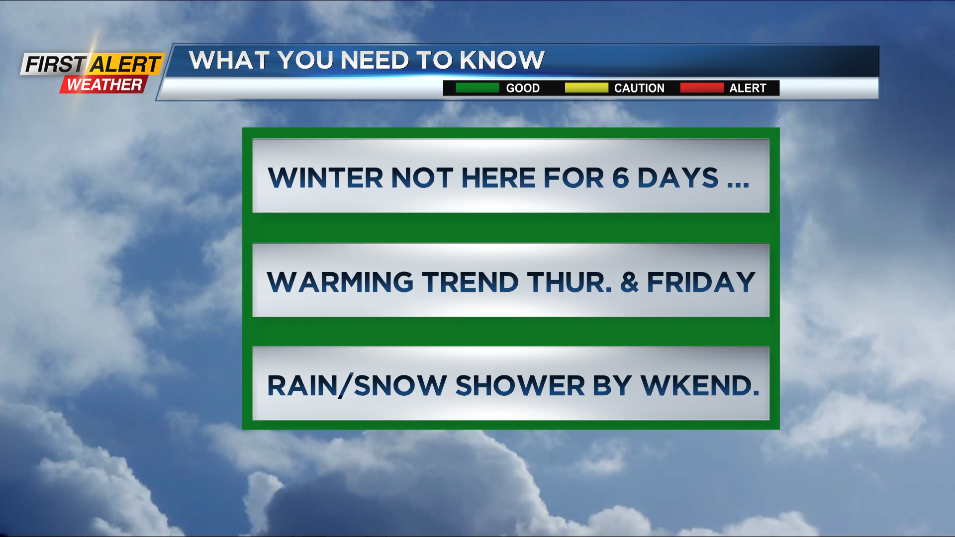
ROCHESTER, N.Y. – Most of the active weather this week is in the deep south and western half of the country. That leaves the great lakes with fair, temperate weather for most of this upcoming week. A persistent ridge of high pressure will be anchored from the upper mid-west to northern New England. This will provide Western New York with dry and unseasonably mild weather through Friday.
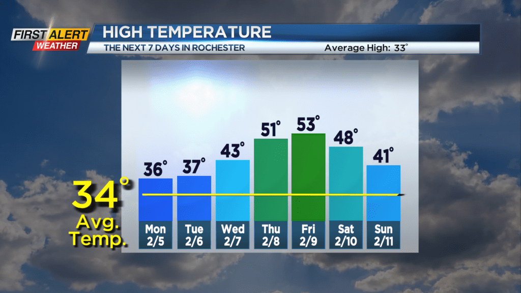
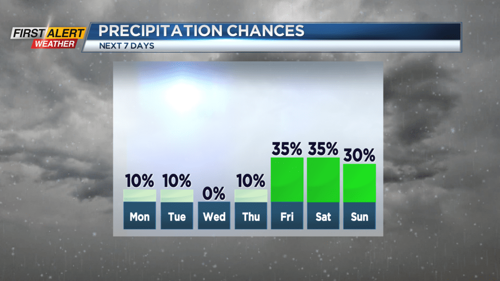
Sunday night, look for mainly clear skies for the early evening and then more clouds arrive for later Sunday night. Depending on the amount of cloud cover, the temperature will likely fall into the upper 20s. Monday will feature morning clouds, then breaks of sunshine for the afternoon. The high temperature will be in the middle 30s. The dry weather continues through Tuesday, Wednesday, and Thursday. The temperature will slowly warm each day, eventually reaching 50 degrees by Thursday and Friday. Spotty showers should arrive by the end of the week, and it will turn colder through the weekend.
It appears a return to a more winter-like weather pattern will be likely for next week.
Stay tuned to News 10NBC First Alert weather for updates on the forecast.