First Alert Weather: No snow today, but accumulating snow this week
[anvplayer video=”5167097″ station=”998131″]
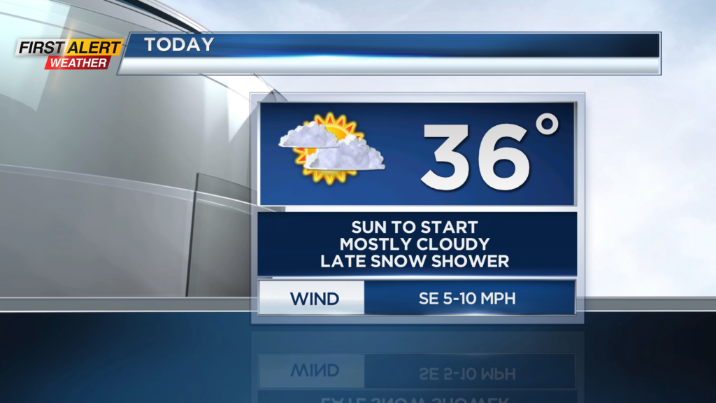
ROCHESTER, N.Y. – Waking up to a cold start this Sunday as temperatures are starting off in the teens and low 20s. However, after the cold start we will see our afternoon highs reach the mid and upper 30s! It will be with a lot of cloud cover through the day as the best chance for sunshine will be early this morning.
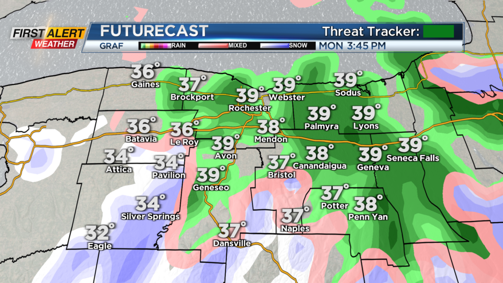
There is also a chance for a passing snow shower late today, but no impacts to the roads are expected. A better chance for snow showers will arrive tomorrow, but no accumulations is expected as temperatures will be too mild. Snow showers mixed with rain showers are expected tomorrow as our low pressure begins to strengthen off the East Coast.
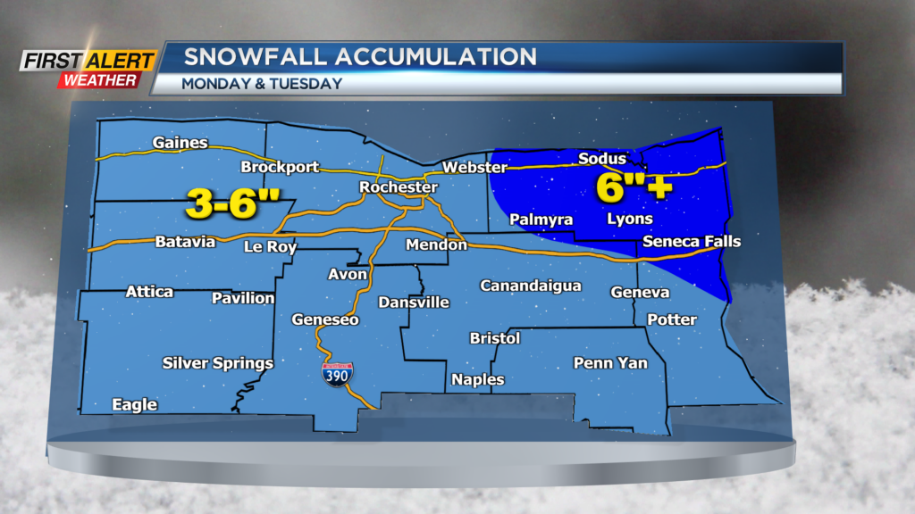
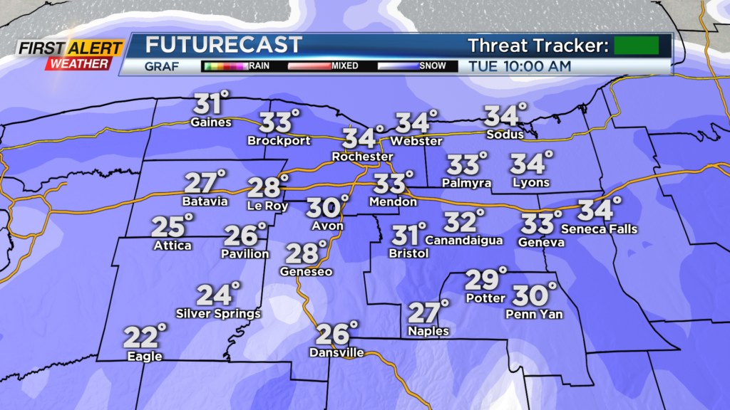
Then Tuesday is when we are expecting accumulating snow as cold air wraps in. Snow will likely be falling through a good portion of the day Tuesday before we transition to snow showers late Tuesday evening. Snow will be heavy at times and create slick conditions on the roadways. This is why the First Alert Weather Team will continue their Yellow Alert for Tuesday. Slick spots and limited visibility on the roads will be possible as we also deal with windy conditions as well.
Snow will transition over to snow showers Tuesday night and when things are all said and done, we will be looking a good 3-6” of snow with the best chance for more east of Rochester. The snow map will likely change as more data comes in so stay tuned for updates.