First Alert Weather: Nuisance type of snowfall for Rochester
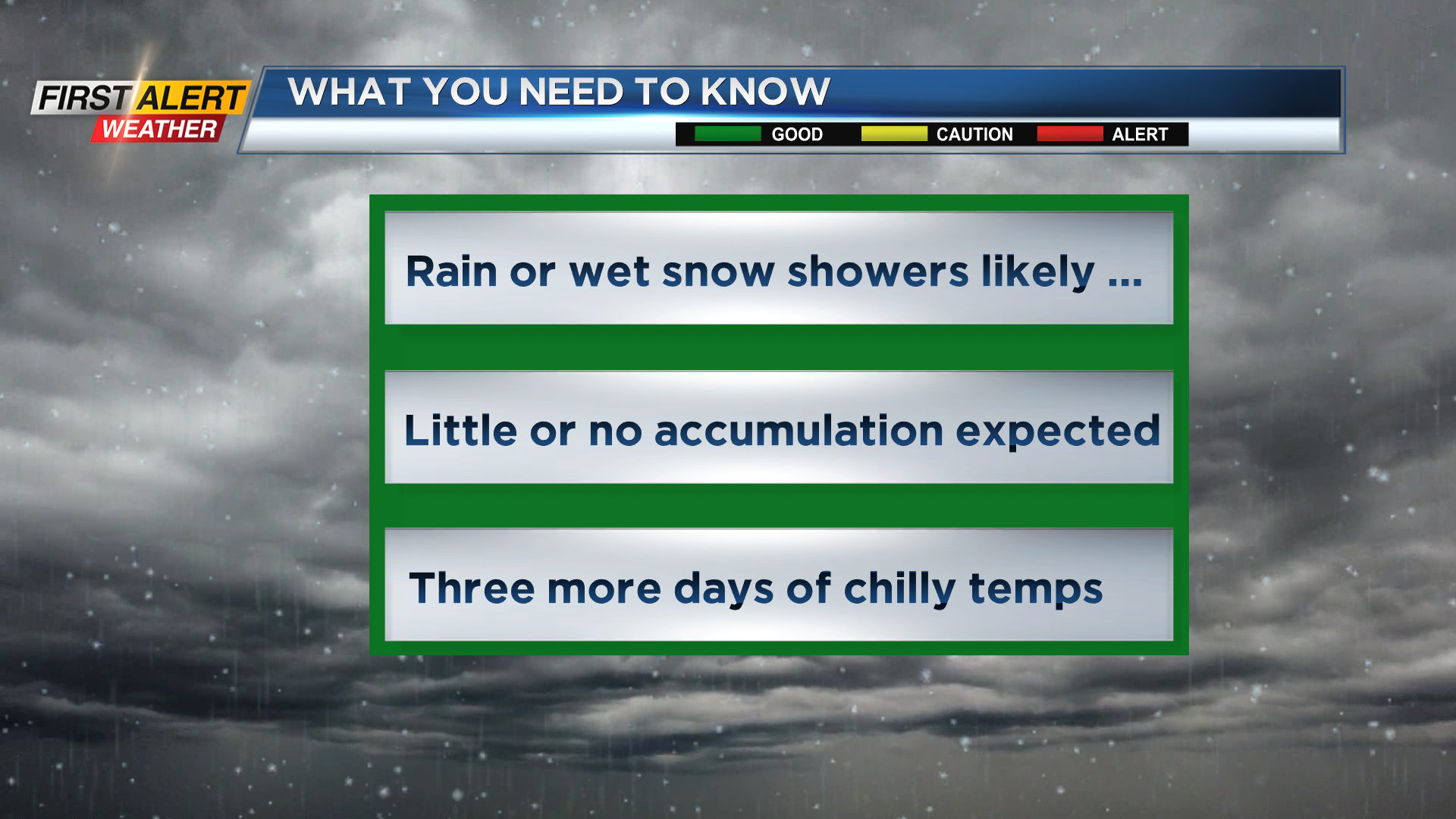
ROCHESTER, N.Y. – Marginally cold temperatures are expected over the next couple of days. At times, the air will be cold enough for wet snow, but not cold enough for any real accumulation. The two exceptions will be grassy surfaces and the higher elevations south of Rochester. In those areas through Thursday, any accumulation should be limited to just a coating of snow.
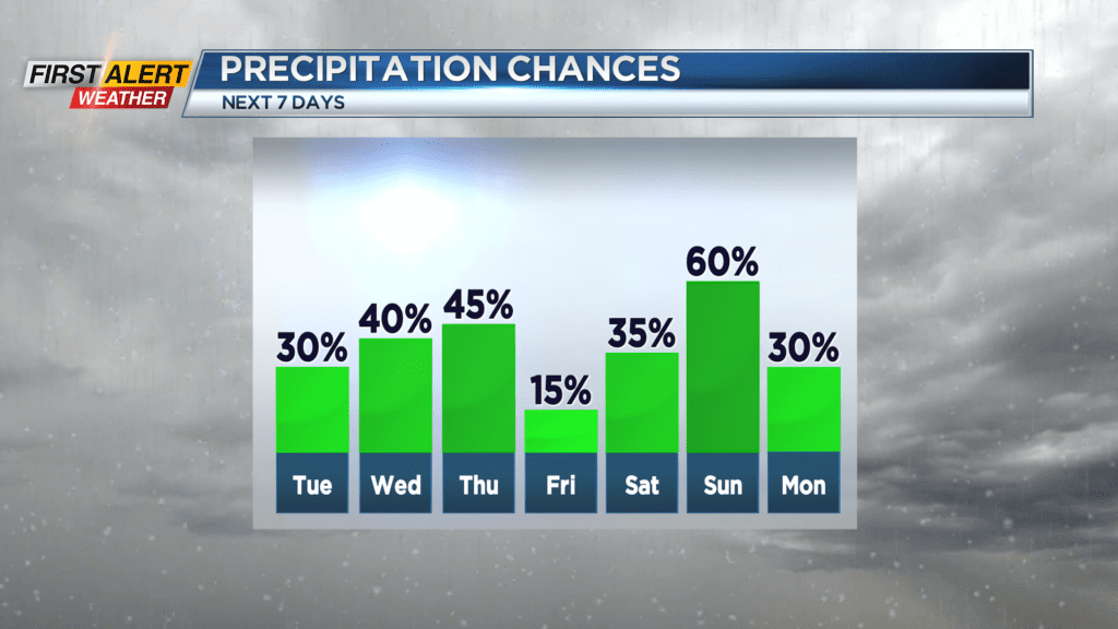
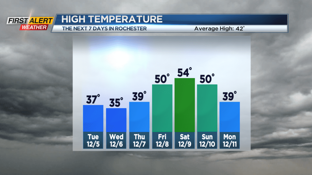
Monday night, look for passing rain and wet snow showers with little or no accumulation expected. The temperature will be falling into the lower 30s. Tuesday, Wednesday, and Thursday will bring mainly gray skies each day. Again, there will be a periodic mix of light rain and wet showers. The temperature will stay in the middle to upper 30s.
Finally, a change for the better is expected by Friday as mild temperatures begin to arrive. The end of the week will feature breaks of sunshine and noticeably warmer weather with the temperature near 50 degrees.
Stay tuned to News 10NBC First Alert weather for updates on the forecast.