First Alert Weather: Off-and-on lake snow this weekend
ROCHESTER, N.Y. — Our weekend weather will feature more of a classic February look and feel, with off-and-on lake effect, along with a brisk wind at times and chilly air.
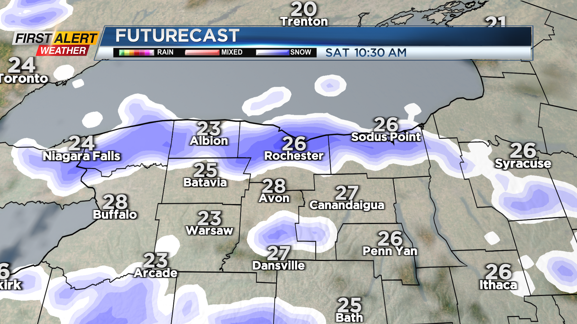
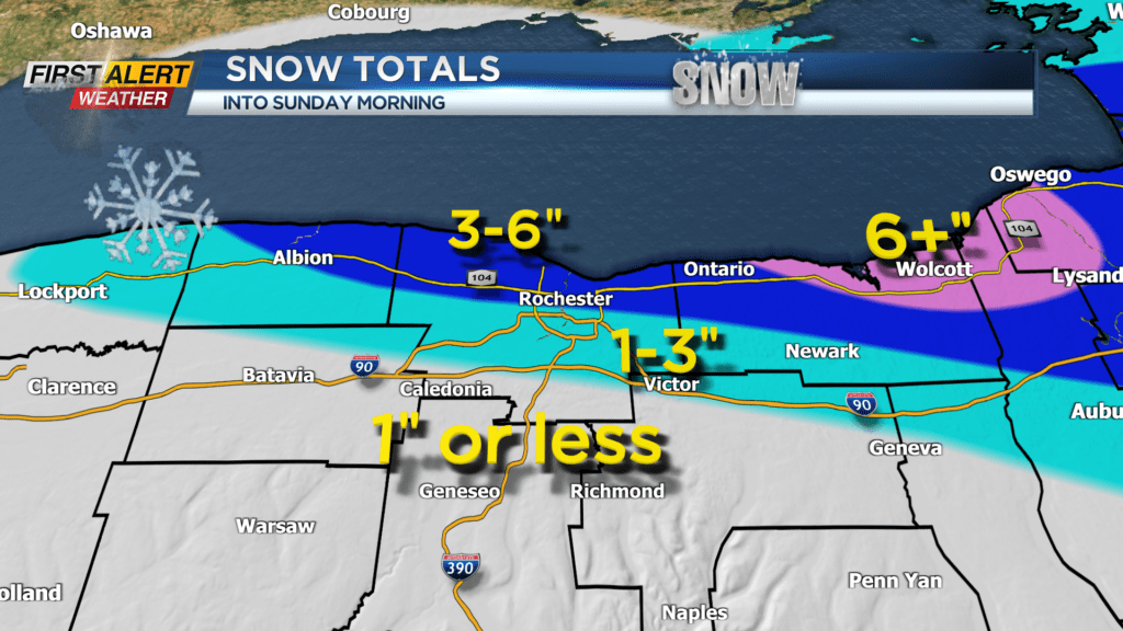
Lake effect snow tonight will tend to focus near Lake Ontario and north of Rochester, with parts of Wayne County picking up one to three inches of accumulation. That lake snow will tend to push south Saturday morning with a wind shift, followed by more scattered lake snow showers into the afternoon. Overall, expect another coating to an inch or two of accumulation for most of the area, a little more possible east of Rochester.
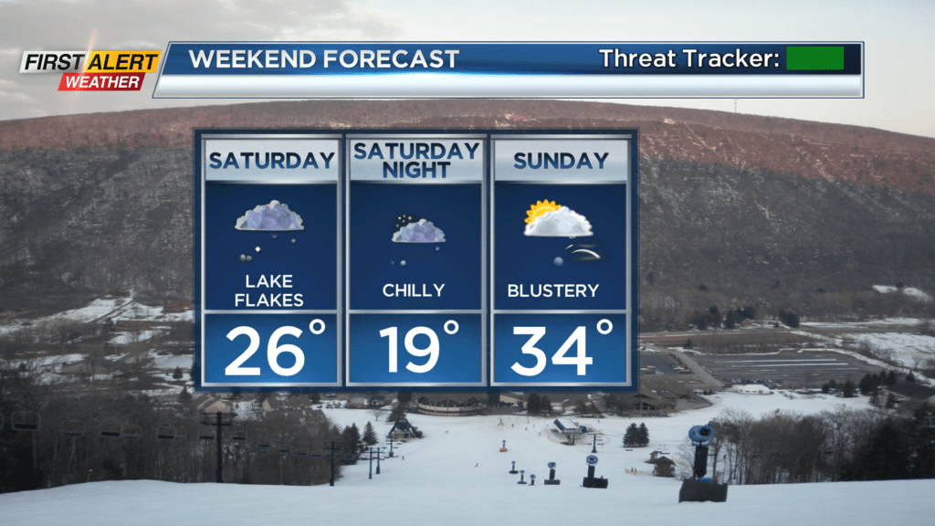
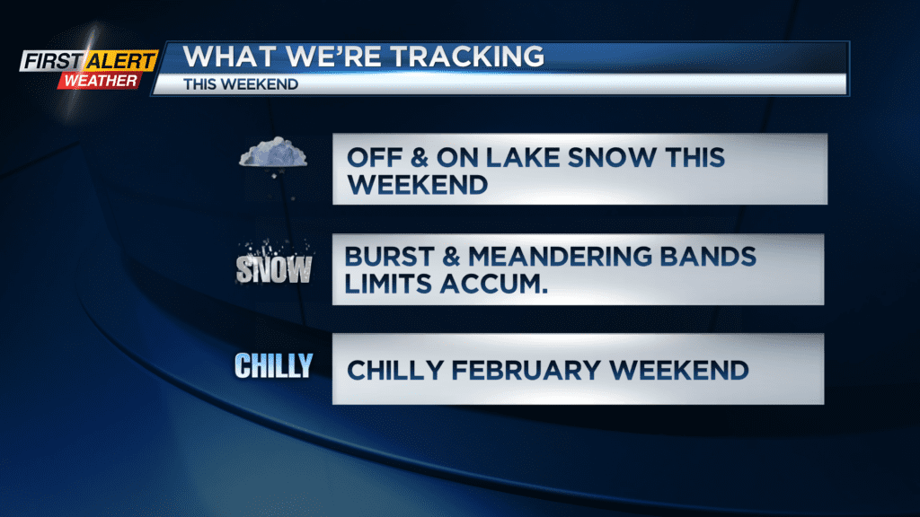

It’ll be chilly on Saturday with highs holding in the mid 20s. Sunday will feature another wind shift, with lake snow focusing west of Rochester off of Lake Erie this time around. We should see at least some sun where the flakes aren’t flying, but it’ll feel chilly with a brisk wind. We’ll get another wind shift Sunday night into Monday morning, with a little more snow off of Lake Ontario, but nothing too organized, so amounts should stay very minor.
Presidents Day will be chilly but bright, with any lake snow north ending early. After that, we’ll see a warming trend into February break week, with temperatures climbing into the 40s on Tuesday, and possibly pushing 50 by Wednesday. We’ll stay mild on Thursday, but rain showers will return with our next system. There’s a chance we could see some snow by the end of next week, but overall break week looks fairly quiet for kids.