First Alert Weather: One more hot Summer day before cooling down this weekend
[anvplayer video=”5179722″ station=”998131″]
ROCHESTER, N.Y. — It’s another wonderful start to the day on Friday as we start off with plenty of sun and mild temperatures once again.
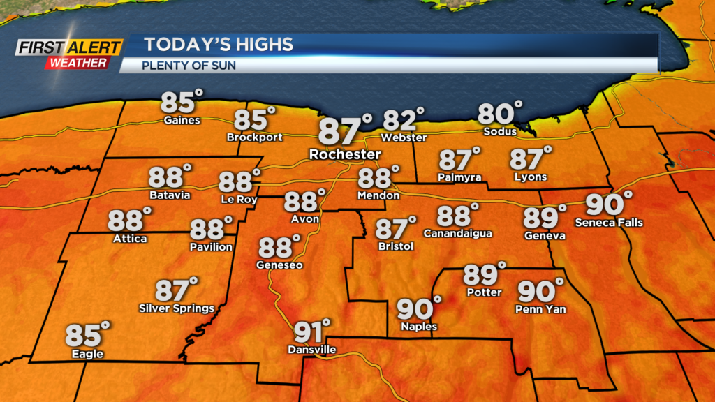
Afternoon highs feel like summer as they reach the mid and upper 80s. There will be plenty of sunshine throughout the afternoon.
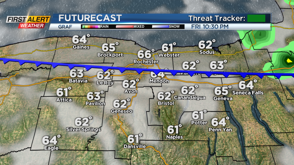
We are watching a cold front to the north but that will not affect us until Friday evening and night. We will see the chance for a spotty shower after 9 p.m. but most will be dry.
The bigger story with this front will be the cooler weather into the weekend. This front will drop our afternoon highs into the low 70s.
On Saturday, we will see plenty of sunshine, but afternoon highs only reach near 72 degrees. We will be a bit breezy also with gusts out of the northeast around 25mph. We will remain cool for Sunday as we only reach the upper 60s and low 70s in the afternoon.
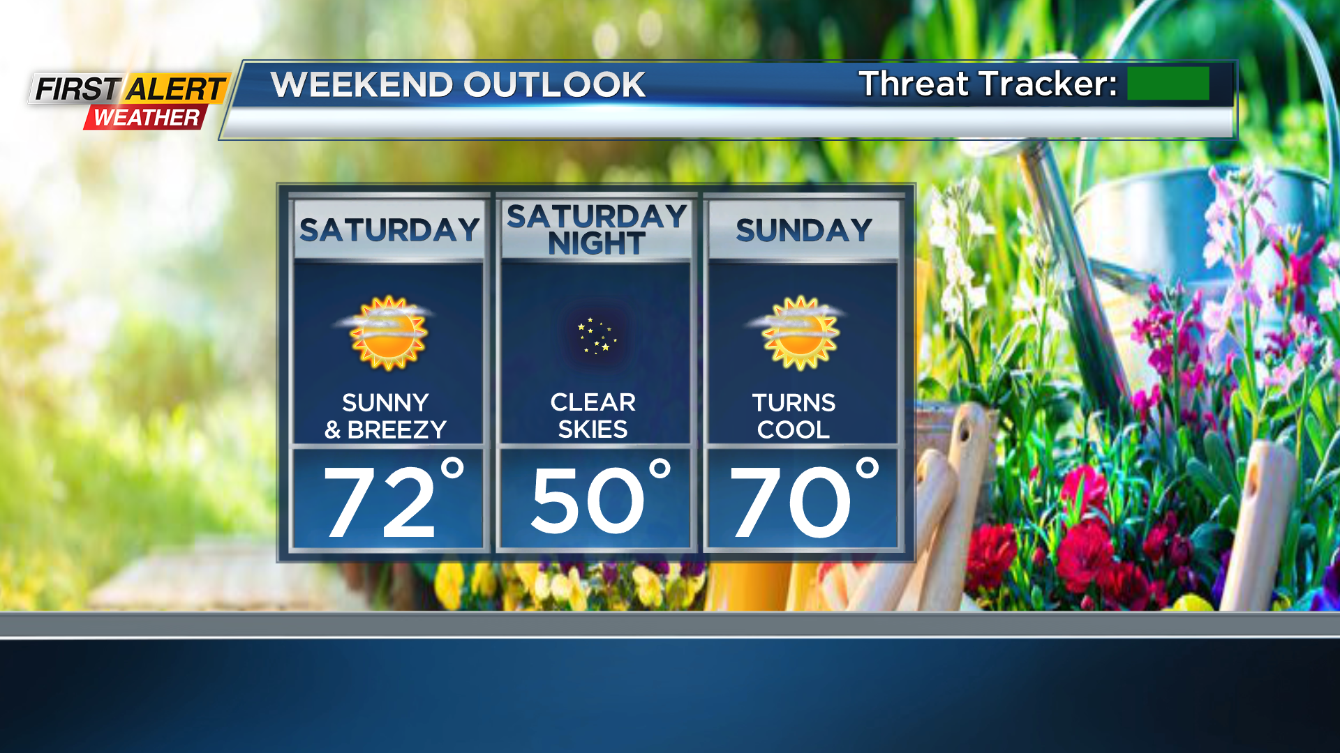
However, we will see plenty of sunshine through the weekend so any outdoor plans should go on without any problems. Enjoy the dry weather through the weekend as it looks like we will turn a little unsettled heading into the middle of next week as low pressure sits off the East Coast.
______________
Download the WHEC First Alert Weather app to stay up to date while on the go.
Watch the latest full forecast online.