First Alert Weather: One more November-like day, then sunshine and warmth return
[anvplayer video=”5142712″ station=”998131″]
ROCHESTER, N.Y. The big upper-level trough and surface low that have plagued the Great Lakes and brought unseasonably chilly air all the way to the deep south will finally shift east by the end of the week.
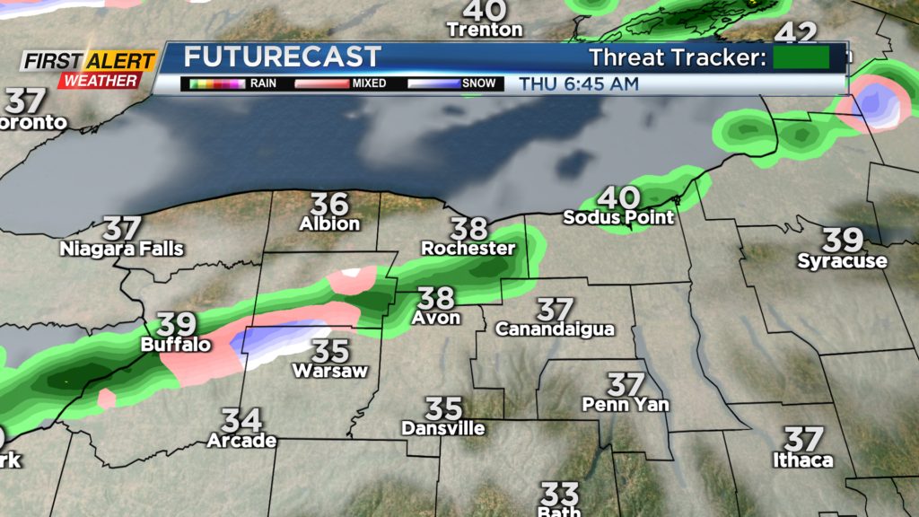
But that means we have one more day of lake effect, cool air and unsettled weather. Lake rain showers stick around tonight and Thursday, with some wet flakes mixing in the higher terrain once again tonight and early Thursday.
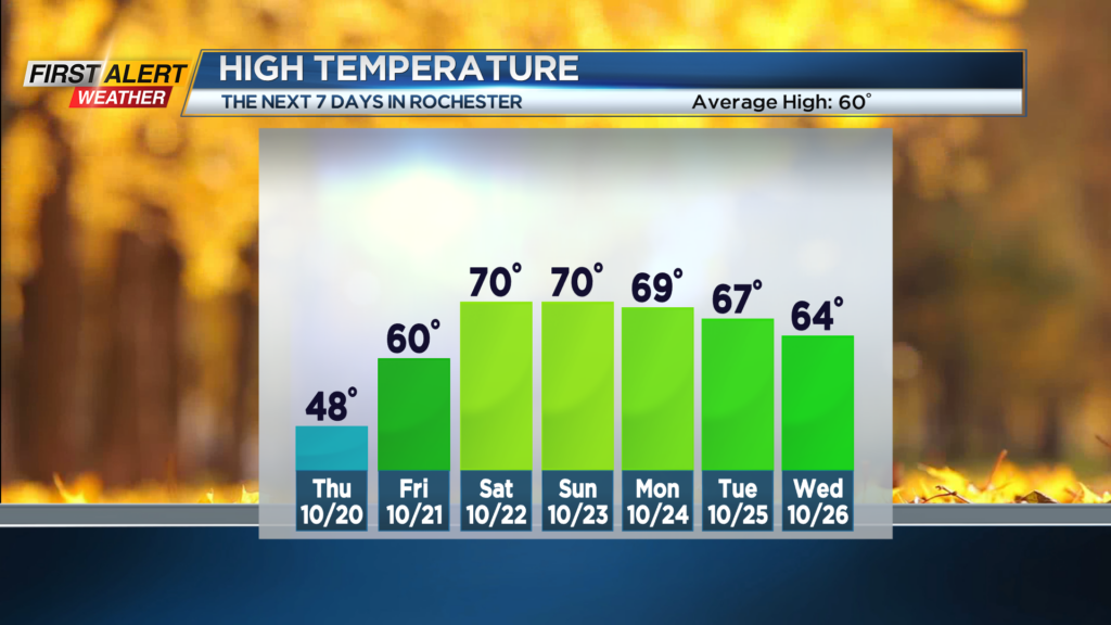
Thursday will hold in the 40s with a chilly wind. And just like that, it’ll be gone by Friday. Sunshine and 60s return on Friday, with highs up near 70 on both Saturday and Sunday.
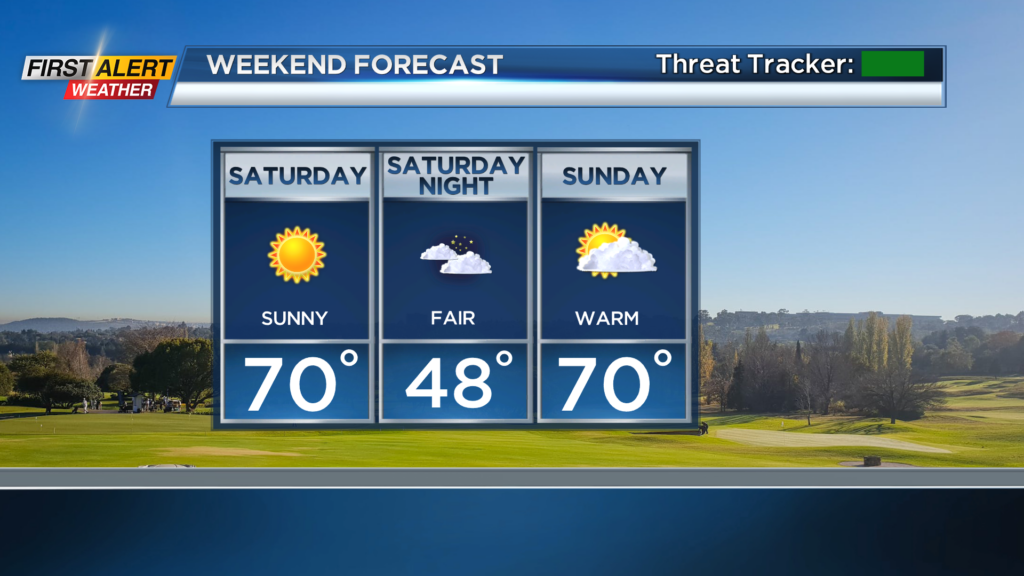
Both weekend days will also feature plenty of sun and dry weather. Perfect timing to check out what will likely be peak fall foliage across the Rochester region!
We’ll keep the milder pattern around until at least the first part of next week, before more seasonable air returns by the middle to end of the week. Still, we’re not looking at any more snow chances until at least early November.