First Alert Weather: Pushing the record high temperature on Tuesday
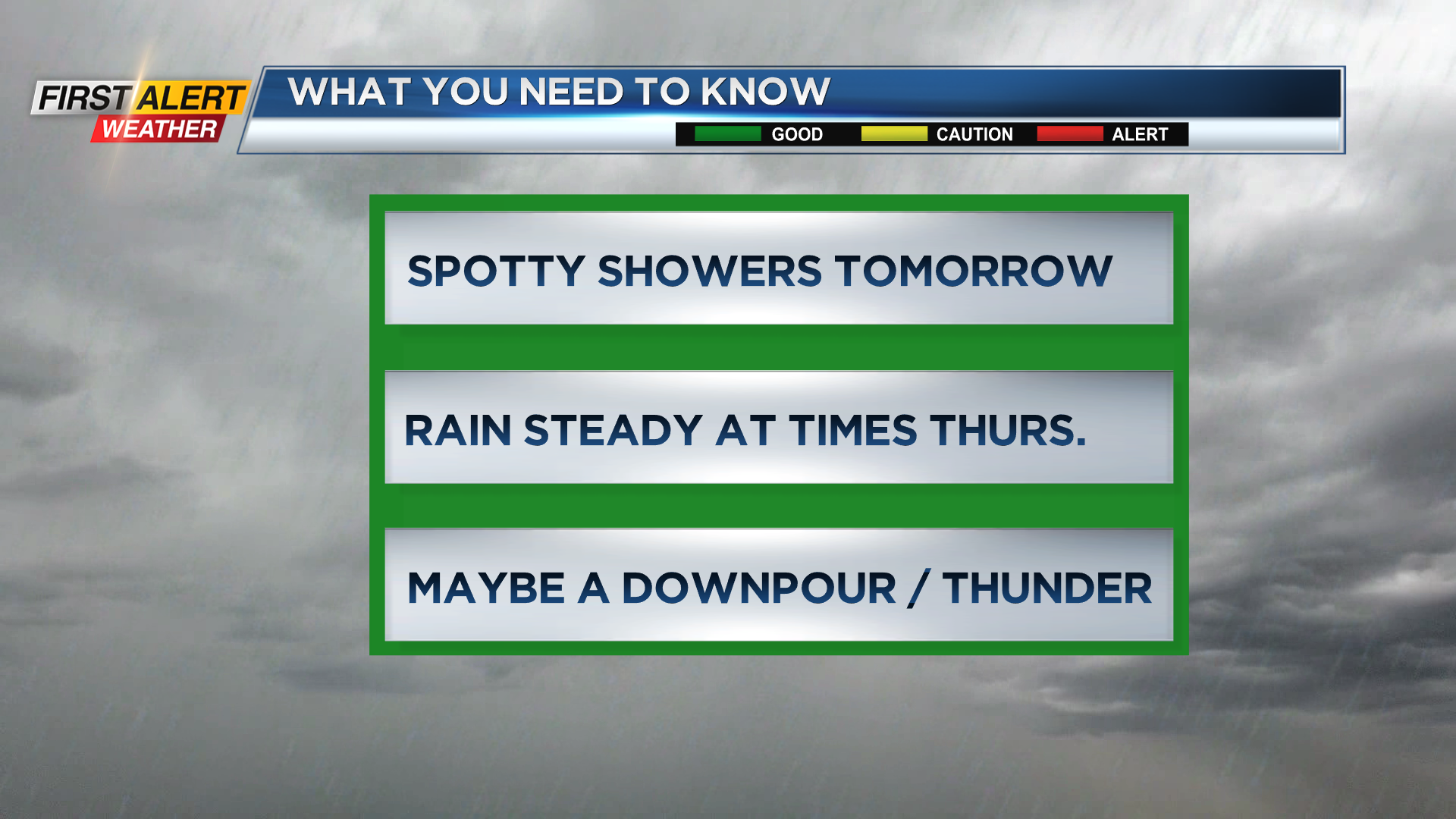
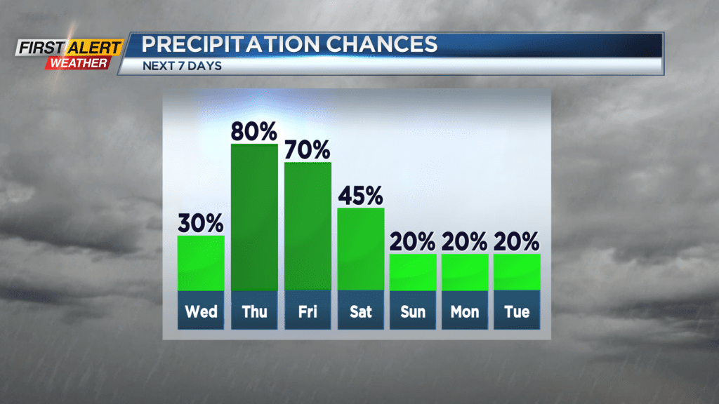
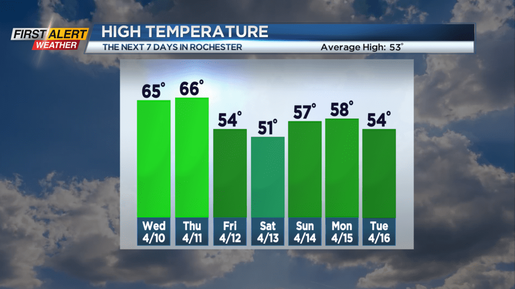
ROCHESTER, N.Y. – The record high temperature at the Rochester Airport on Tuesday has stood for 55 years (79 degrees set in 1969) and Rochester came very close to reaching that mark this afternoon. Thus far, we are 77 degrees, and some folks would say it is time for a little air conditioning! However, the second half of the week will not be as nice. The News 10NBC First Alert meteorologists are tracking a strong low-pressure system which will be moving north into the central great lakes. This will produce an extended period of wet and windy weather. It will not be a continuous rainfall, but we expect rain will be steady at times with area creeks and eams rising by the end of the week.
Tuesday night, look for patchy clouds for the evening and then there is the chance of shower arriving late. The low temperature near 53 degrees. Wednesday there will bring morning clouds with the chance of a spotty shower. Then expect more sunshine for the afternoon and the temperature rising into the middle 60s. As the storm approaches look for a much higher probability of rain for Thursday, Thursday night and Friday. There is the chance of some thunder and maybe even a few downpours. The temperature will still be in the mid-60s on Thursday, but the mercury will fall through the 50s and into the 40s on Friday. In addition, it will be windy at times with gusts pushing 35 miles per hour for later Friday and Saturday. Our meteorologists will continue to monitor the weather data for changes, but at this point, the News 10NBC First Alert Threat Tracker is green through the end of the week.
Stay tuned to News 10NBC First Alert Weather for updates on the forecast.