First Alert Weather: Quiet Friday before some snow arrives this weekend
ROCHESTER, N.Y. — Our weather will remain quiet to end the work week, with a mix of clouds and sun and seasonably chilly temperatures on Friday.
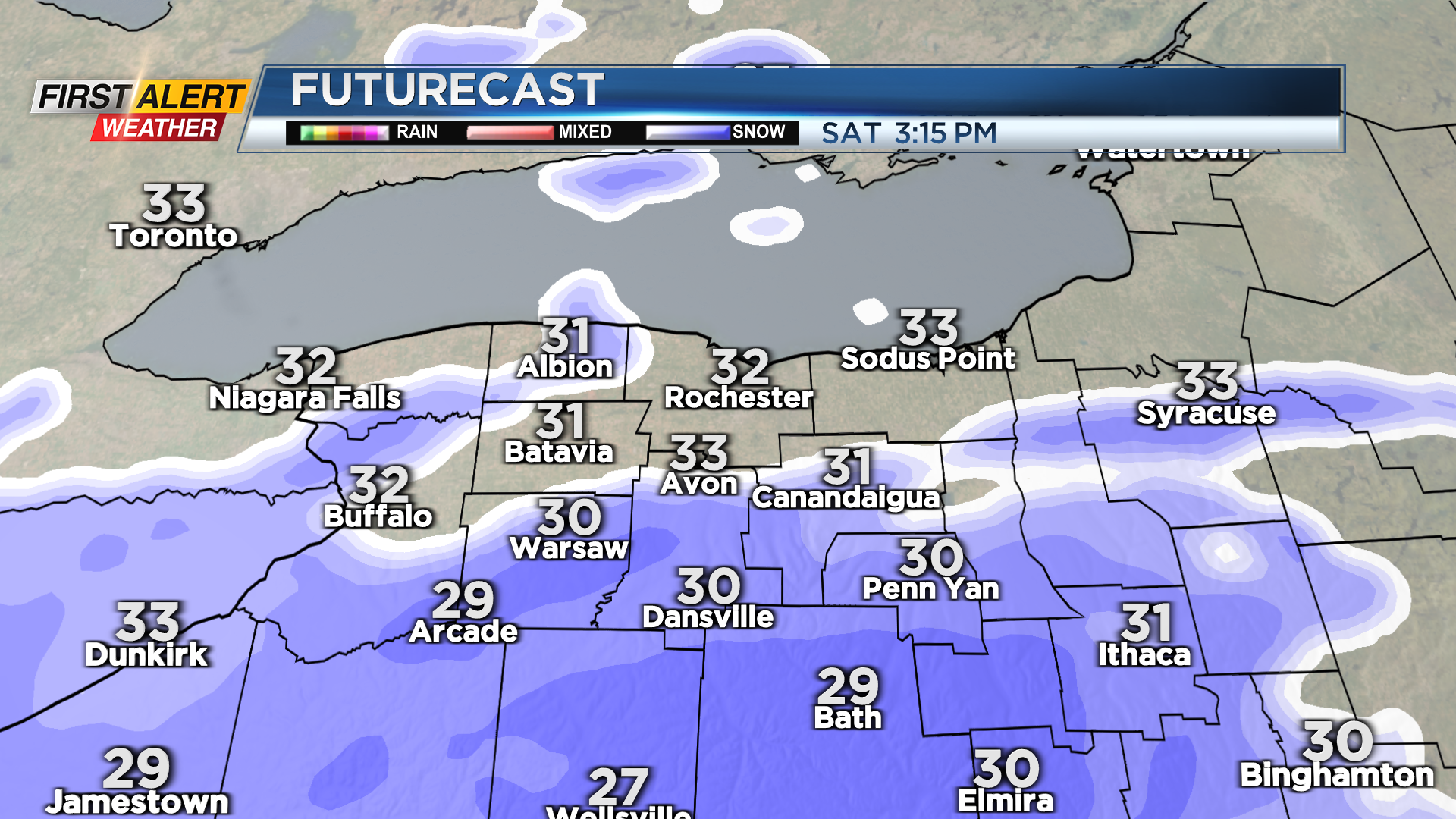
A well-advertised Nor’easter developing this weekend will bring heavy snow to cities in eastern and downstate New York, Pennsylvania, and New England, with a general light snowfall locally. Saturday starts off dry but cloudy. Light snow will move in from south to north Saturday afternoon, giving everybody a fresh coating as the sun goes down. We’ll likely see a few hours of a steady light snow Saturday evening, before tapering overnight. The steadiest and heaviest snow will fall east of Rochester, while the snow will move out the quickest west toward Buffalo.
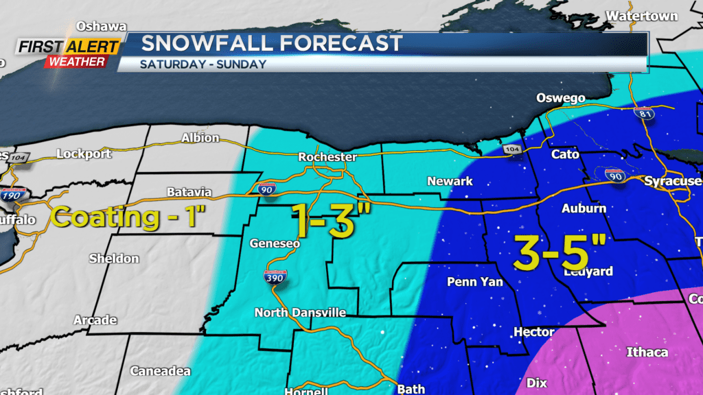
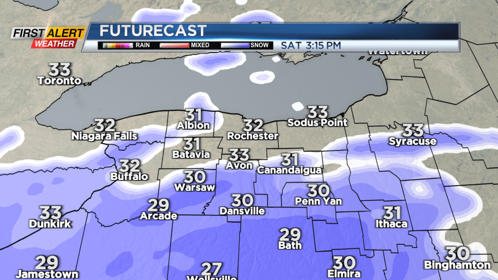
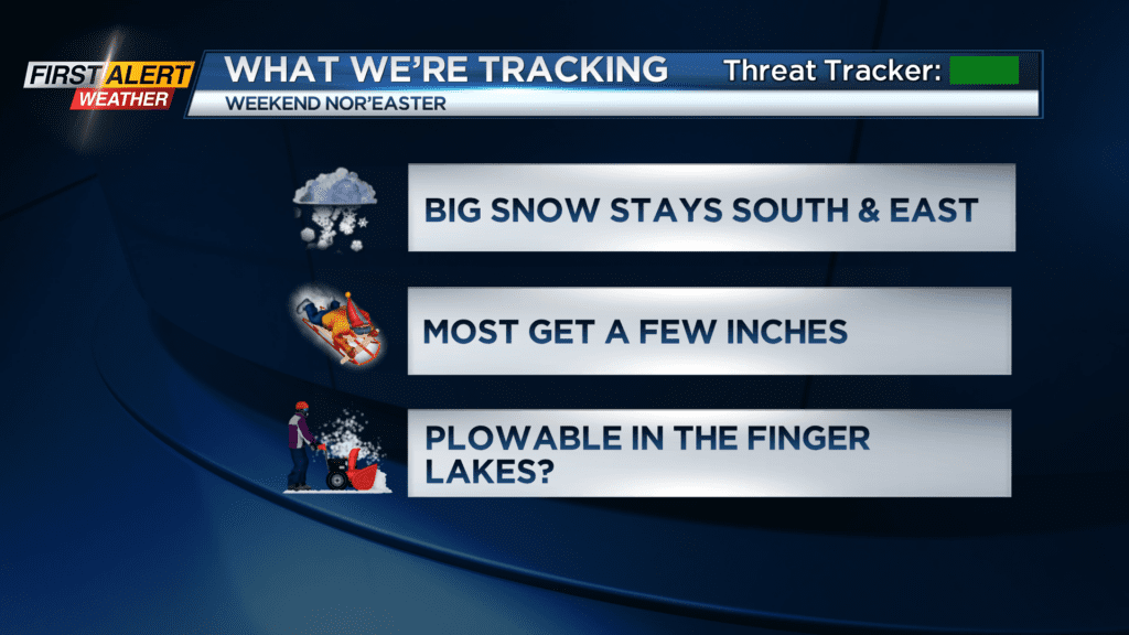
In all, expect a general one to three inches of accumulation near Rochester, as much as six inches well east in the Finger Lakes, and just an inch or so near Buffalo. This forecast may change a bit as we get a little closer to the event, so keep watching News10NBC on air and online for updates.
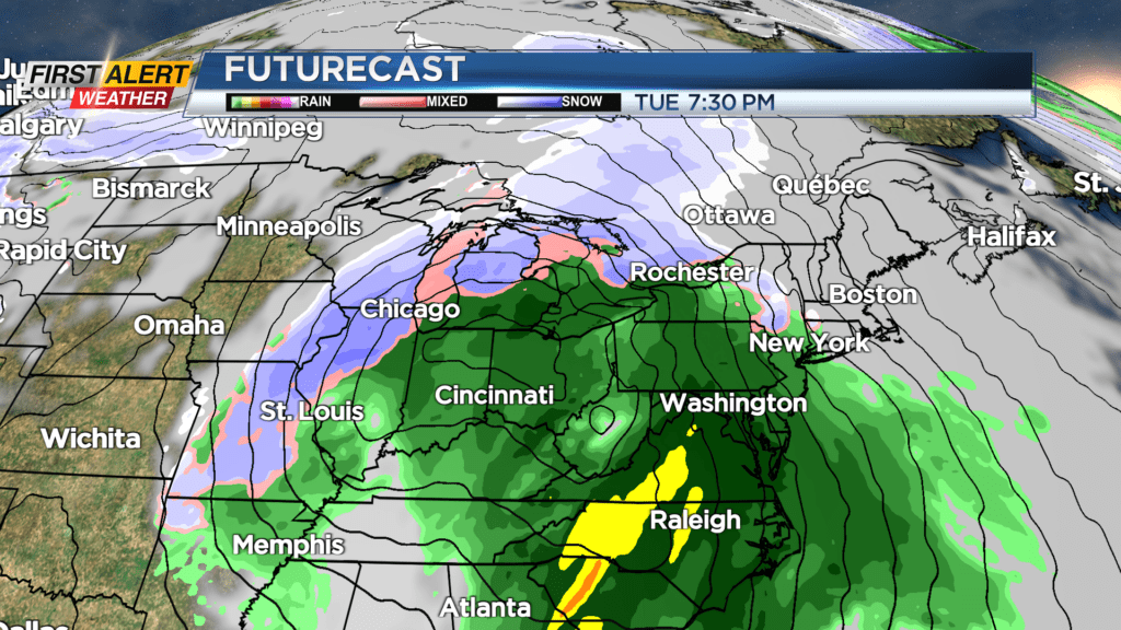
We’re tracking another more powerful storm for Tuesday and Wednesday of next week. This storm will track to our west, putting us on the “warm” side of the storm. We’ll likely see a little snow at the onset Tuesday, along with a gusty wind. Temperatures rise, changing any snow over to rain. We go the other way on Wednesday, with rain changing back over to snow showers and a gusty wind. At this point, the main impact will likely be wind.