First Alert Weather: Rain and snow Saturday, Yellow Alert for lake snow & frigid air next week
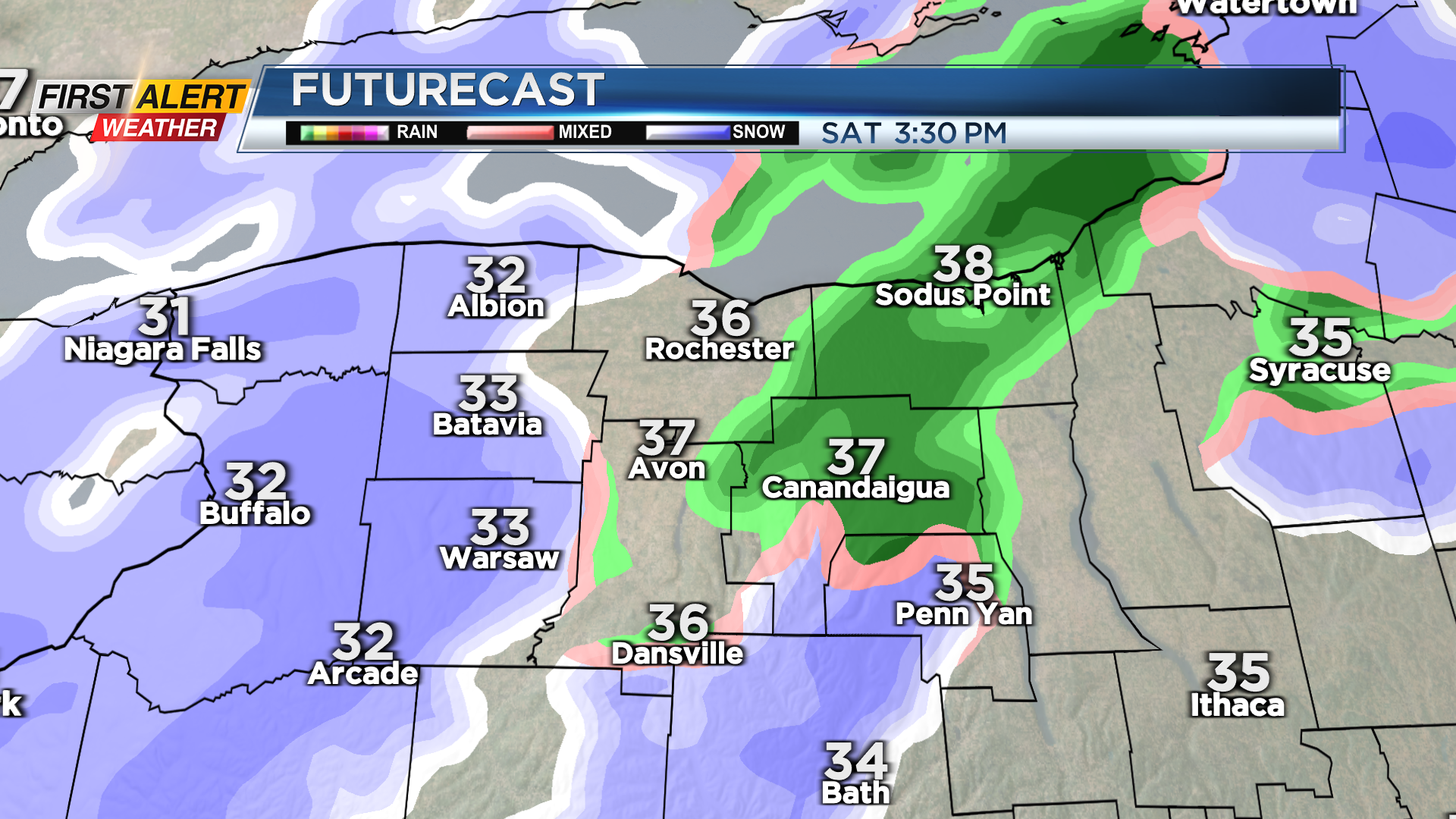
ROCHESTER, N.Y. — We’re breaking free of the cold air and lake effect snow, at least for one more day. It’ll be turning breezy and fairly mild Friday night, which will push our temperatures into the mid and upper 30s on Saturday.
While Saturday will be the mildest day in 2025, it won’t necessarily be pretty. We’ll see a mix of rain and wet snow moving in fairly early in the morning, and continuing through much of the afternoon, before tapering by evening. The widespread precipitation will be pushed out of our region by an Arctic front. This is the cold front that will bring us dangerously cold wind chills and some lake snow into next week.
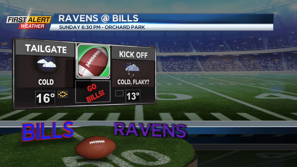
We don’t expect any issues on Sunday, but it’ll be turning much colder with highs falling through the teens, and some lake effect snow slowly developing during the evening. Conditions at the Bills game in Orchard Park will be cold with temperatures in the teens and some lake effect snow developing through the game.

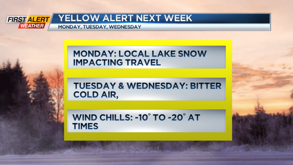
A Yellow Alert is now up for Monday, Tuesday and Wednesday of next week for cold and snow. Monday will likely see some lake effect snow, which may be locally heavy in the morning. It is a federal holiday, and schools are out, so there many not be as many people on the roads, but the snow may impact the roads and make for slick travel.
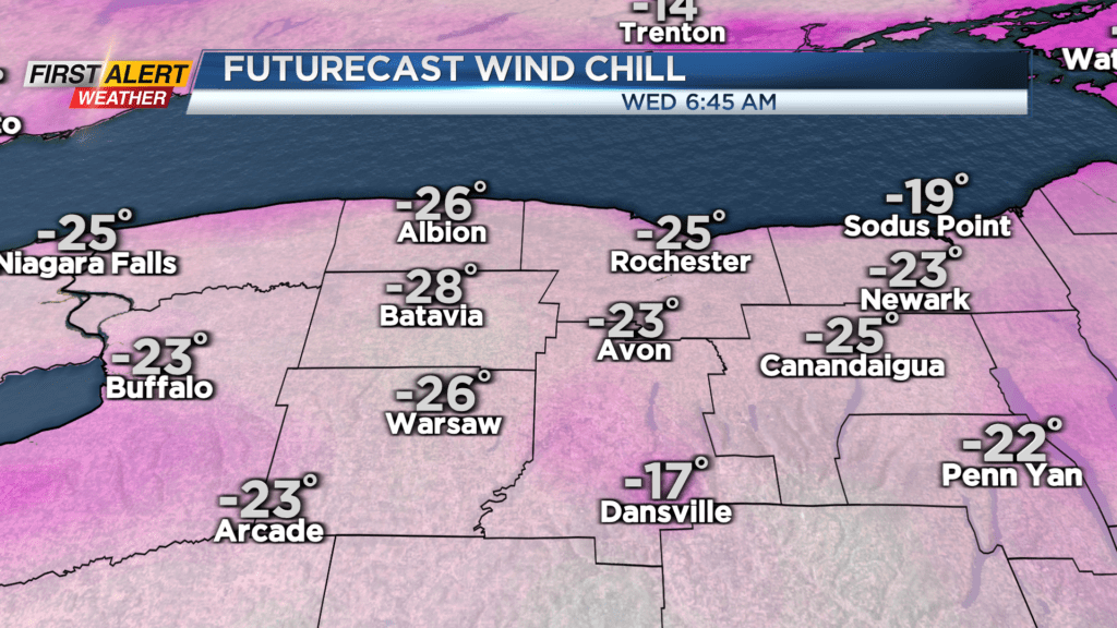
Then, we turn our attention to the bitter cold air moving in on Tuesday and Wednesday. Daytime highs will hover in the upper single digits and lower teens, while overnight lows may drop below zero. The bigger issue will be a brisk breeze, dropping the wind chill to -10° to -20° at times. This is how it will feel on exposed skin. So make sure you have to be out for any amount of time on Tuesday and Wednesday, you cover as much skin as possible.
This is an early “heads up” with the Yellow Alert, so expect some changes to the forecast as we get a little closer.